Evening Update: Rain switches to snow Friday into Saturday


The entire area is dealing with steady rain and a strong east wind gusting to 30 mph. That rain will persist this evening and linger overnight.
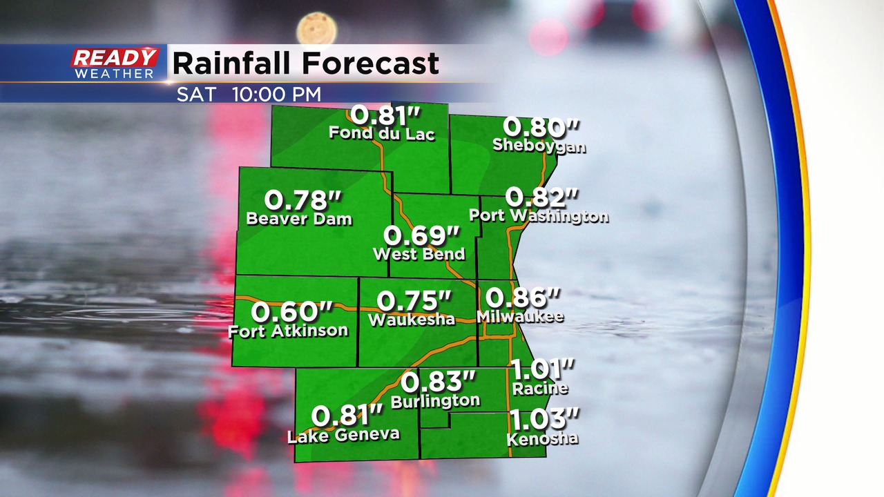
Most areas will receive up to 1" of rainfall. Rain will transition to snow between 6 am and 10 am.
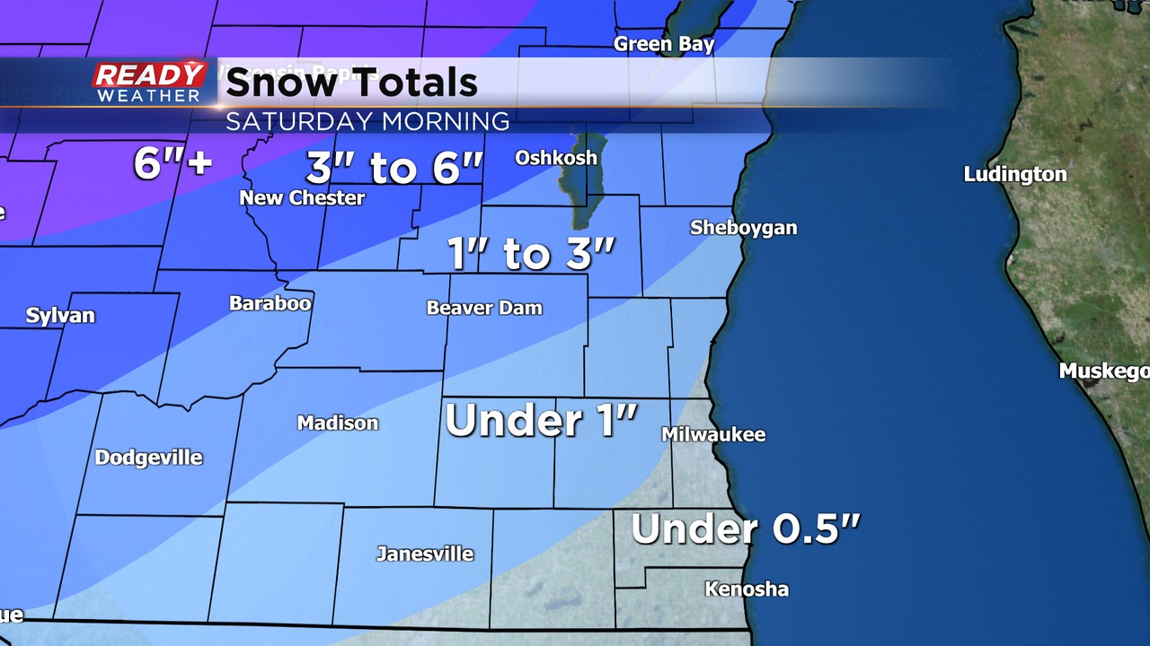
Areas to the northwest of Milwaukee will have the best chance for 1" to 3" of snow. 3" will be isolated. Winds for Saturday morning will gust over 40 mph.
______________________________________________________________________________________________________________
Our well advertised large winter storm has arrived in the Upper Midwest. As of Friday morning the snow is falling across parts of South Dakota, Nebraska, Minnesota and Iowa. Most of the snow will start falling in western Wisconsin around noon Friday then continue through Friday morning. Winter storm warnings have been posted (in pink) for most of north central and western Wisconsin with winter weather advisories (in purple) on either side of the warning.
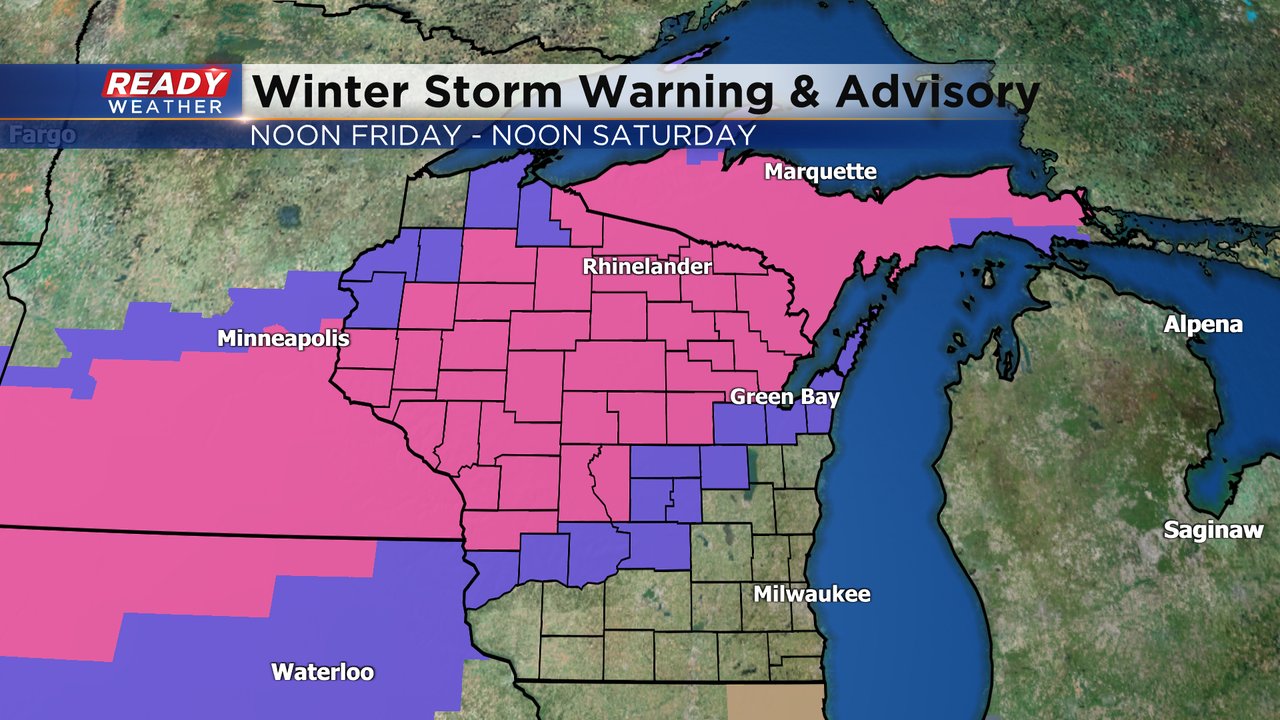
There are no warnings or advisories for southeast Wisconsin. We stay on the overall warmer side of the storm with mostly rain showers during the afternoon and evening. A little snow could mix in around Fond du Lac County before switching to all rain. A few rumbles of thunder are also possible.

The rain showers will continue through most of Friday night before switching to snow. Rain totals will amount to a half to full inch of rain for most of southeast Wisconsin. This is the biggest rainfall since the end of October!

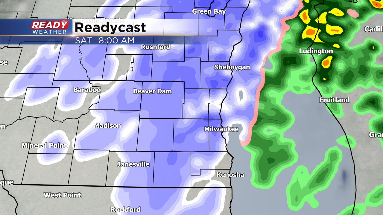
The rain showers switch to snow showers between 5 to 8 AM Saturday morning. Snow showers will last through the rest of Saturday morning through about midday. Some of our western counties could see a little sun by late Saturday afternoon. The rest of the weekend is dry but windy.
Most of southeast Wisconsin will see less than an inch of snow. Our northwest areas, especially around Fond du Lac County, could get 1-3" of snow. with a lot more snow north and west of there. 6-12" of snow is expected for most of north central and western Wisconsin.

Download the CBS 58 Ready Weather app to track the rain switching to snow.