Rain returns, strong to severe storms tomorrow


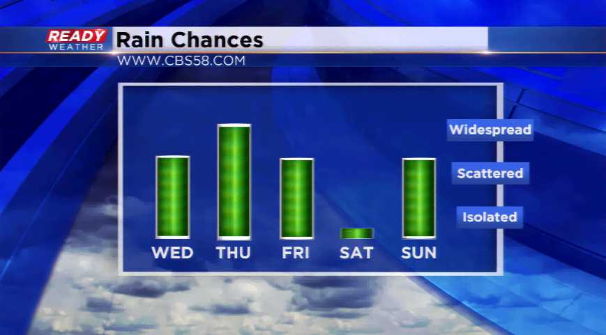
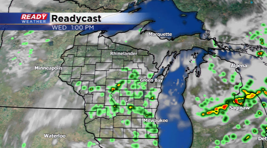
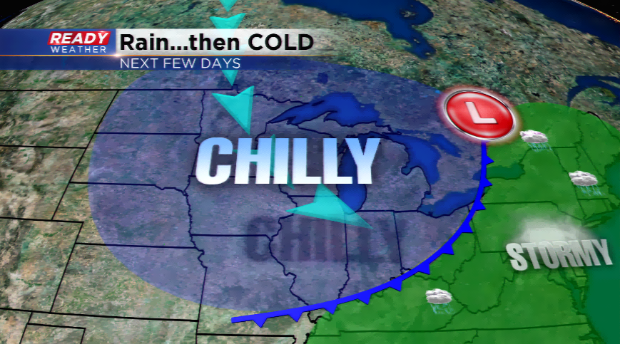
The stretch of unbelievable summer weather will come to an end starting today. This has been the longest dry spell since mid-February around southeastern Wisconsin with six straight days without rainfall. A cold front will pass through the region kicking up showers and storms today. With a NE wind developing today in the wake of the front; expect temperatures to be a few degrees below the norm.
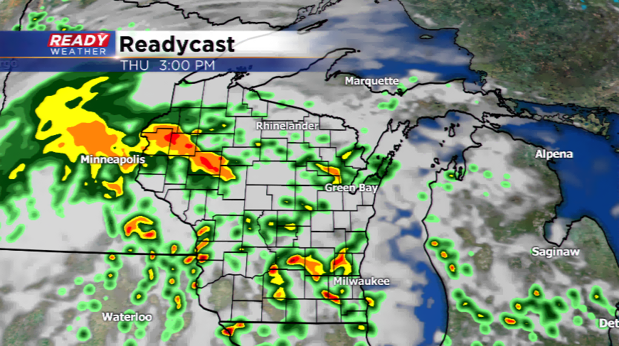
Low pressure will track into Wisconsin Thursday giving way to more showers and thunderstorms. Some of these storms could turn strong to severe. The Storm Prediction Center is focusing a *slight* risk of strong to severe storms tomorrow afternoon and evening. The primary risks will be large hail and high winds. The one dynamic that could prevent severe weather from happening will be cloud cover. This is always key in a severe weather scenario. A few times this season, clouds have busted a good severe weather forecast.
The low will move out along with a cold front later tomorrow. This will usher in much cooler air for Friday. Highs will struggle to make it out of the 60s around the viewing area on Friday. Milwaukee has had ONE high below 70 degrees this summer. Friday might be the coldest day since late May.