Rain expected later today, then turning cold!
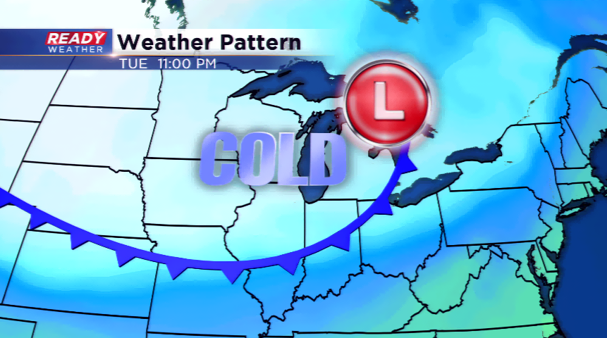
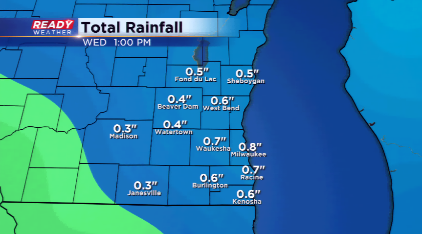
One storm system moves out, but another is on its heels with rain returning to the region later today and tonight. Low pressure moves in today picking up the winds, and likely throwing at us a quick 0.50” to 0.75” of rainfall through tomorrow morning. Once the rain scoots east, the wind and cold will be ushered in behind the storm system.

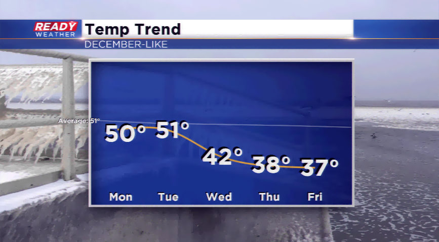
This will be the coldest air of the season. Highs will fall into the 40s, and then the 30s by week’s end. Some of the model data is hinting at areas in Wisconsin, even SE Wisconsin, seeing highs close to freezing. This means overnight lows could fall into the teens late this week in parts of the viewing area. With a NW flow, expect the opportunity for clippers system to drive in late this week with a mix or snow possibly. Not only will it be chilly, but we could see the first true threat of snow here.