Rain ends today, more on the way this weekend
Low pressure slowly marches out of the region this morning and takes the rain with it. Most spots in southeastern Wisconsin picked up 0.50”-1.00” with more closer to the border and less far north. The clouds will stick around for the rest of Wednesday and most of Thursday.
The best day of the week and weekend will be Friday. Count your blessings if you have this Friday off as sunshine will be the main feature with highs climbing into the 70s. This won’t last long!
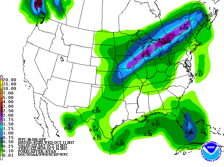
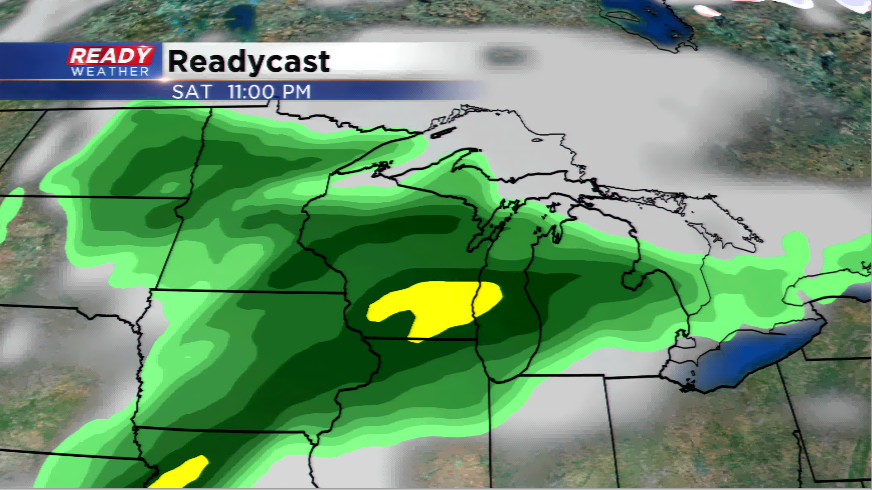
Another round of rain around a cold front and upper-level disturbance will cash more wet weather into the equation. With a healthy supply of moisture and good divergence aloft, this will feed rain into the area for a good chunk of the day Saturday and some of Sunday. As of now, it doesn't look like rain will be an issue all day on Sunday. It might be the best day for outdoor activities, especially later in the day. Timing will start to come together by week’s end, so stay tuned!
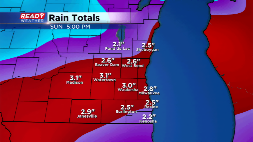
Rainfall totals could exceed one inch or more once again. QPF and computer model data have spots hitting 2"-3" possibly. This will put another dent in the drought and possibly help lead to our first above average rain month since June.