Rain chances return with a threat for strong to severe storms


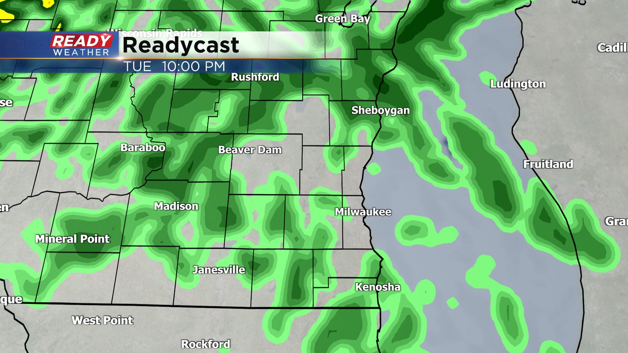
The mix of sun and clouds and warmth from Monday will hold on as we start Tuesday. Expect slowly increasing clouds Tuesday with highs ranging from the upper 50s to low 60s. The next chance for rain arrives Tuesday evening. The better thunderstorms may stay off to our west in Central Wisconsin but at least a few showers are likely in southeast Wisconsin.
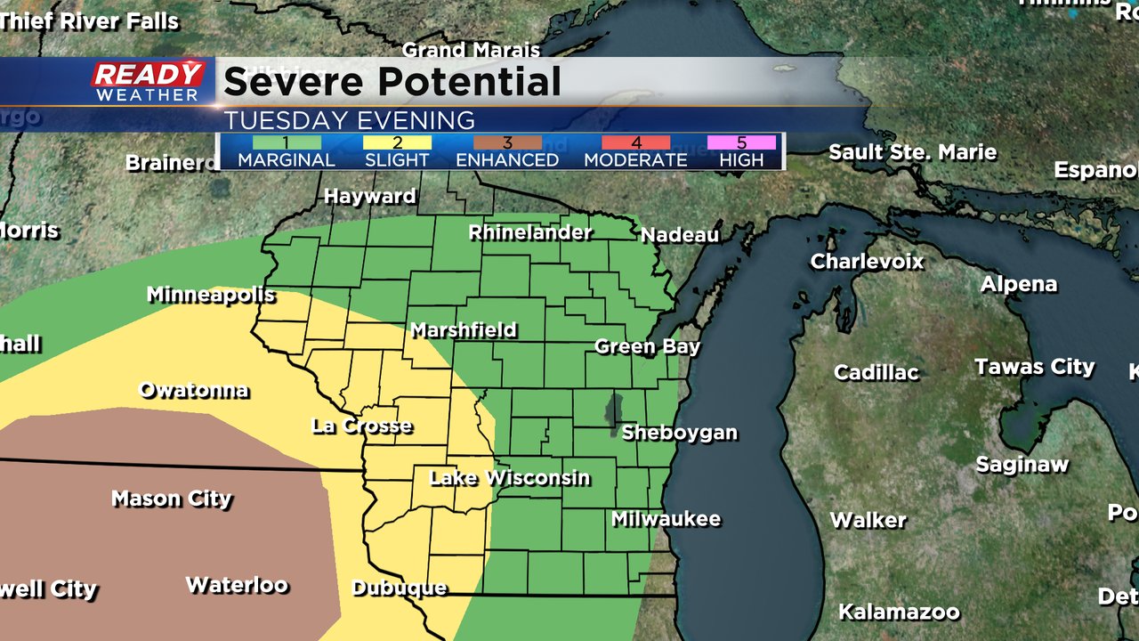
Any rumbles of thunder that do manage to move into southeast Wisconsin Tuesday evening and night could be on the stronger side with some hail possible. For this reason, most of our local area is under the "marginal" risk (level 1 of 5) for severe storms.
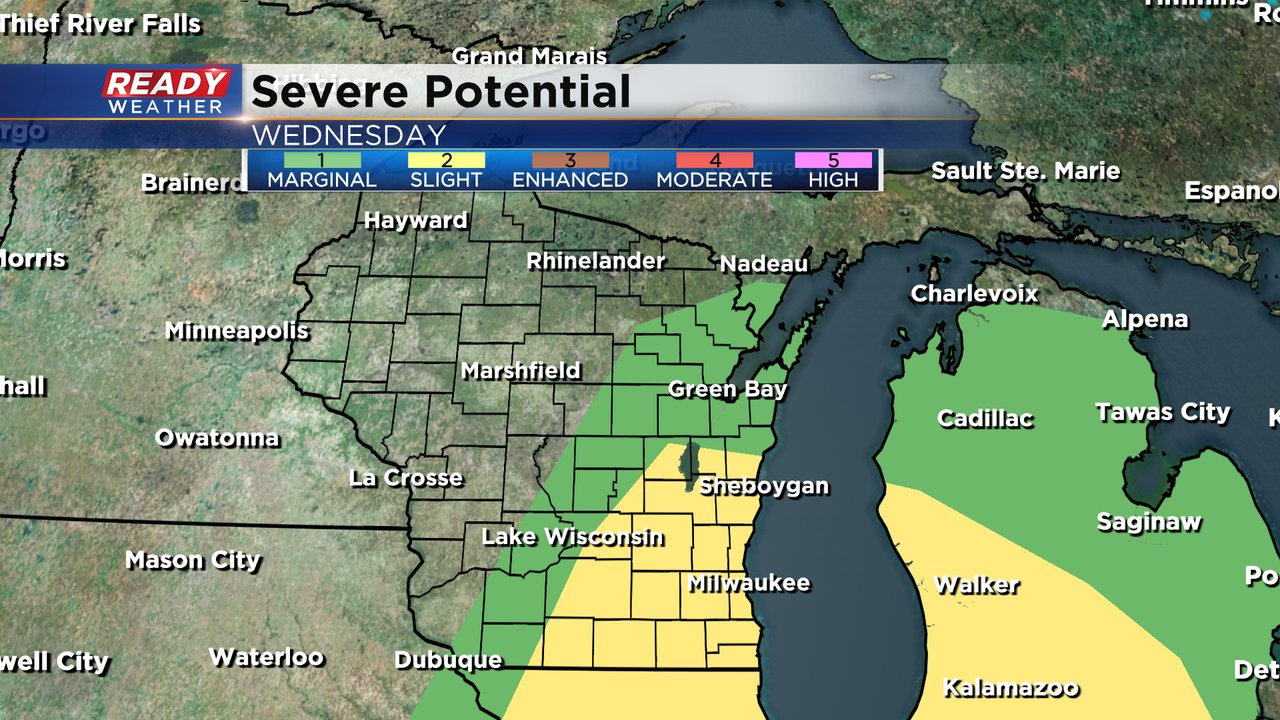
Scattered showers will continue off and on through much of Wednesday. A few rumbles of thunder may be possible throughout the day. The best chance for any stronger storms will be Wednesday afternoon and evening. The threat for severe weather is conditional - the more sunshine we see during the day, the better our severe chances are. It will also depend on the exact timing and track of the main area of forcing to push up thunderstorms. Some weather models have storms developing over southeast Wisconsin whereas others keep that threat to our south and east. All of southeast Wisconsin is in the "slight" risk (level 2 of 5) for severe weather.
The severe threats for Tuesday evening and throughout Wednesday will change depending on the time of day. Hail will be the primary threat with any storms Tuesday night through Wednesday morning. By Wednesday afternoon and evening damaging wind will become more of a threat along with an isolated tornado or two.

Download the CBS 58 Ready Weather app to get alerts if any severe thunderstorm or tornado warnings are issued.