Rain and storm chances increase heading into the weekend


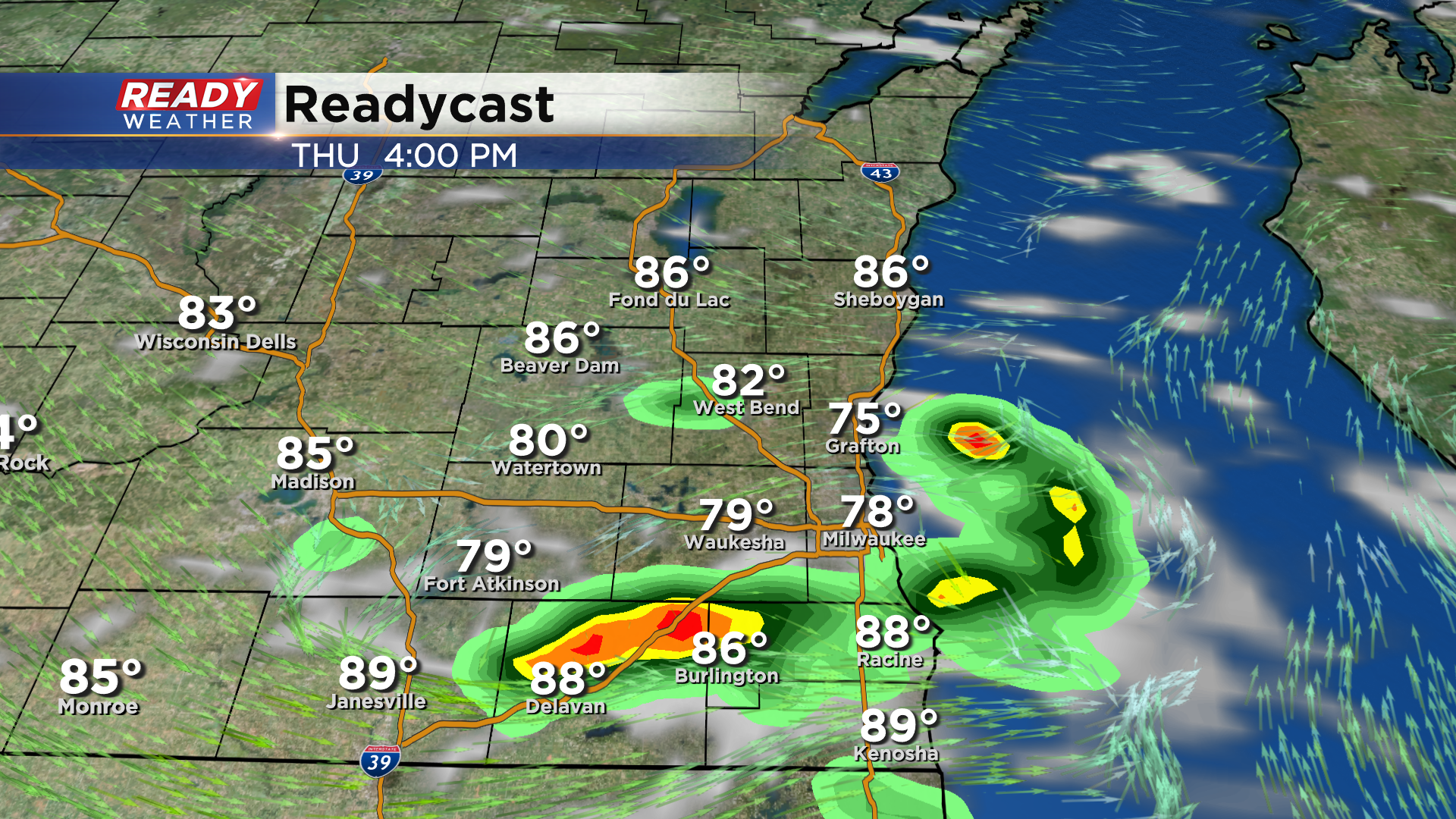
WISCONSIN (CBS 58) -- It's been a dry and hot stretch of weather for most of southeast Wisconsin this week. A few places north of Milwaukee were lucky to get *some* rainfall Wednesday evening, otherwise it's been pretty dry. A cold front is sliding through the state this afternoon. While the front is weak, we can't rule out an isolated shower or storm popping ahead of the front.
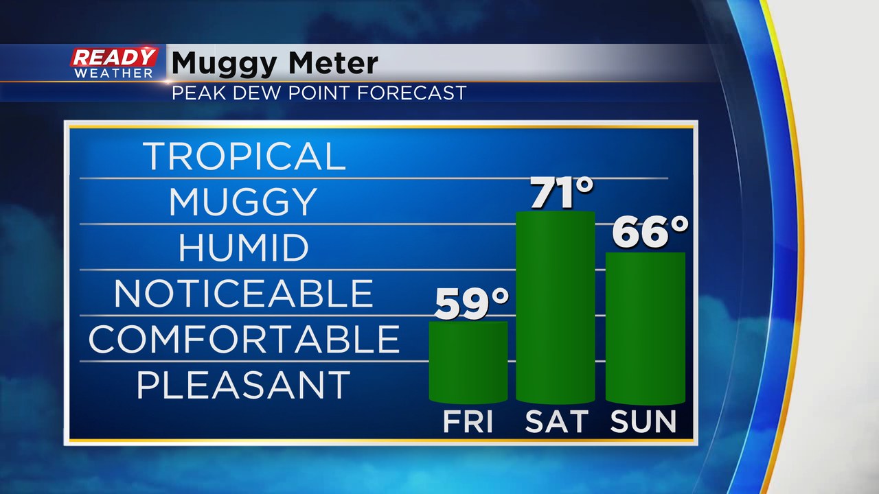
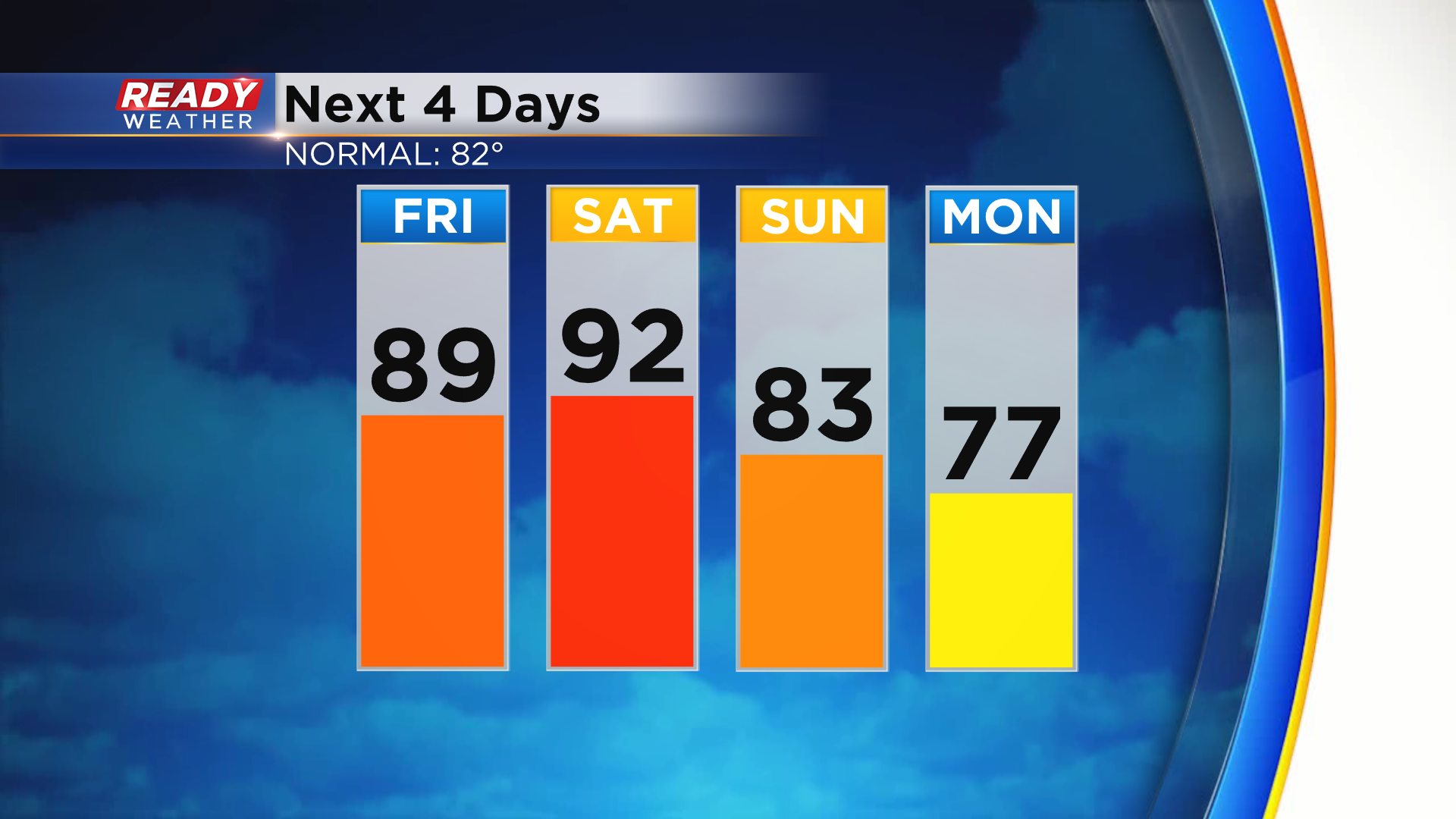
The front won't bring us much of a drop in temps with highs still in the upper 80s on Friday, but it'll bring us a brief break from the sticky weather. However it won't last long, as a warm front lifts through SE WI Friday night, allowing dew points to soar into the low 70s on Saturday.
As the warm front approaches Friday evening/night, we'll have a chance for scattered showers and storms, which taper off by Saturday morning. Heat, humidity, and sunshine Saturday afternoon will fuel another batch of storms Saturday evening - night, which will likely be strong to severe.
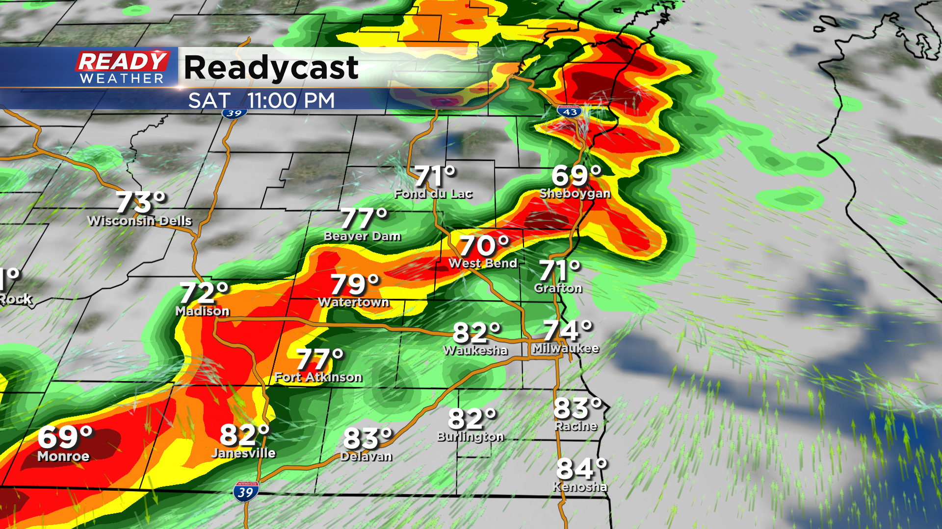
Damaging straight-line winds will be the primary threat with the line or lines of storms, but embedded tornadoes and hail are also possible.
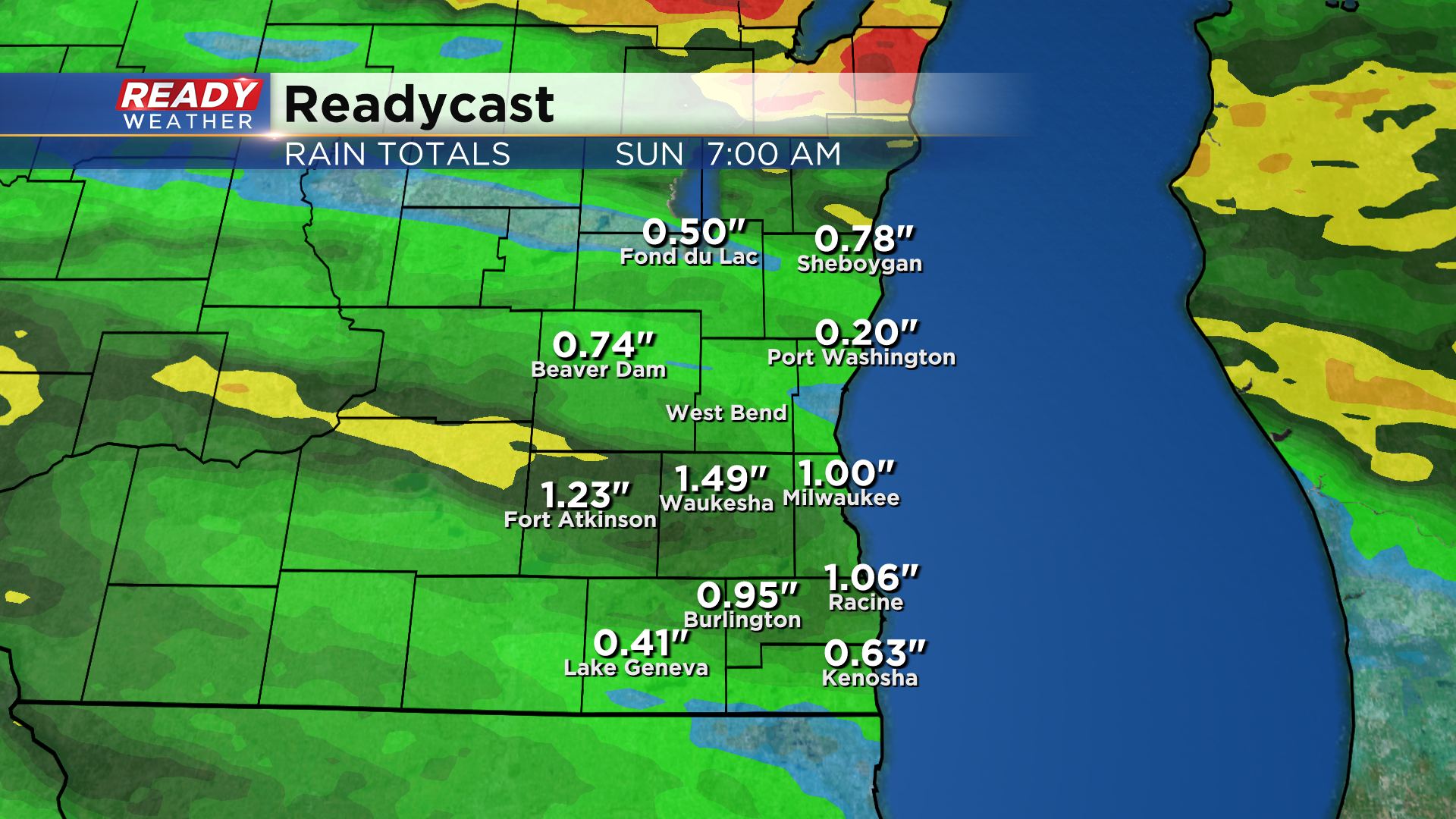
Storms will be moving fast enough that flooding shouldn't be an issue, but a solid inch .5-1" of rain looks like a good bet for most.
Temperatures finally drop back closer to normal behind the front with highs in the upper 70s to low 80s.
Download the CBS 58 Ready Weather App to track any incoming storms.