


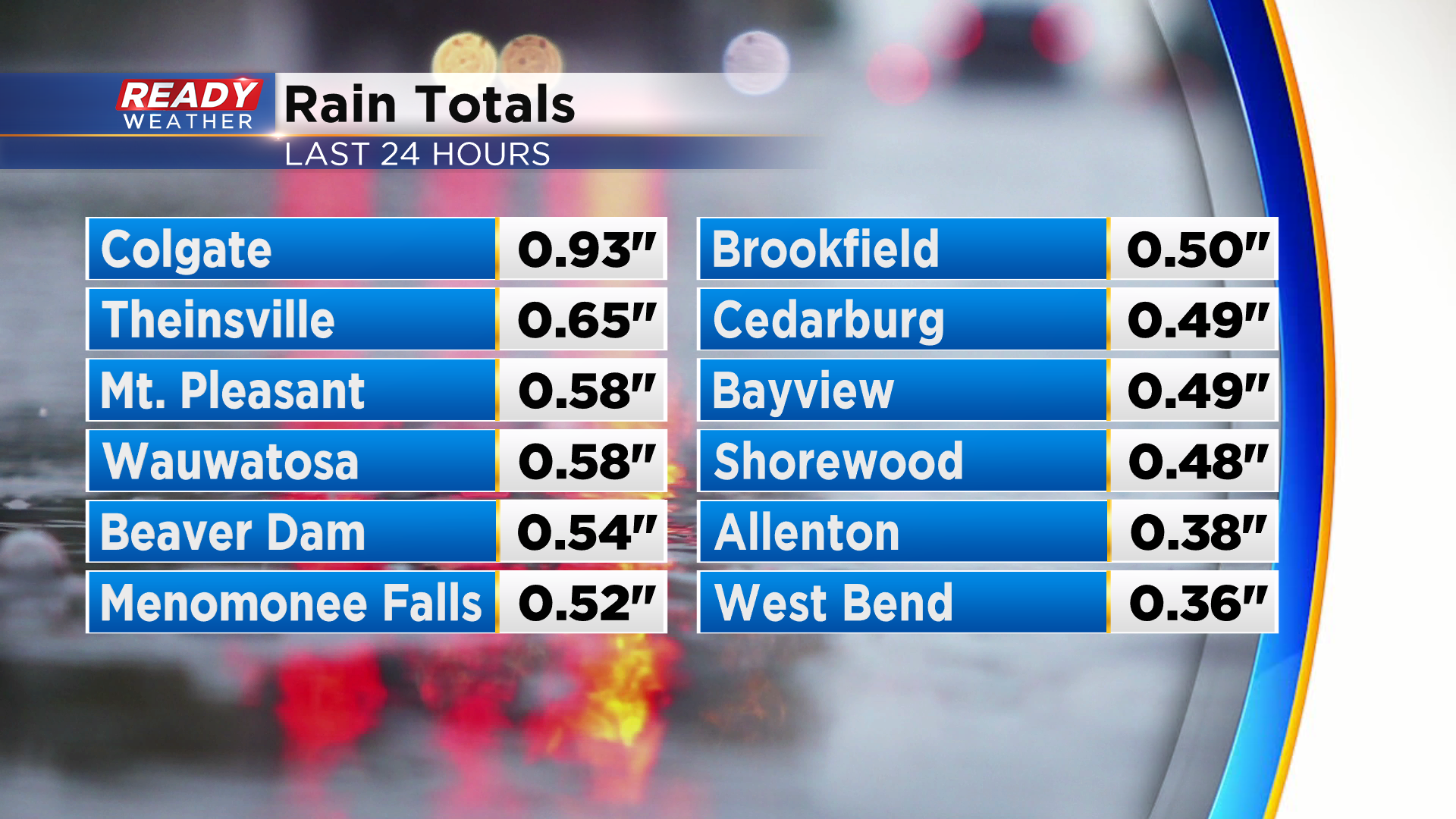
Early morning thunderstorms produced some decent downpours in parts of southeast Wisconsin. A good portion of Milwaukee, Dodge, Washington, and Ozaukee counties picked up between .40-.60" of rain from these storms.
We'll be dry and comfortable through tonight into the start of Father's Day, but showers and storms will return for the afternoon and evening. First round could move into the area as early as midday, with the brunt of the showers and storms tracking through between 2-6pm with this round. As it pushes into the area, storms may strengthen and could become strong to severe.
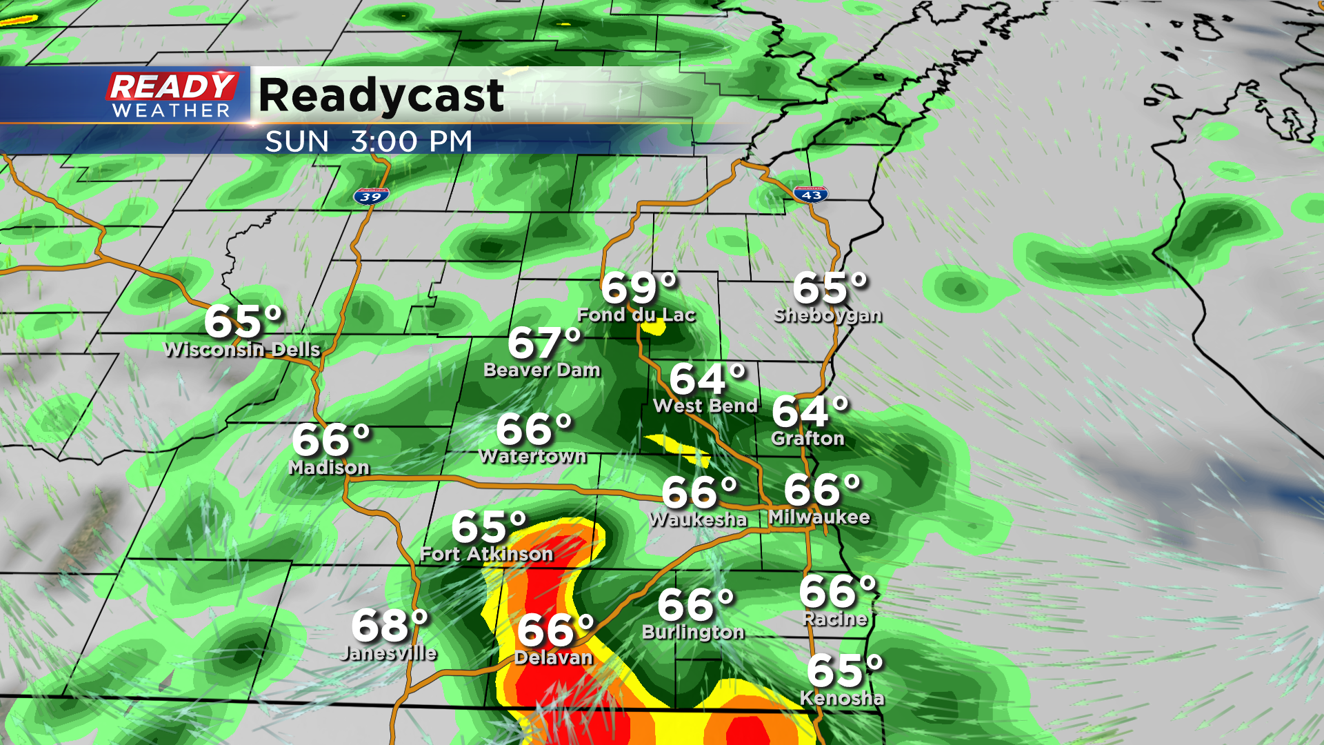
We could have a second round of showers and storms between 7-10pm as the cold front approaches from the west. This will depend on how fast or slow the afternoon round of rain and storms clears out. If we'll have a couple of dry hours for instability to build back into the area, we could see a more organized line of storms. However, the more likely scenario is a broken line of showers and storms with the severe threat mainly confined to the areas south of I-94.

Areas south of I-94 are under a level 2 of 5, Slight Risk, for severe storms on Sunday, with a lower risk to the north. The highest risk for severe storms will be across central Iowa and northern Illinois where a level 3 of 5, Enhanced Risk is in place.
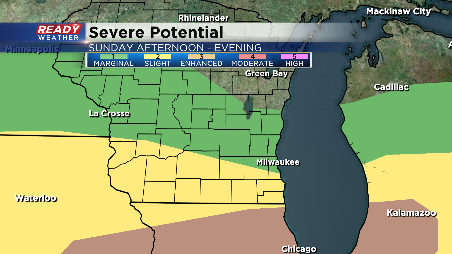
Damaging winds and hail will be the primary threats, but there's also an isolated tornado risk primarily in Walworth, Racine, and Kenosha counties.
Heavy downpours are expected in any storms, with .50-1" expected for a good chunk of the area. If we see multiple rounds of storms, rain totals could exceed 1.5" in localized spots. Download the CBS 58 Ready Weather App to track the storms and to get any warnings sent to your phone.