


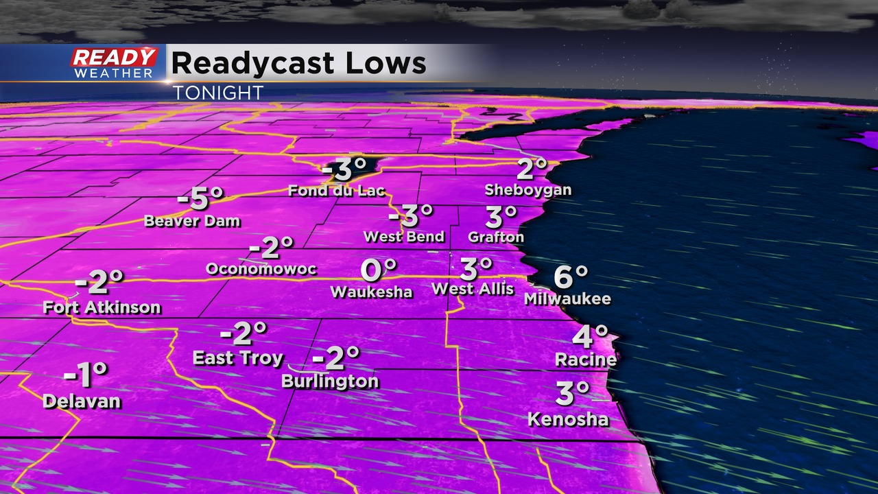
Sunshine returned across southeast Wisconsin today, but so did the cooler temps with highs topping out in the teens to low 20s. Temps will drop into the single digits above and below zero tonight with clear to partly cloudy skies and light winds in place. With winds are 5 mph or less, there won't be much of a wind chill, but whenever there is a bit of wind it'll make it feel more like -5 to -10.
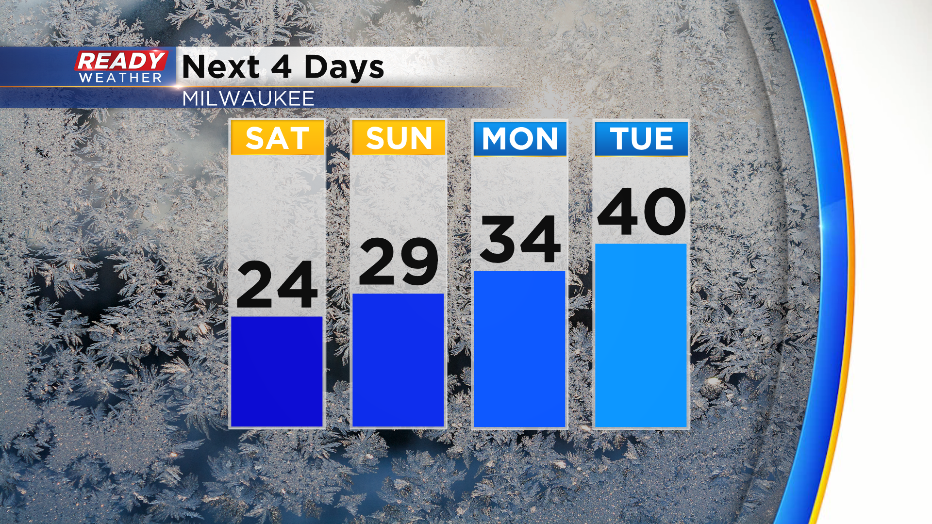
Temps won't be as cold through the weekend, but will remain below normal in the low to mid 20s Saturday and mid to upper 20s Sunday with more clouds in the area. Temps rise back above normal early next week, but that warmth won't be sticking around.
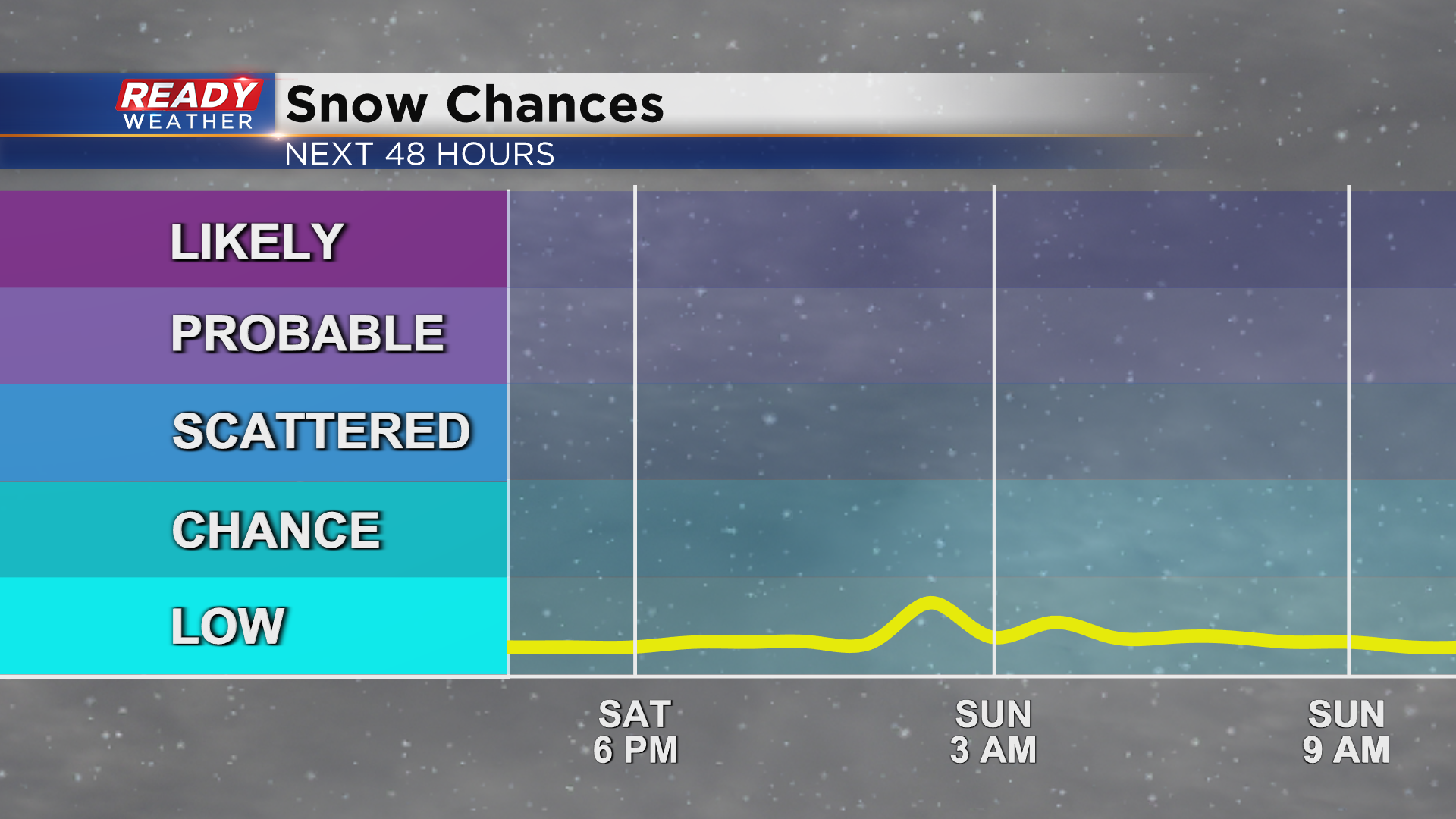
You won't need the shovel this weekend, but a few flurries are possible Saturday night into Sunday morning.
Dry weather then returns for Monday and Tuesday, but you may have already heard rumblings of a larger storm looming for the middle of next week. There is a *ton* of uncertainty being 5-6 days away, and the biggest uncertainty is the track of the system. A southerly track through the Tennessee Valley would keep the heavy snow to our south.
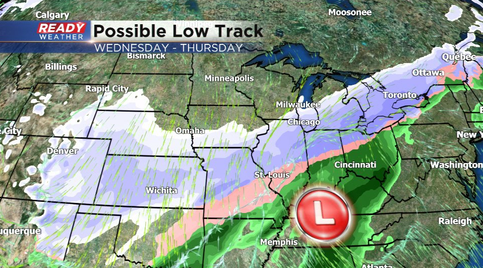
A northerly track through southern Illinois would put SE WI in prime position for a big snow event.
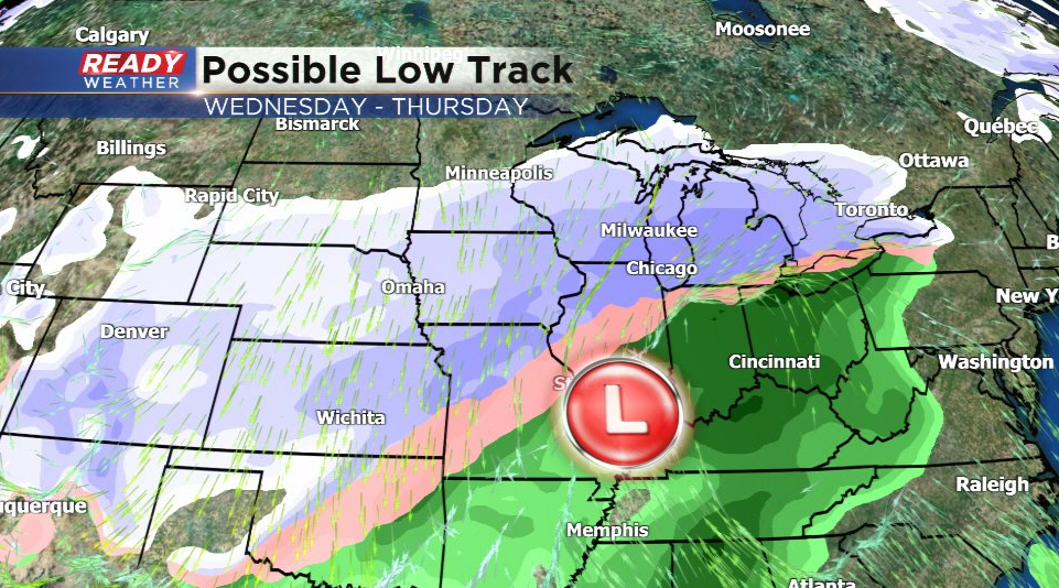
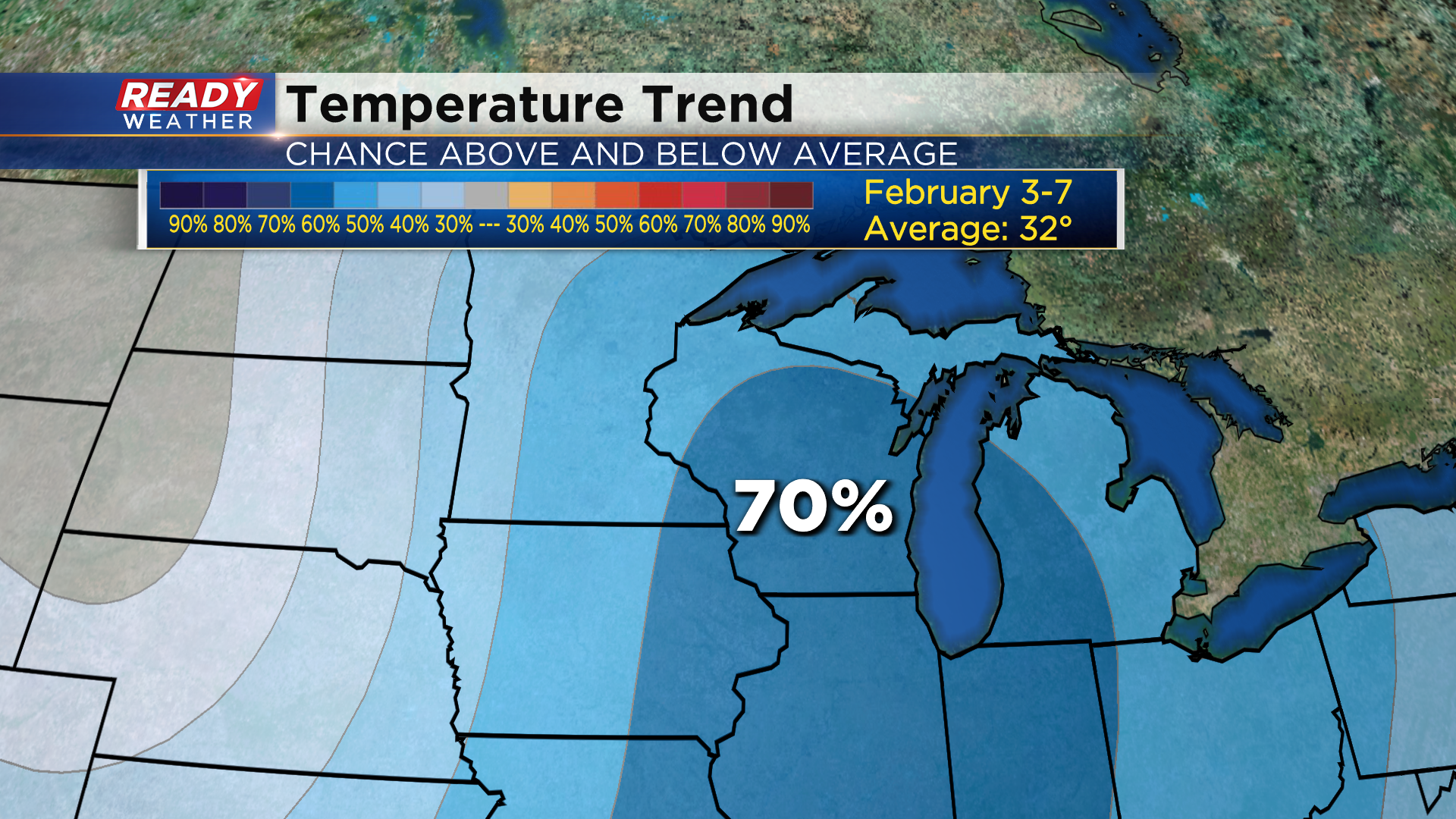
There's also a chance it tracks so far south that it misses us completely. All in all, it's something to keep an eye on for the middle of next week as it *could* be a rather impactful snow event, but this far out we have equal chances of either track panning out. Stay tuned for updates through the weekend! What's more certain is another shot of cold will follow this system for the end of next week. Most of Wisconsin has a 70% chance of below normal temps from Feb 3rd-7th. Milwaukee's normal high by then is around freezing.
Download the CBS 58 Ready Weather App to track the forecast into next week.