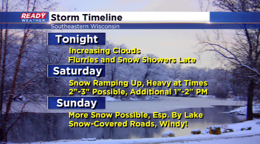
Prolonged snow event this weekend
It starts out cold this morning with wind chills 10 to 20 degrees below zero as the winds will still be breezy out of the WNW. The winds turn more southwesterly later today ahead of our next snow maker, a clipper!
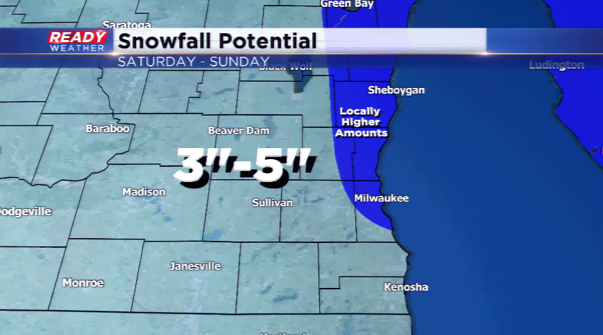
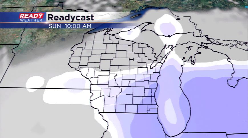
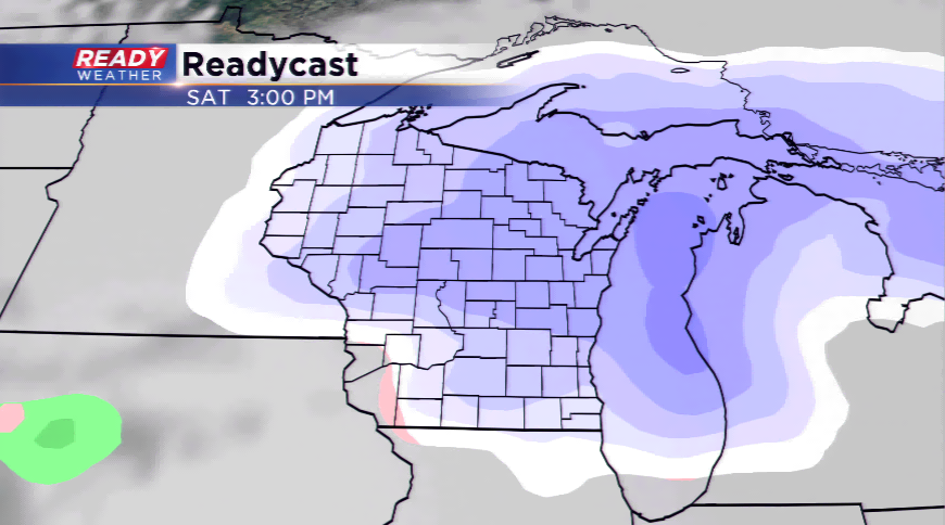
This clipper system will usher in snowfall as early as tonight, and it could last until Sunday. The main period of snow will take place on Saturday afternoon into Sunday morning. The heaviest snow will fall along the lakeshore where there could be lake enhancement into Sunday morning. The totals will be higher along the lake if the lake effect snow kicks in; otherwise, expect snowfall totals to range from 3"-5".
If you’re thinking of traveling anytime this weekend, think about getting it done tonight or Saturday morning. The snow will cause impacts such as snow-covered roads, blowing and drifting, slippery stretches, and slower travels.