


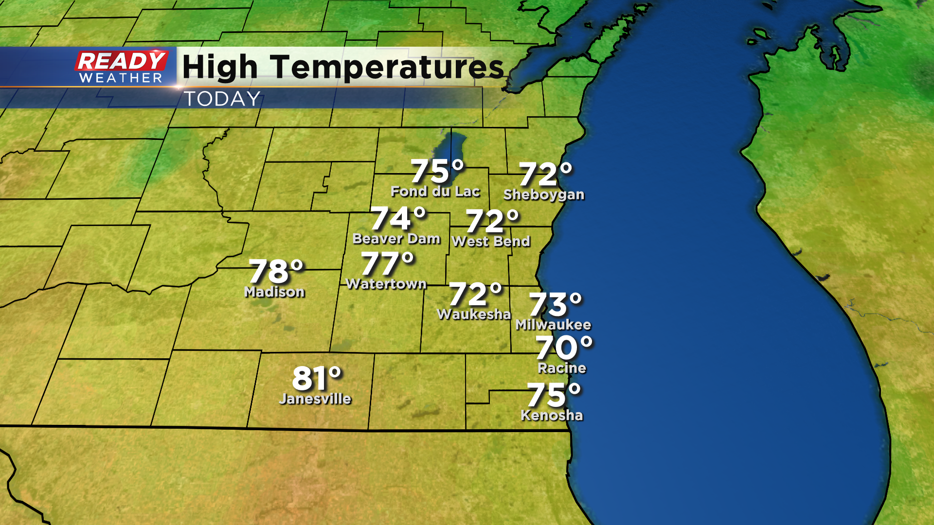
It was a refreshing day across southeast Wisconsin today! Temperatures were able to climb into the 70s in most locations, although lakeside areas spent most of the day in the 60s.
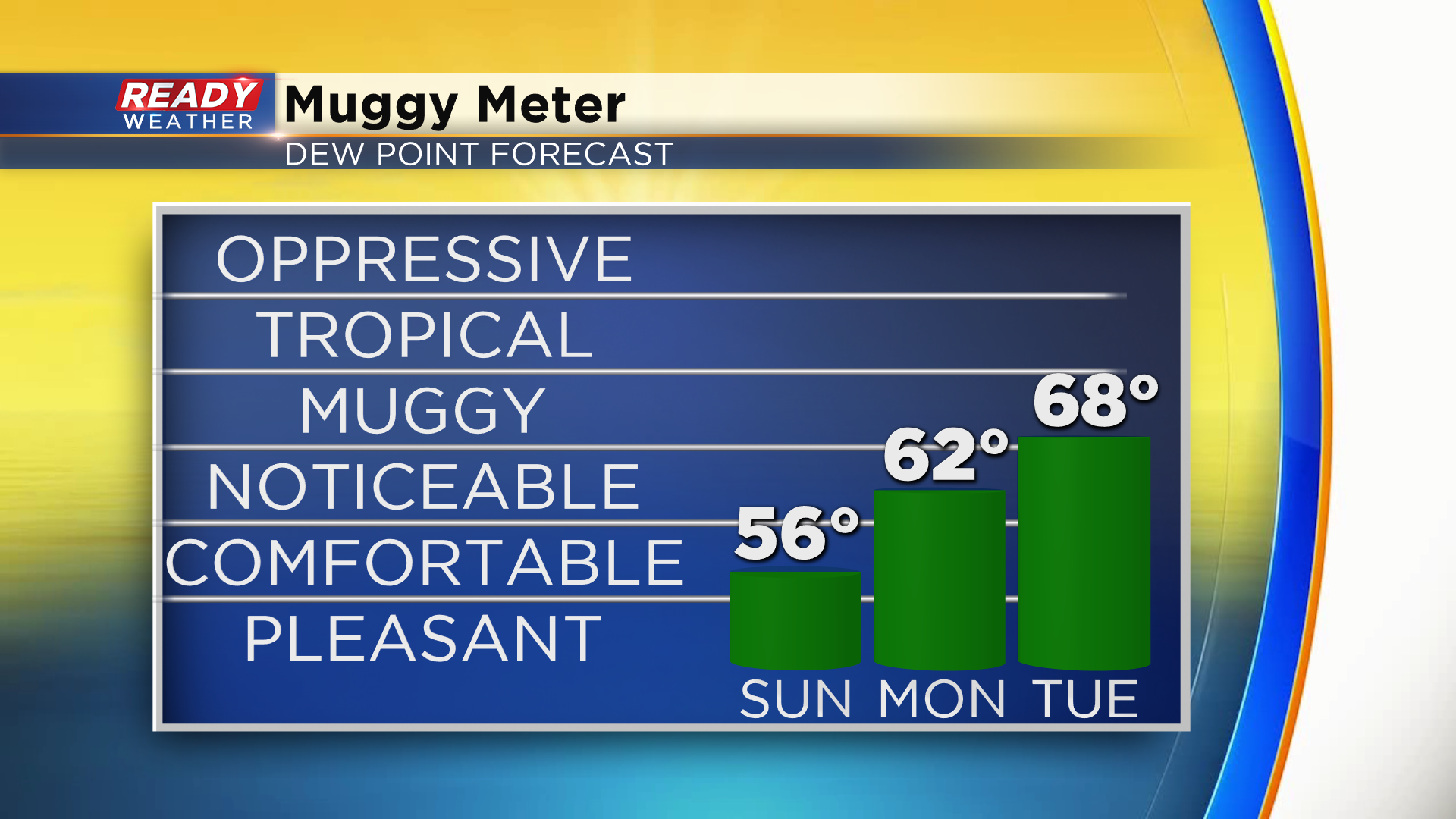
Comfortable temperatures and levels of humidity will continue on Sunday with easterly winds keeping temps in the upper 60s lakeside and mid 70s well inland. 80s return to the area Monday and Tuesday with upper 80s possible well inland on Monday.
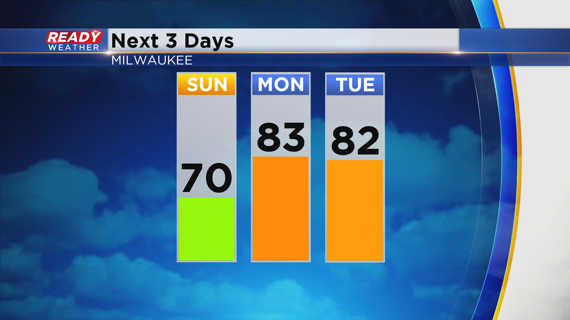
Enjoy the comfortable air we'll have in place for tomorrow because the humidity will return on Monday and Tuesday.
While we can't rule out a stray shower in Sheboygan and Fond du Lac counties early Sunday morning (20% chance), we should be dry through at least midday Tuesday. By then, the remnants of Tropical Storm Cristobal will be working towards the state.
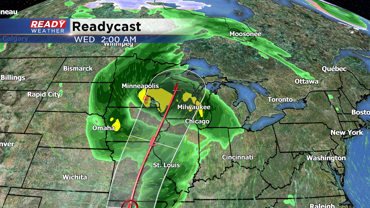
There's still a bit of uncertainty in the track of Cristobal once it makes landfall, but confidence is growing that it'll track through the badger state, bringing with it some very heavy rainfall. The exact track will determine where the heaviest rain will fall, so check back for updates over the next few days.