Pleasant weather continues into the start of the work week


It's been a 10/10 day across southeast Wisconsin with plenty of sunshine, comfortable humidity, and temps in the 70s.
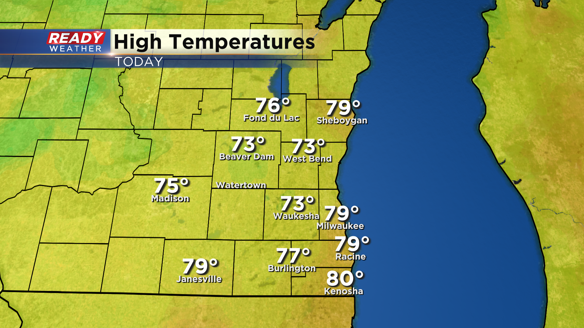
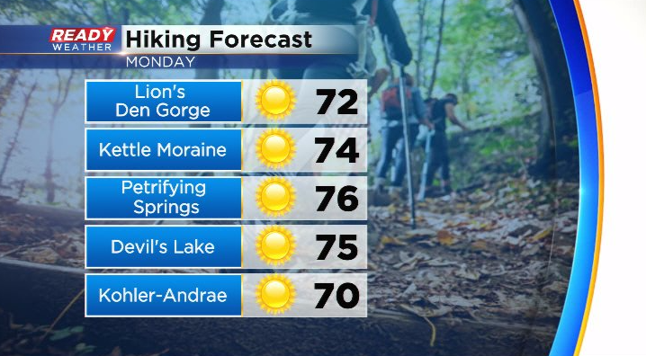
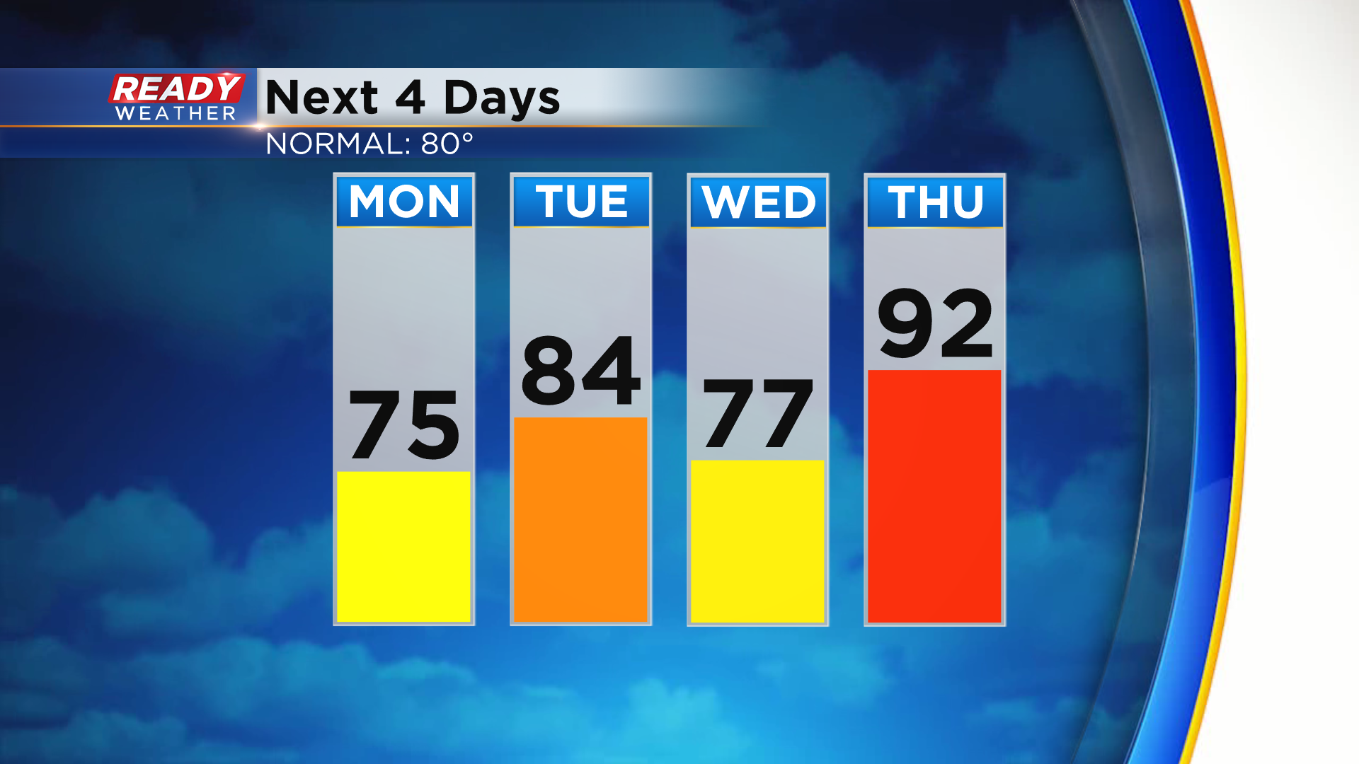
The wind has been a bit gusty, but it'll calm down this evening and stay light on Monday. The light wind on Monday will allow a lake breeze to develop in the afternoon that'll likely push inland, capping temps in the low to mid 70s for highs despite abundant sunshine.
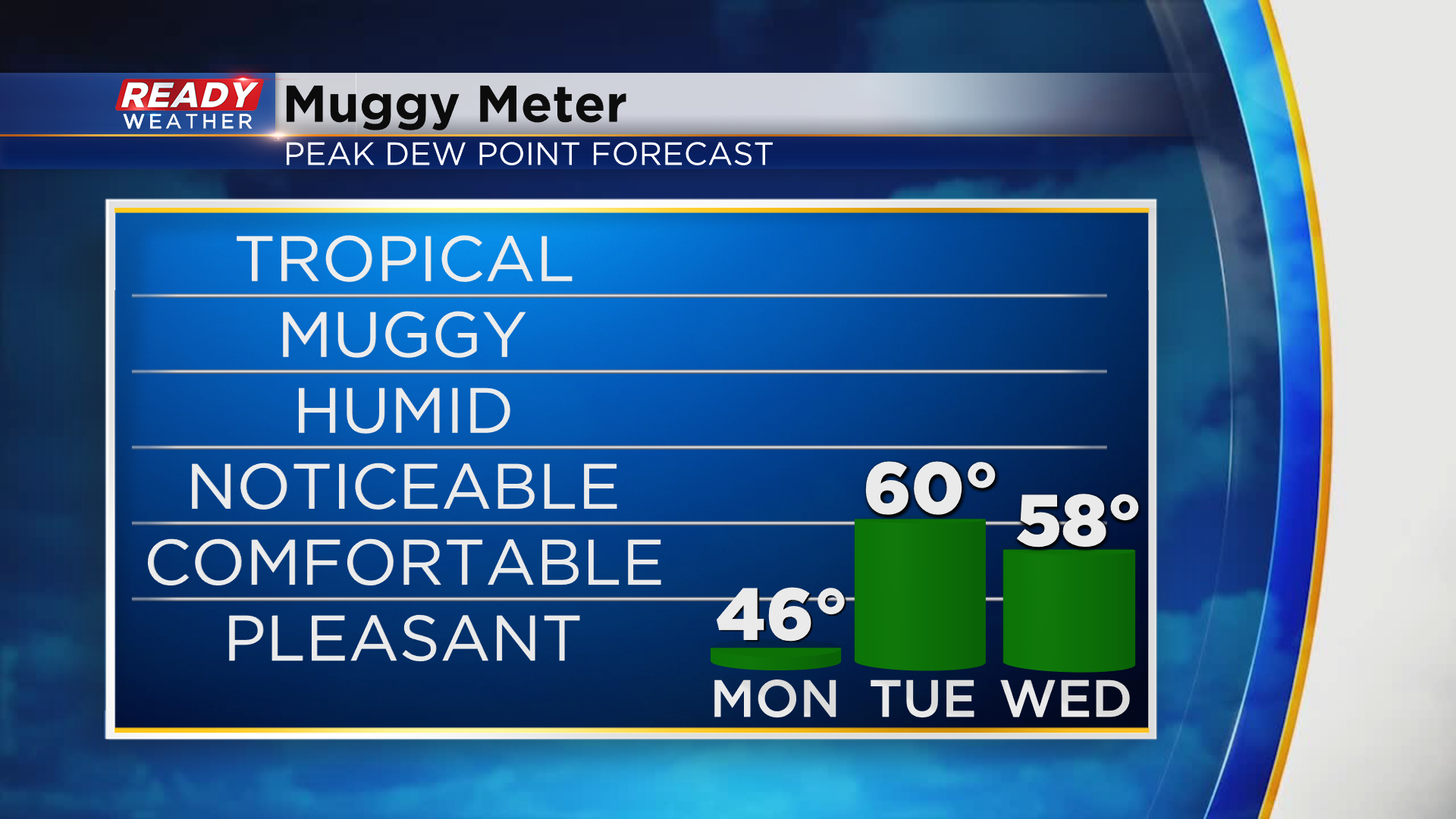
Wind turns to the south on Tuesday, which will help boost temps back into the low 80s ahead of a cold front. You may notice a bit of humidity on Tuesday, but it won't be sticky by any means.
The slight increase in temps and humidity will help trigger scattered storms late afternoon through the evening on Tuesday.
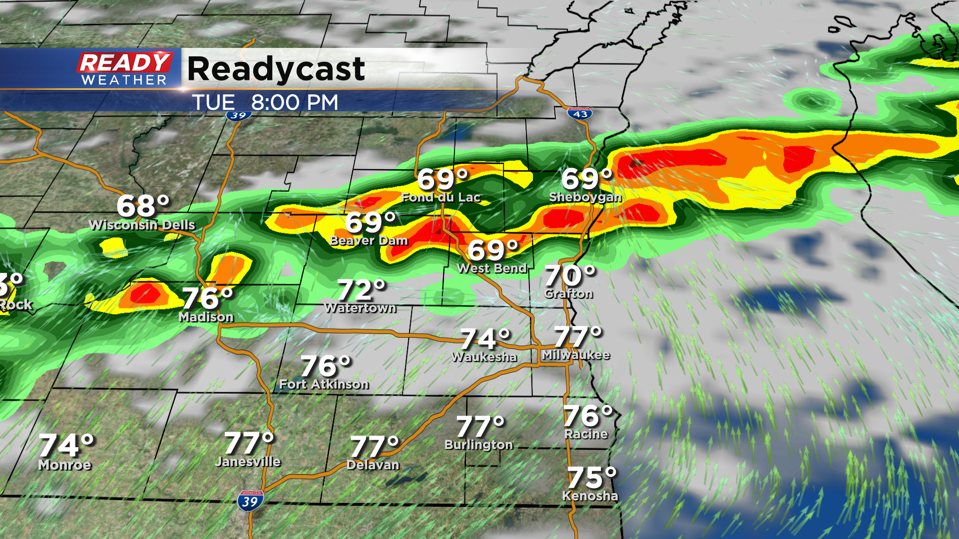
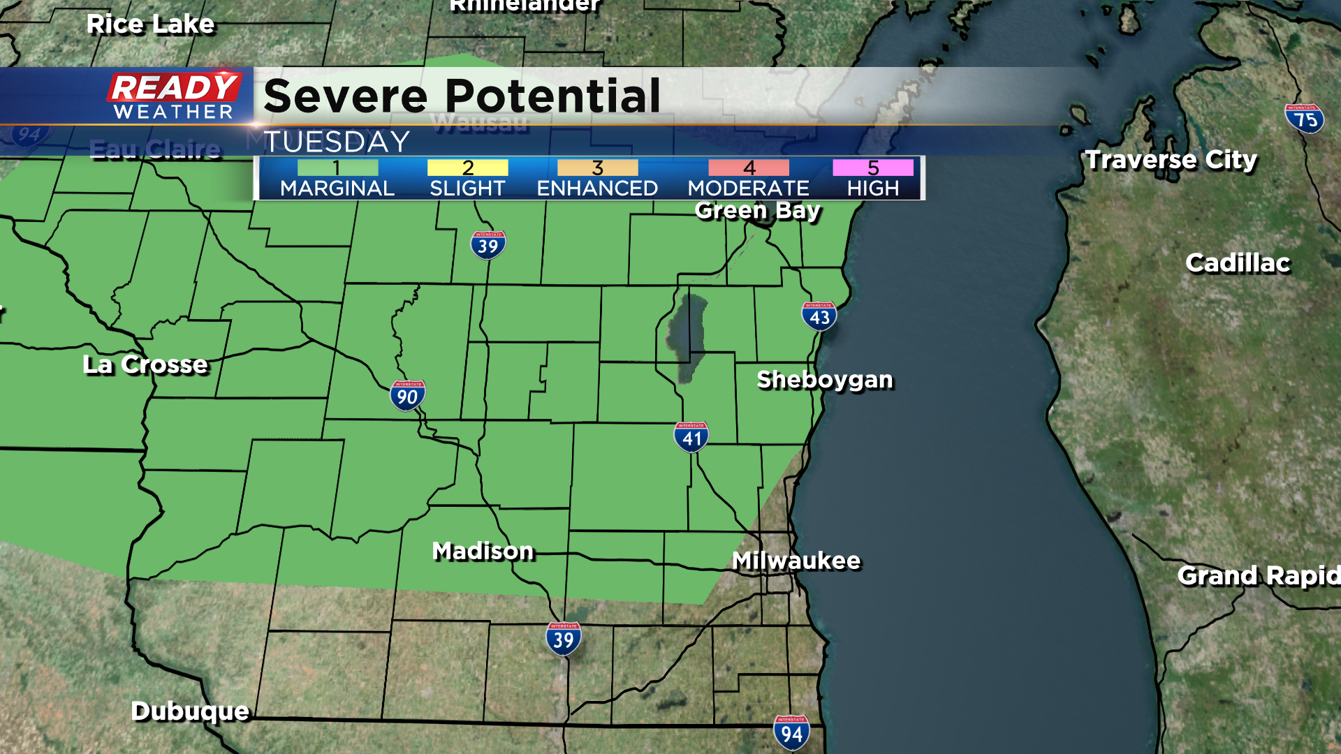
A few of these storms could be on the stronger side with gusty winds being the main concern. Areas north and west of Milwaukee have the best shot at stronger storms due to them arriving before sunset. These areas are under a level 1 of 5, Marginal Risk, for severe storms.
Temps cool down briefly on Wednesday behind the front, but will make a run at 90 degrees once again on Thursday.
Download the CBS 58 Ready Weather App to see if there are more storm chances besides Tuesday evening.