Our amazing stretch of nice November weather quickly coming to an end


MILWAUKEE (CBS 58)--It was great while it lasted. Our temperatures over the last few days, for highs, ranging from 65 to 70. Now, expect temps to go the other way, slowly at first, and then a huge plummet by the end of the week.
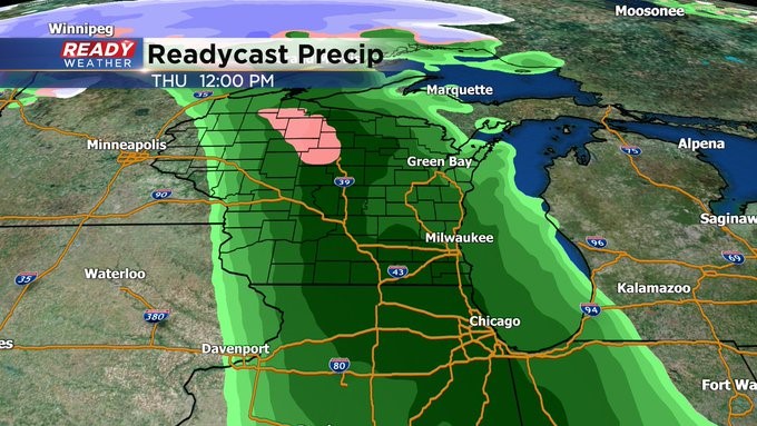
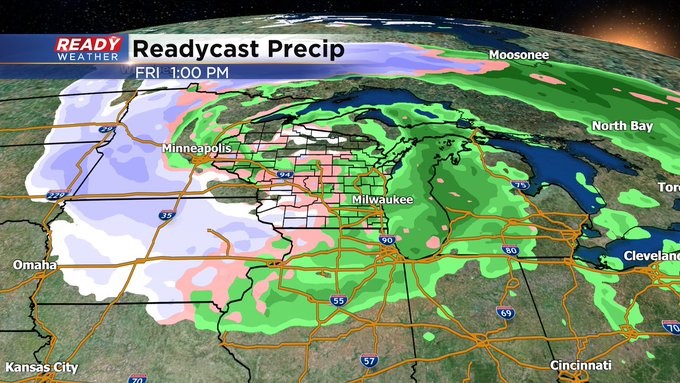
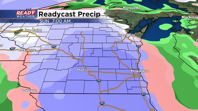
First things first, a "cool" front will cross the region overnight. Then an area of low pressure might attach to it south of us on Tuesday keeping clouds and isolated showers in the forecast. Most of the rain activity should be south of I-94. Then a more potent system moves in from the west later Thursday into early Friday. This could change some of the precip over to a mix of rain and snow once we get behind the front. In fact, we face the possibility of this wintry mix Friday and Sunday too. At times on Sunday, it could be all snow. leading to a slight accumulation. But there's a lot more forecast that needs to be done between now and then. It's a good thing the CBS 58 Ready Weather team is here for you.