


Another big cold blast is coming but not before a mild day. Temperatures on Tuesday will rise into the middle to upper 30s. A 40* high temperature is not out of the question! An arctic front arrives Tuesday night into Wednesday morning dropping temps quickly. At midnight early Wednesday morning the temperature will probably still hang out around 30* but by the time many of us are waking up we are in the middle teens and we don't warm much during the day.
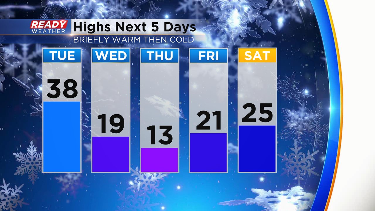
Expect highs mostly in the teens for the end of the work week then it gets a littler better this weekend in the middle 20s.
The wind will pick up Tuesday night going into Wednesday with gusts to 30 mph. By the time we are waking up Wednesday morning wind chills will be in the -5 to -15 range. Wind chills will likely stay below-zero all day long. Even colder wind chills are expected Thursday morning to -20. The wind gets a lot lighter Wednesday night so there won't be much wind Thursday morning which could factor into whether or not we see a wind chill advisory.

Beyond the next few days, the colder air looks to stick around. The 8 to 14 day temperature trend has a 50-60% chance for below-average temperatures. This would take us through the end of January. So once the teens and 20s for highs arrive it looks like they will stick around.

Download the CBS 58 Ready Weather app to track the colder temperatures.