One last round of gloom, rain and snow before a (mostly) dry weekend


We are waking up to scattered rain and snow showers (again) this Friday morning. Most of southeast Wisconsin is starting the day with mostly rain with a little snow and mix at times. Closer to Madison the precipitation is all wet snow.
Here's a look at the current radar that will update with time:
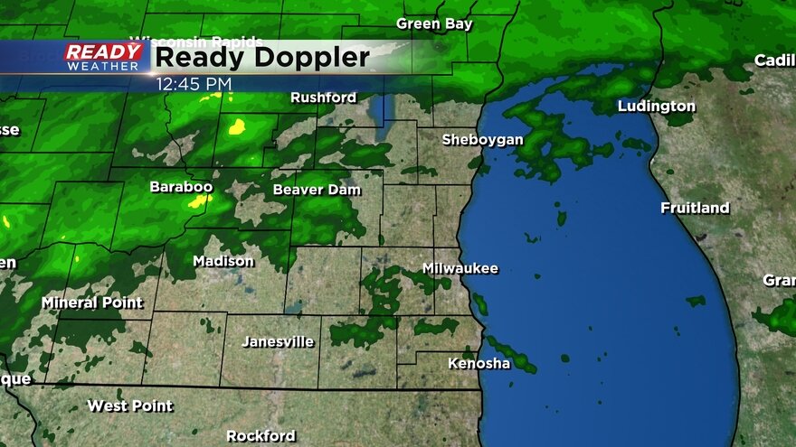
The rain is quickly switching over to a mix and wet snow and the majority of the precipitation through the rest of the day will be wet snow with some rain and sleet mixing in at times. The scattered showers will last all day long through the morning, afternoon and evening. A few flurries may linger past midnight Friday night.
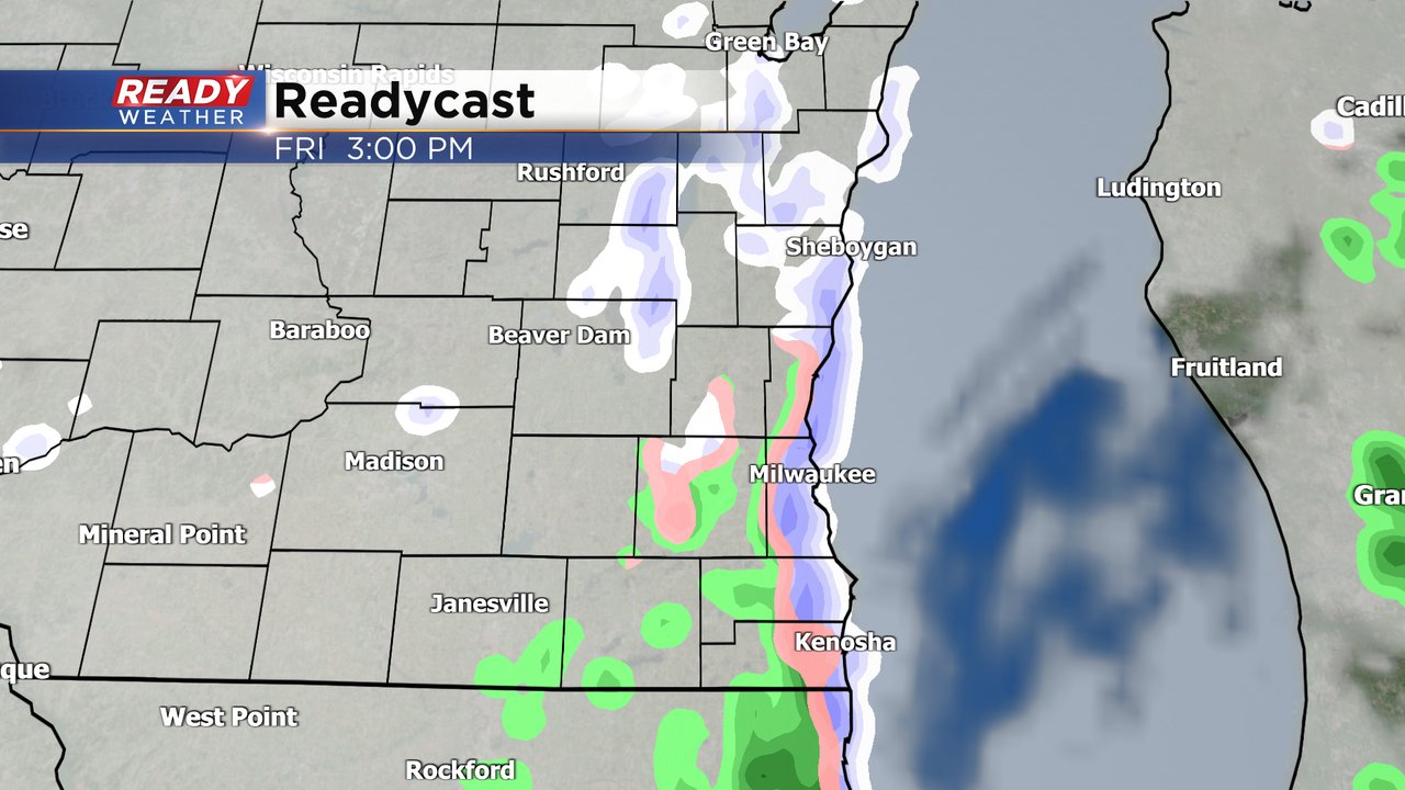
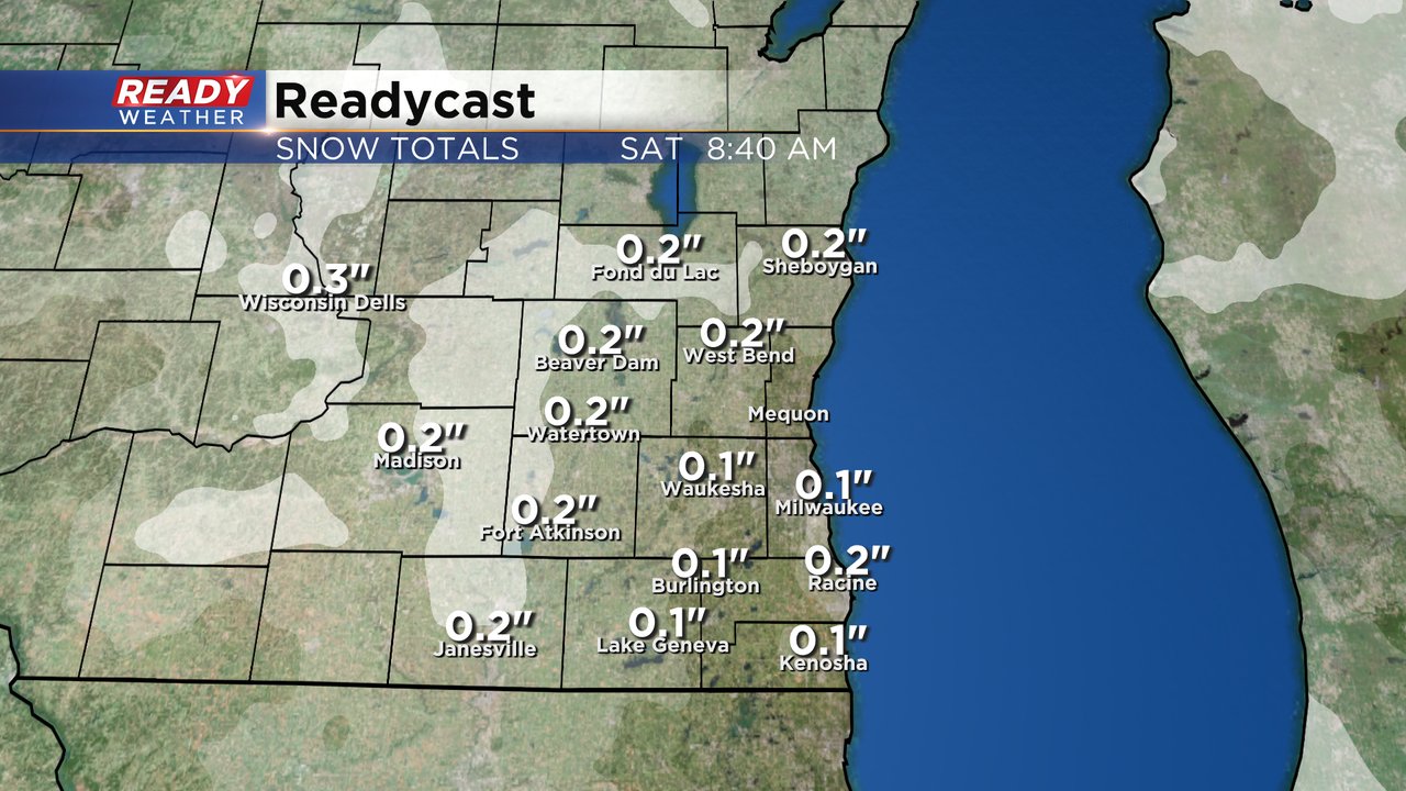
With the wet snow throughout the day we could potentially see a slushy dusting in some communities. Any snow we get will stay on grassy surfaces and won't amount to more than a couple tenths of an inch.
We finally dry out this weekend. Expect a mostly cloudy sky on Saturday with some sunshine arriving by late afternoon just before sunset. The sunshine should last through the rest half of Sunday before we start to bring in clouds ahead of the next chance for rain Sunday night. Sunday will be warmer than Saturday with highs in the 50s.

Download the CBS 58 Ready Weather app to track the rain and snow showers.