October Starts with Cool Days and Mild Nights
The beginning of the month came with big weather news. Hurricane Joaquin grew into an intense Category 4 Hurricane out in the Atlantic and threatened the eastern Seaboard. While it never came onshore, a stationary boundary held fast, providing record rainfall, especially to South Carolina. Meanwhile, we had an area of high pressure overhead with nowhere to go! That meant days of brisk northeast wind, providing cool temps here across our area.
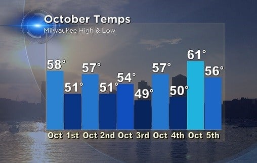
Take a look at temperatures the first five days of October for Milwaukee. Most days featured cool highs in the middle 50s with a brisk northeast wind. Wind gusts during this time frame were in the twenty to thirty mile per hour range. As that flow came across the lake, which by the way is still in the lower 60s, temps held steady for both the high and low. Days were five to ten degrees below normal, while lows were five to ten degrees above normal.
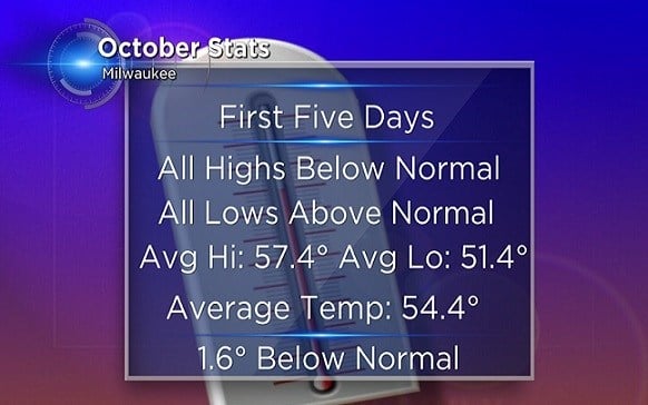
Overall we are running just slightly below average so far on the month. The pattern is changing now with a return to the 60s and even some 70s in the forecast. We're also monitoring the chance for showers and possibly a few storms on Thursday. Stay tuned to our CBS58 forecasts for the latest information.
I'm meteorologist Rebecca Schuld
