It was another seasonal early March day across southeast Wisconsin with temperatures topping out in the low to mid 40s. Much warmer air is just off to the west with a warm front.
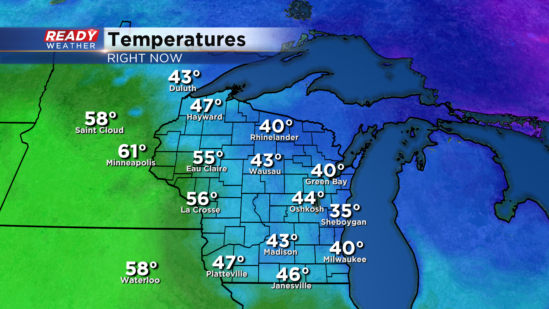
That front will move through late this evening, which will turn our winds to the southwest and help temperatures rise back into the low 40s after dropping into the upper 30s early this evening.

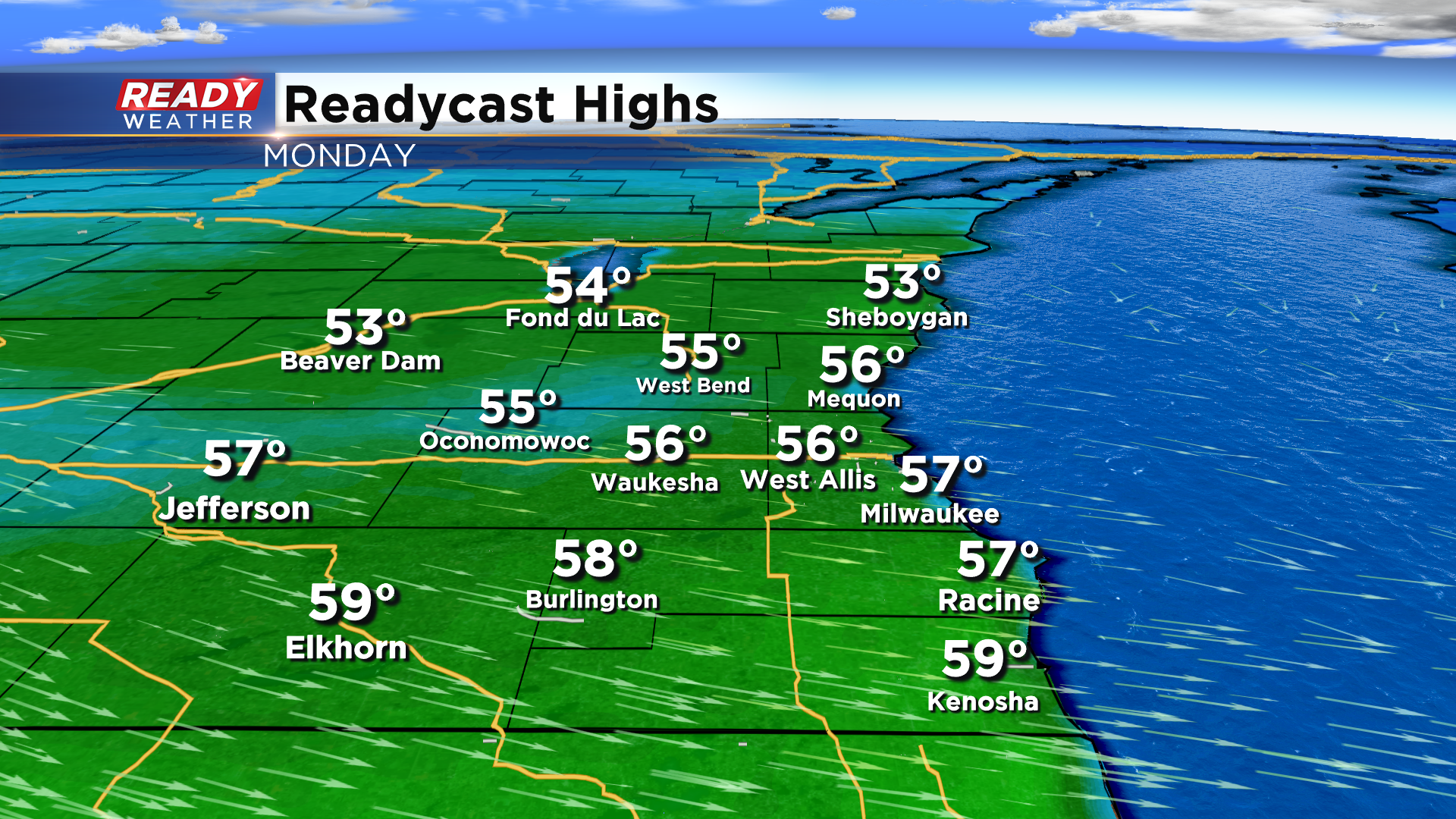
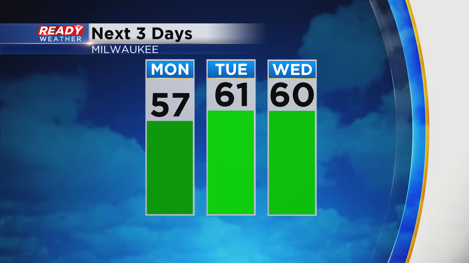
That warm front is associated with a low pressure system tracking through Canada. That system will drag a cold front through southeast Wisconsin Monday morning, but it will wash out across the area, leaving temps in the mid 50s with a WNW wind to the north and WSW winds with highs near 60 along the WI/IL border.
Another warm front will move through Tuesday morning, so after a cool and foggy start, temps will jump into the low 60s during the afternoon. There's some uncertainty if a lake breeze will develop Tuesday afternoon. If the southerly wind is strong enough to hold off the lake breeze, temperatures could be a couple of degrees warmer than the current forecast.
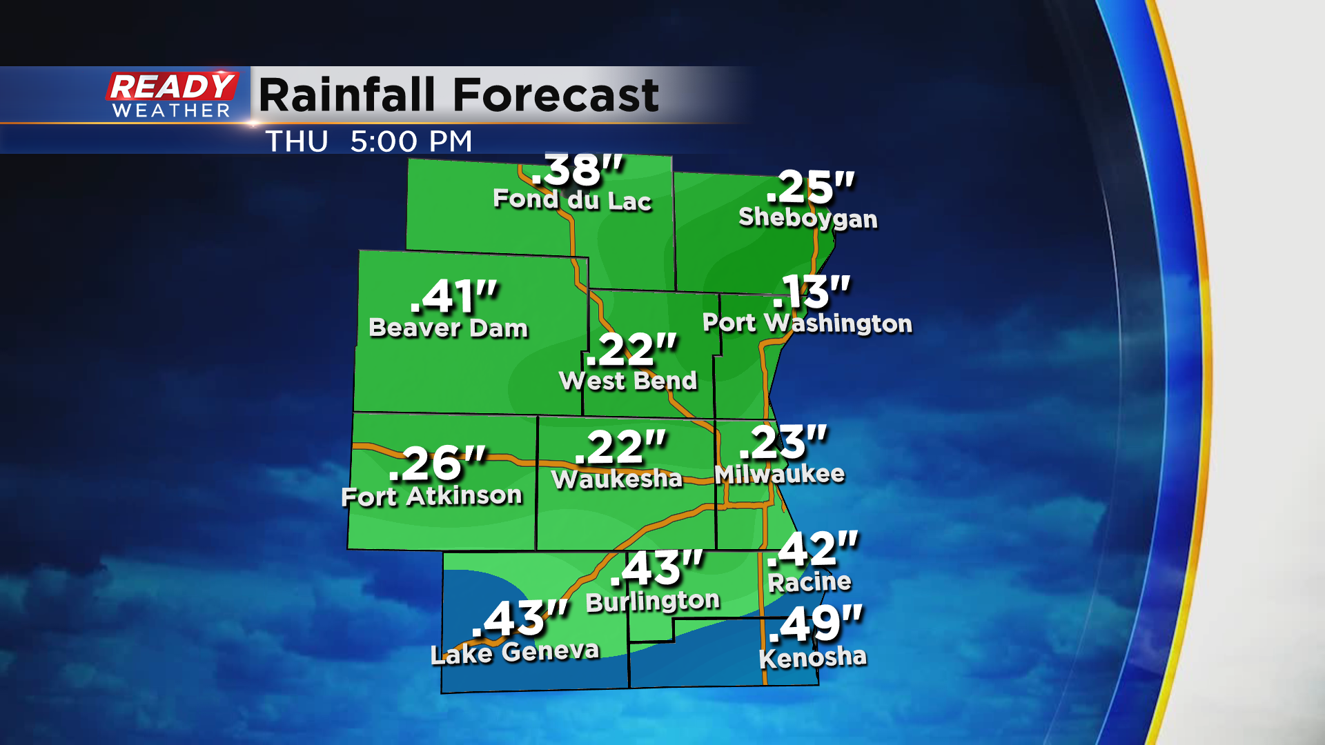
We'll continue to have a breezy southwest wind on Wednesday, but rain showers look likely. A few rumbles of thunder are possible at night as the cold front moves through. Another wave of energy rides along the front Thursday morning as the front stalls to our south, bringing a few more showers far southeast Wisconsin. Overall, .25-.50" of rain will be possible Wednesday into Thursday.
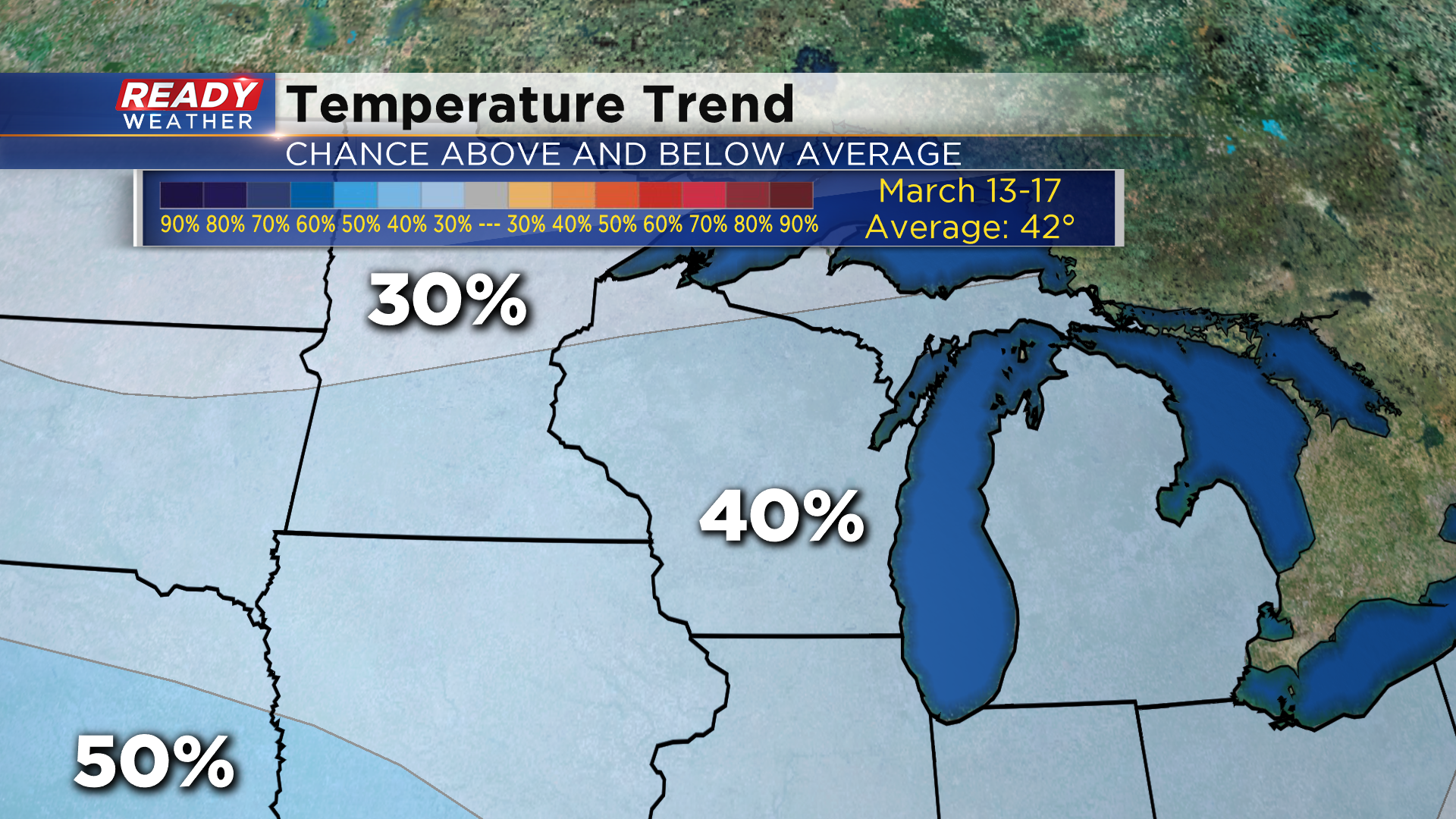
Cooler air looks to settle in behind that system into early next week. The 6 to 10 day temperature outlook favors slightly below normal temperatures for the third week of March.
Download the CBS 58 Ready Weather app to see the full 7 day forecast.
