Nice again Sunday, but heat and humidity return for next week


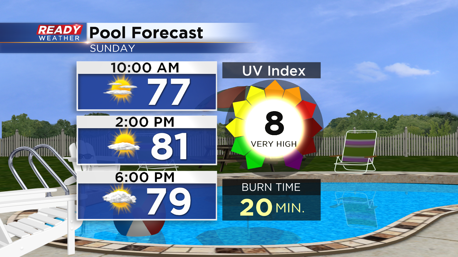
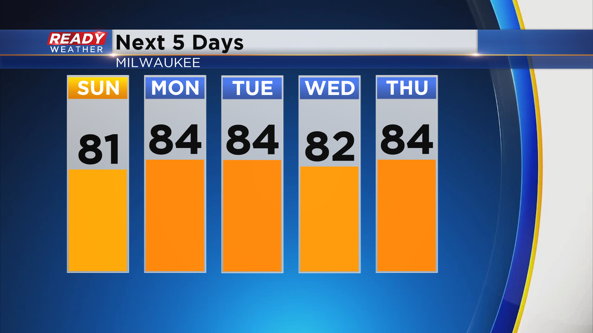
Today was a warm, but pleasant summer day across southeast Wisconsin. More great weather is in store for Sunday with highs in the upper 70s to low 80s and a nice breeze off the lake.
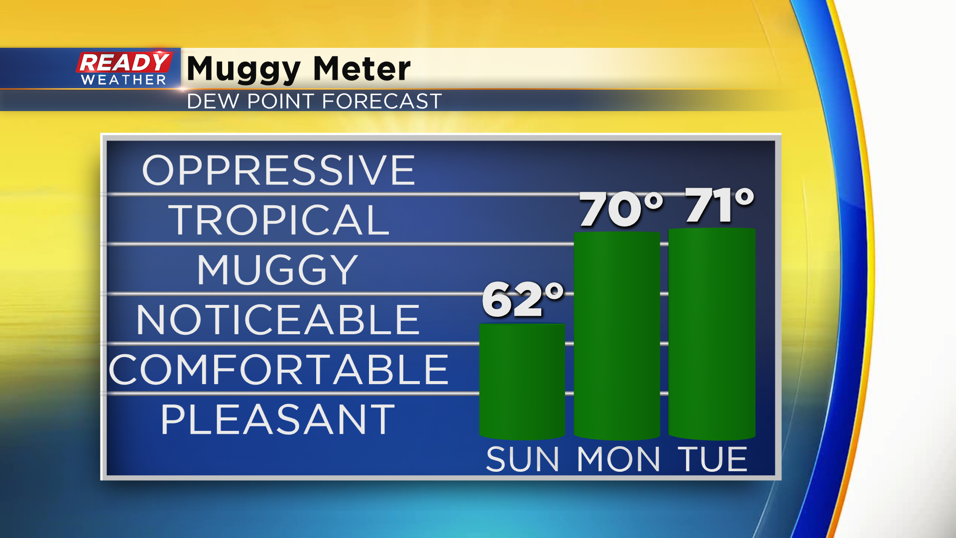
You'll still notice the humidity tomorrow, but it won't be nearly as bad as what's in store for next week. Dew points return to tropical levels on Monday and will likely remain that way for the entire week.
Not only will we have the humidity, but we'll also have to deal with some heat. Temperatures will likely be in the mid 80s lakeside for most of the week, but upper 80s will be possible inland, especially by Thursday.
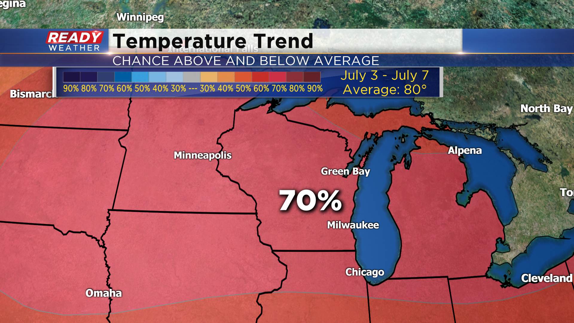
There's a very good chance this heat will continue into the 4th of July weekend as we have a 70% chance for above normal temperatures across the entire state.
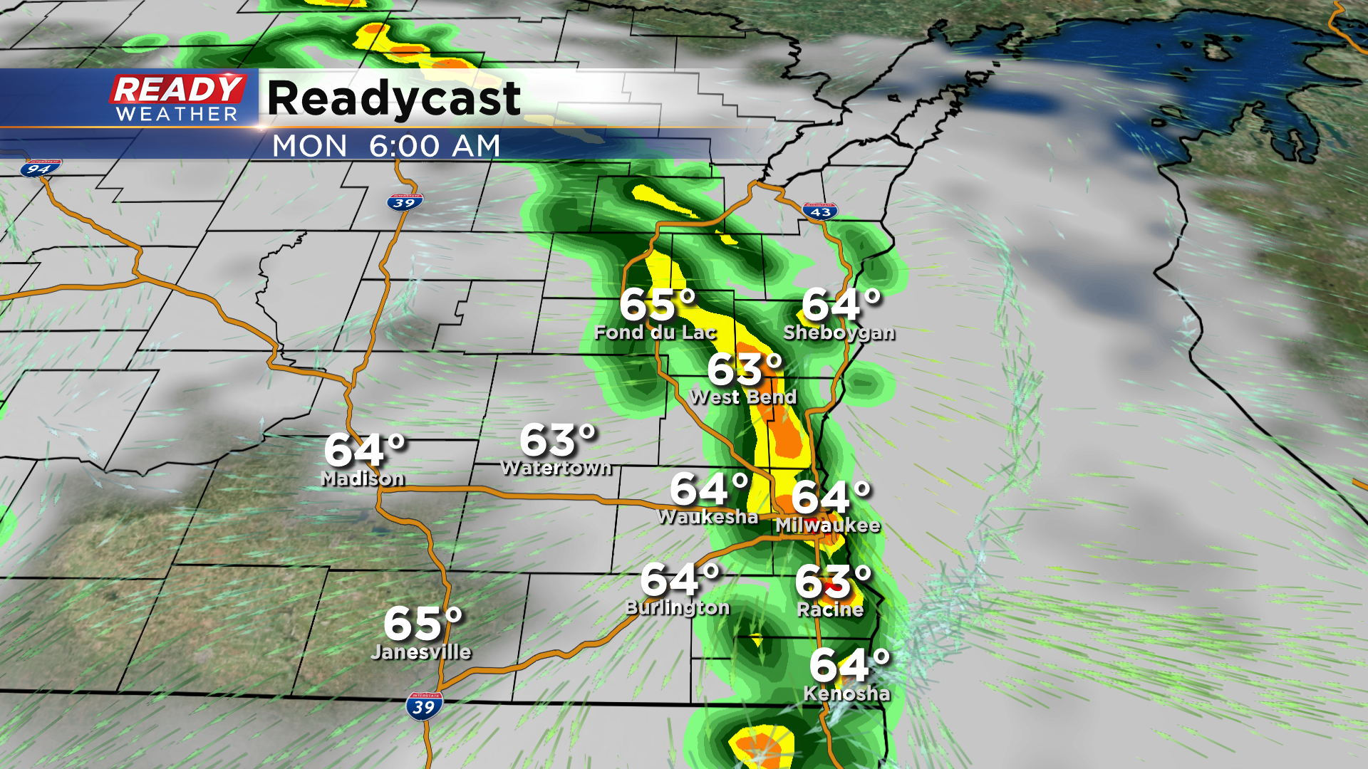
With all of this heat and humidity in place, there will be multiple chances for pop up afternoon thunderstorms. A weakening area of storms looks to move through late Sunday night/early Monday morning. Otherwise pop up storm chances will be possible Monday, Tuesday, and Wednesday afternoons.
Download to CBS 58 Ready Weather App to keep an eye on the pop up storms early next week.