Near record heat with an isolated storm chance Wednesday


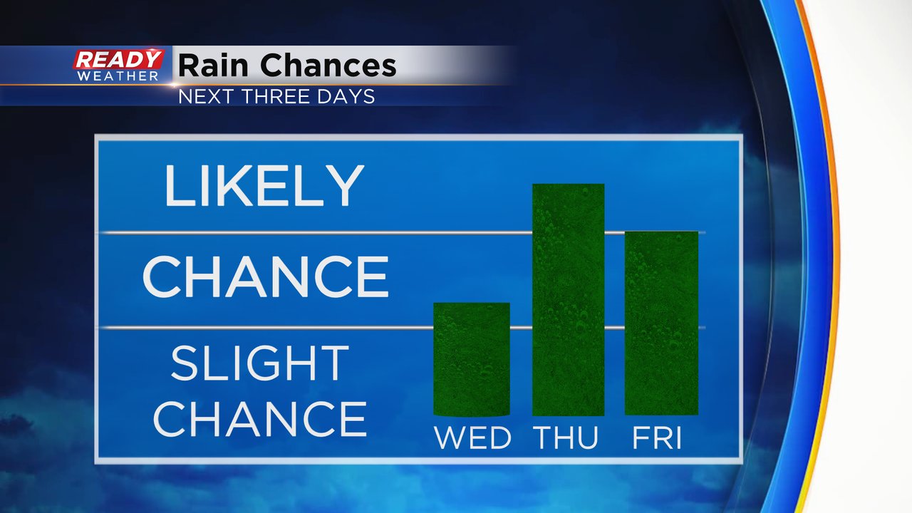
Tuesday saw some decently strong storms roll through with wind gusts between 40-50 mph leading to some downed trees with the soggy ground. Before the storms it was also a very hot day with peak feels like temps reaching 100* or hotter for many locations. The storm chance on Wednesday is much lower with just an isolated chance for a shower in the morning and an isolated storm in the afternoon/evening.

The storm chance looks better on Thursday and Friday with some scattered showers and storms possible. The timing for these storms looks best from Thursday afternoon through most of Friday into Saturday morning.
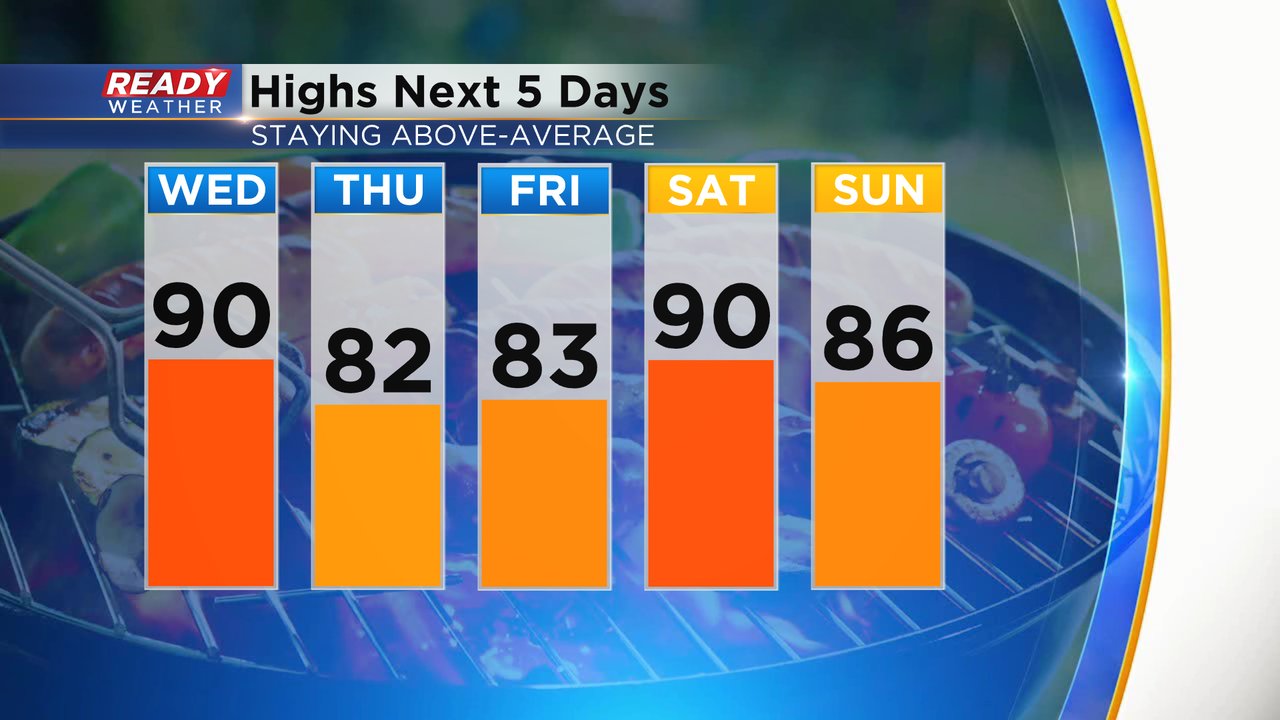
The heat will likely be the bigger story on Wednesday with high temps near 90*. The record high in Milwaukee on August 25th is 94* set back in 1948 so we will come pretty close. The temps drop a bit on Thursday and Friday in the low 80s but Saturday continues to trend warmer with a high near 90* once again.
Expect the sticky humidity to continue. Even with a slight drop in temps for the end of the work week, the dew points will stay elevated in the low to middle 70s. That humidity will likely stay with us through most of the weekend.

Feels like temps on Wednesday will likely reach the middle to upper 90s or even into the triple digits for the second day in a row.

Download the CBS 58 Ready Weather app to track any isolated storms that do form.