Multiple precip chances for Christmas weekend but little snow


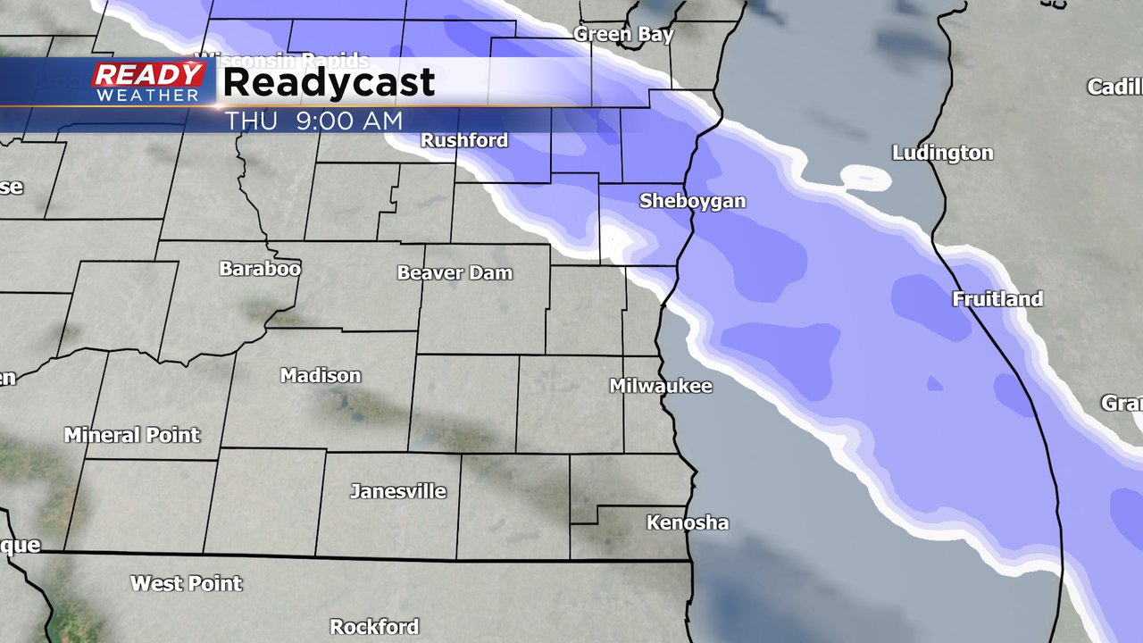
Our train of light rain/snow/mix chances heading into the holiday weekend starts on Thursday. Some snow and mix showers are currently moving through southeast Wisconsin. Most of these are fairly light but it could be enough to make roads a bit slick. This same band of snow and mix is responsible for making roads icy in western Wisconsin and a 100 car pileup in Jackson County.
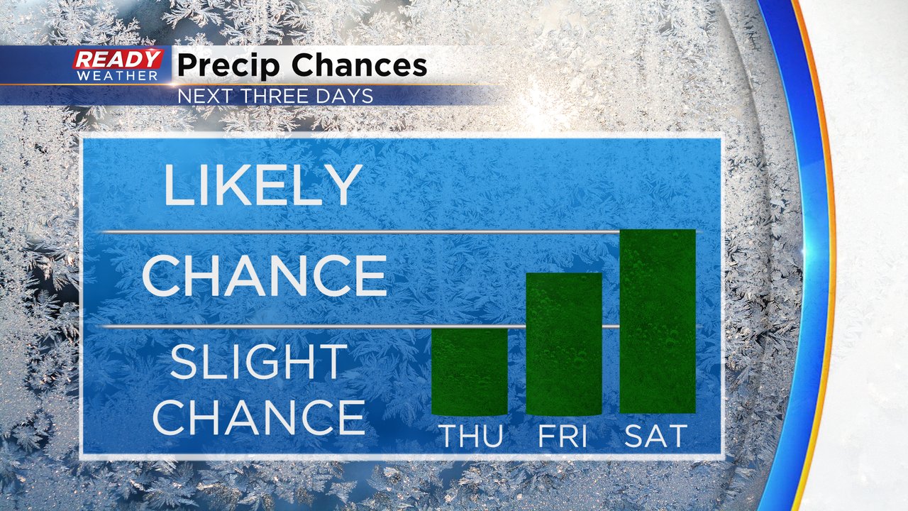
Most of Thursday afternoon going into Friday morning is dry. Friday afternoon and evening will feature a few very light rain showers. It looks to be a gloomy Christmas Eve with some drizzle, sprinkles and light showers with low clouds. The best chance for any precip might come on Christmas Day as we watch two separate storm systems.
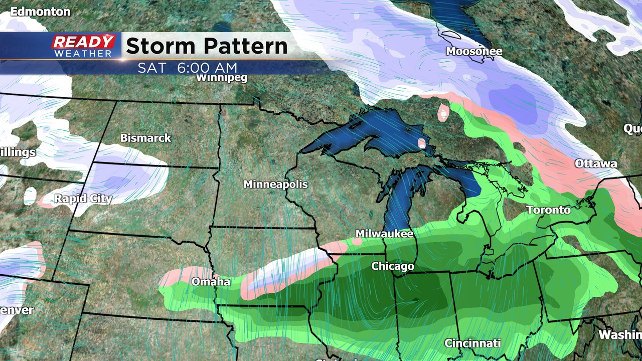
The first is to our south and would bring us rain Christmas morning; this is the more likely scenario. The second is a storm system to our north with some snow but it will probably only bring us a couple of flurries.
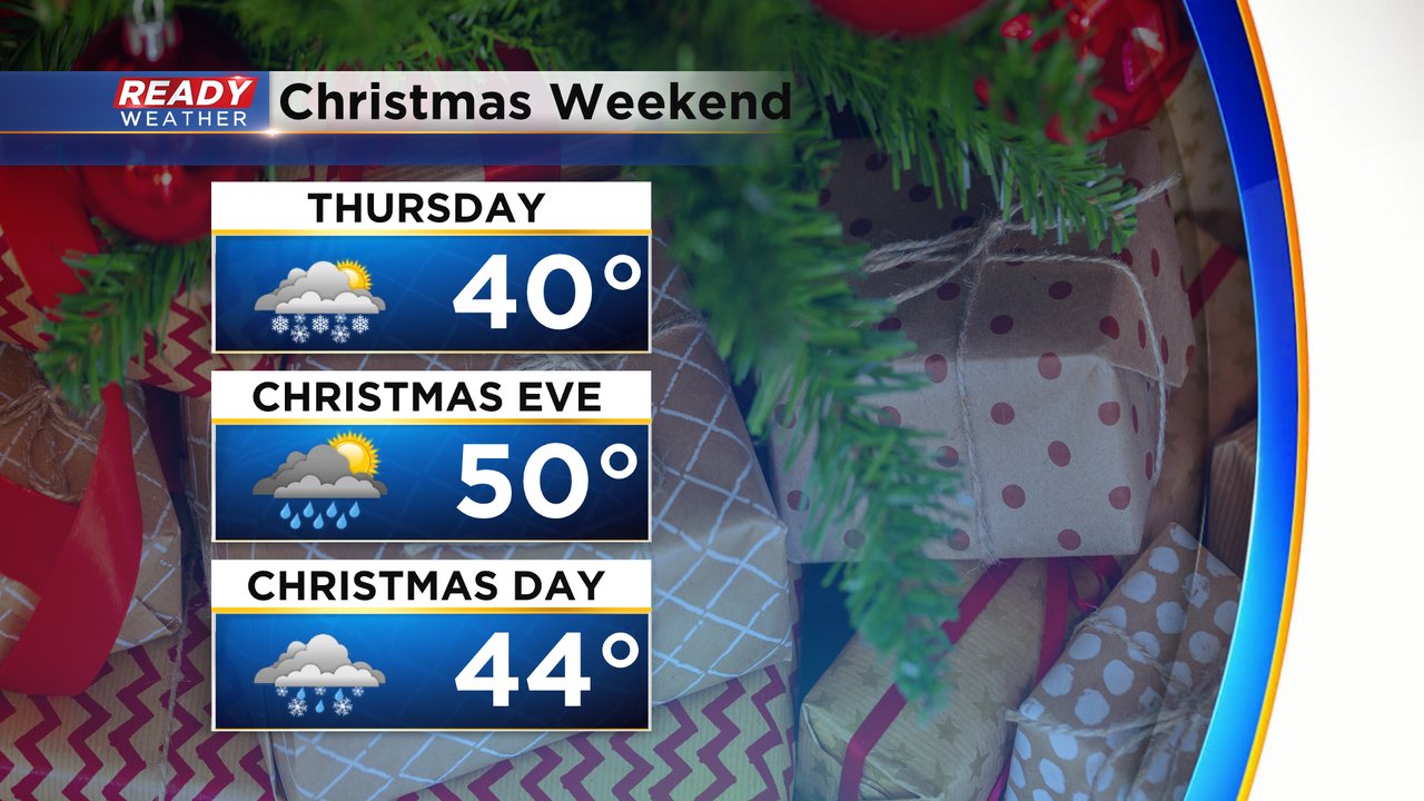
In addition to the multiple chances for precipitation, Christmas weekend is looking warm. After a chilly Wednesday with highs in the 20s, we warm back up into the upper 30s to around 40* for Thursday. Christmas Eve continues to trend warmer and upper 40s look likely with 50* a possibility for some! Christmas Day will also stay mild with highs in the 40s.
Download the CBS 58 Ready Weather app to track the rain/mix/snow and warmer temps.