Most of the heavy rains have passed but still the risk for more showers/storms
Milwaukee (CBS 58)--We called it, and it happened. We got drenched Monday evening and night. Some places, like western Dane County, got pounded. More than 10 inches in fact.
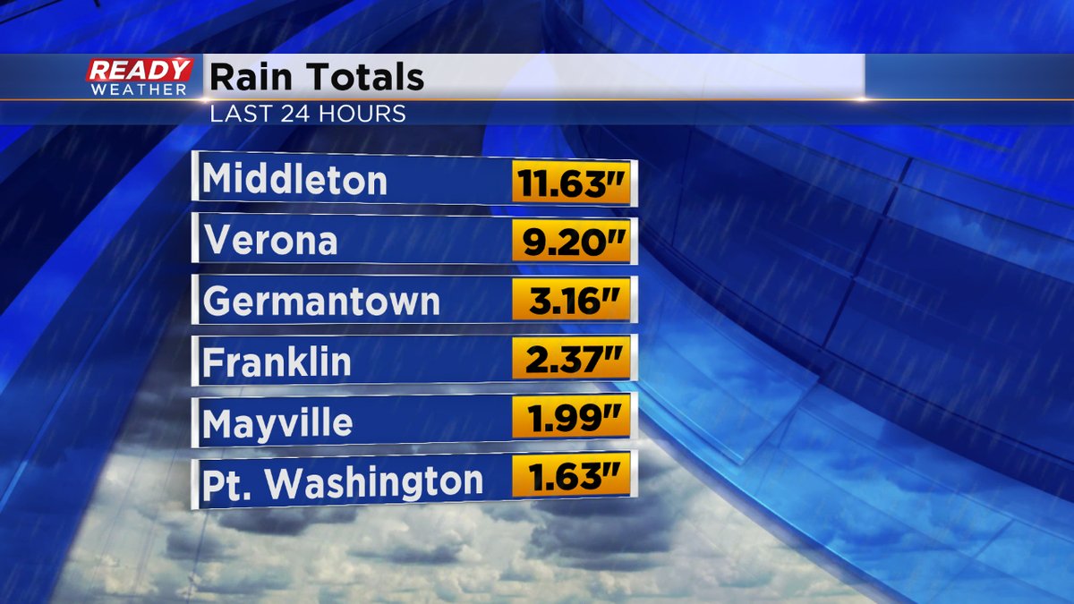
As of early Tuesday morning, the Red Cross was having difficulty getting into communities, like Cross Plains and Black Earth. Closer to home, 1 to 3 inch amounts were more common. Milwaukee received a record rainfall for the date, 2.13". The old record was 1.42" set back in 1938. There was localized flooding but nothing in comparison to what's happening west of Madison.
Also, the National Weather Service has determined a weak tornado occurred around 8 o'clock Monday evening in Delavan There was tree damage but luckily no injuries. Winds were clocked at 70 mph, making it the 10th EF-0 tornado of the season in Wisconsin. In fact, this is all we have seen in terms of tornadic activity for the year. Keep in mind the Badger State gets 23 twisters on average for a year.
Meanwhile, the atmosphere is still ripe for scattered showers and thunder throughout the day, but nothing heavy is expected. The good news is we dry out for the middle of the week. Also, keep in mind, the risk for rip currents and high tides continues into Wednesday. So boaters and swimmers please be advised.
Stay tuned to CBS58 for all the latest weather developments throughout the day.
