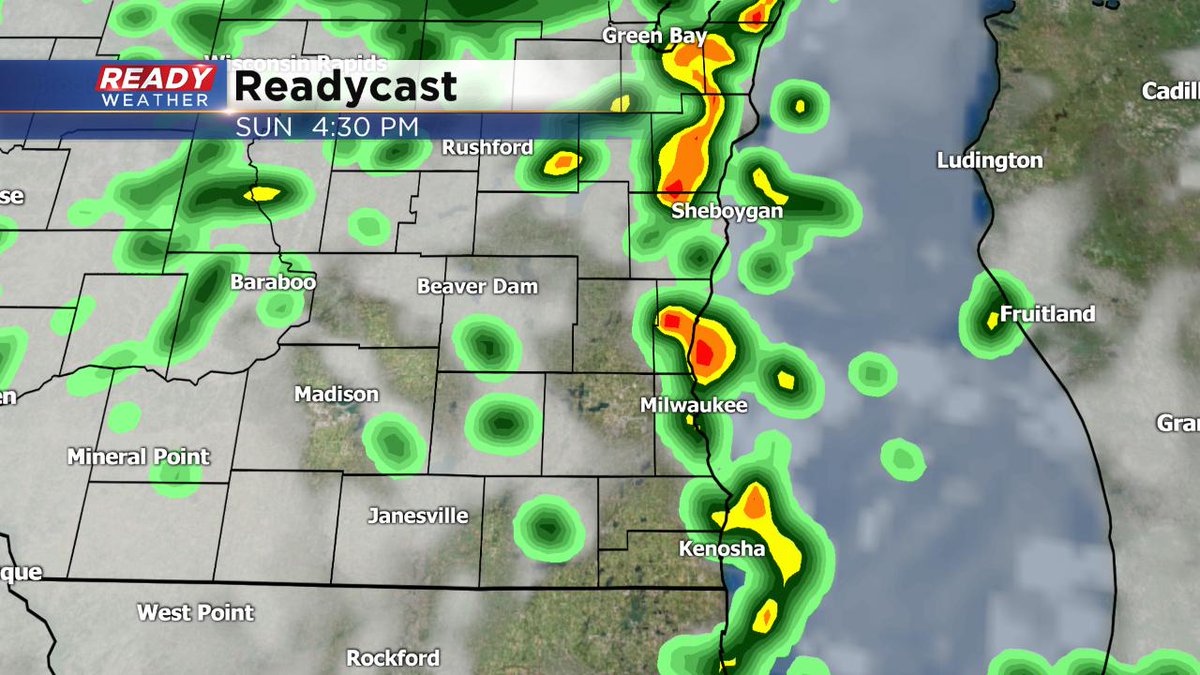
Sunday Afternoon Update: Scattered showers, thunder expected through mid-afternoon
Sunday Afternoon Update...
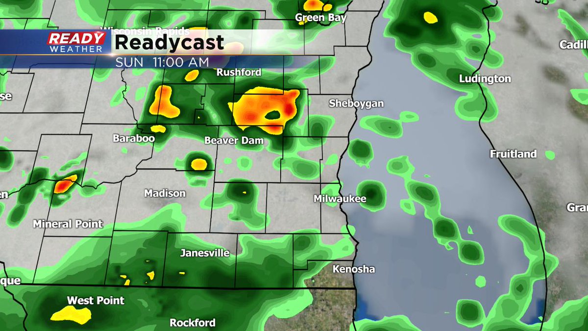
Expect showers and storms to move through the area through 2 or 3 pm. A few storms may contain small hail, gusty winds, and heavy rain. Most of us are still under a "marginal" risk of severe weather. We should quiet down by this evening and start to cool off as well. The CBS58 Ready Weather will keep you updated throughout the afternoon with any important weather changes.
____________________________________________________________________________________________________________
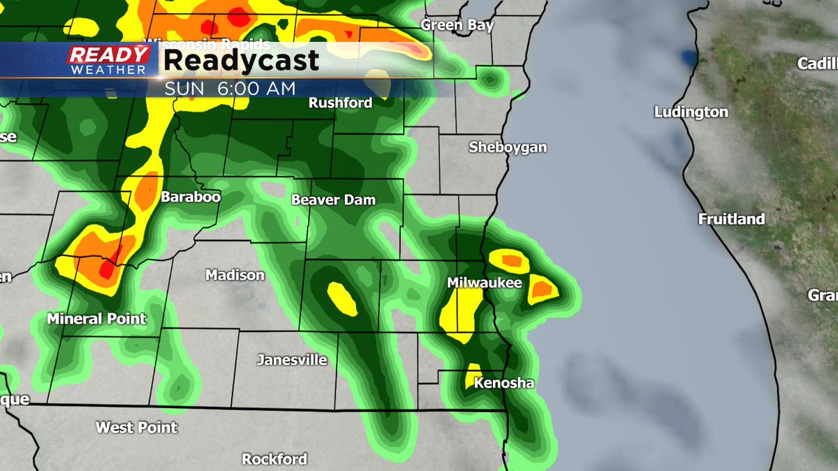
Sunday Morning Update...
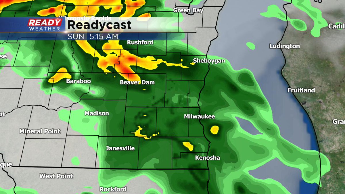
Looking for a regeneration of showers and storms later this morning and through the afternoon with the passage of a cold front. Expect winds to switch from the southeast to the southwest with gusts increasing after lunch to around 35-40 mph. A few storms maybe a little stronger too. There’s mainly a marginal risk of severe weather. Showers wrap up this evening as it turns cooler.
———————————————————————————————————————————————————————-——————
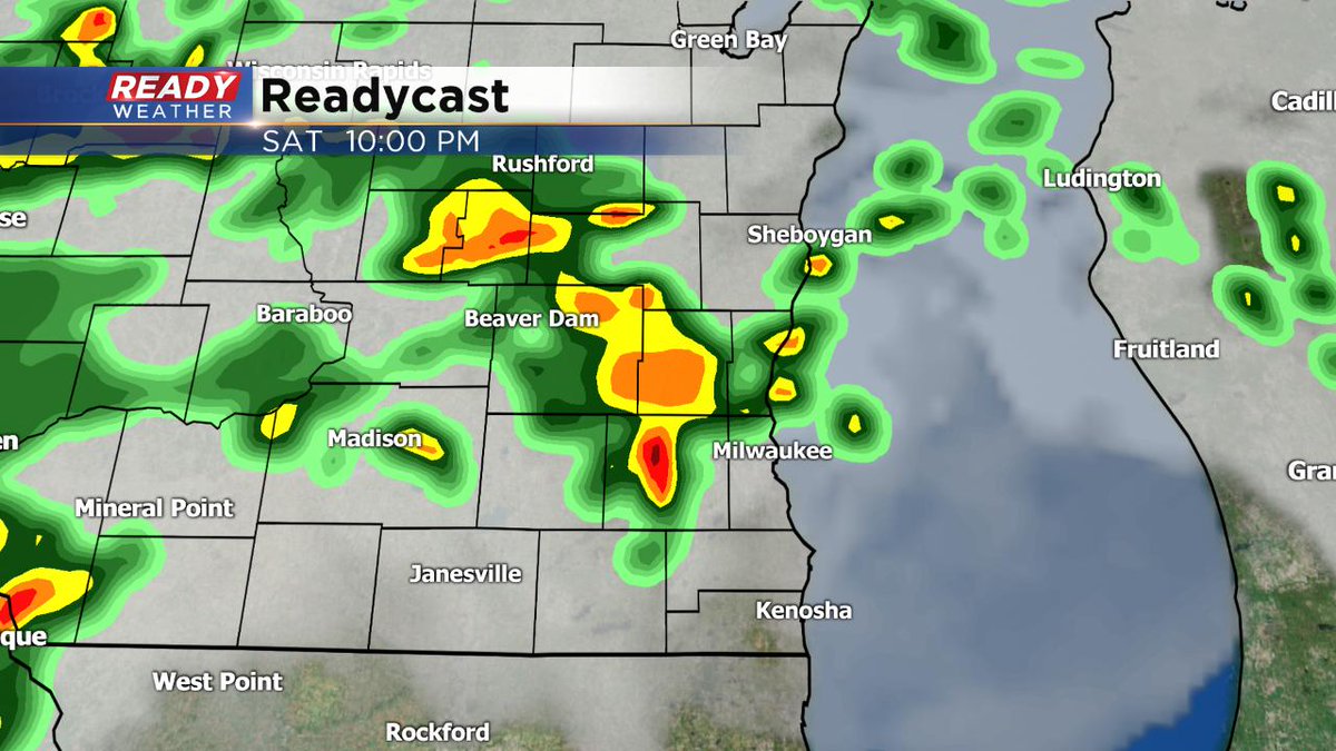
6:00 PM Saturday Update...
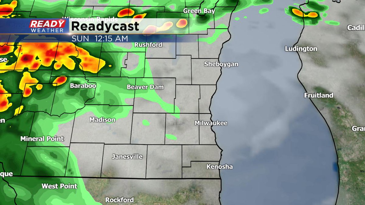
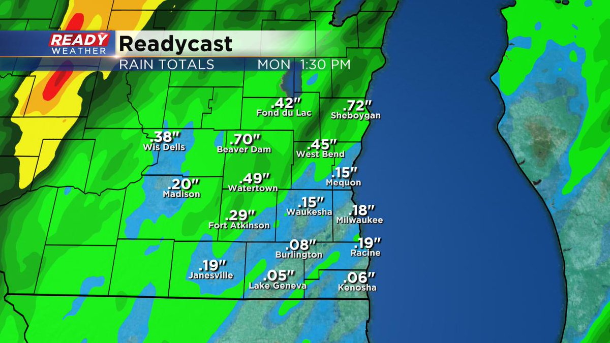
The hurry up and wait game for the rain and storms continue. It looks like our best chance will be later tonight and overnight. The heaviest of the activity, at least into the overnight, looks to be west of us. Our best shot of steadier rain and storms will come around daybreak Sunday. And then we could have a few rounds of showers and storms throughout the day on Sunday. Some spots could see an inch or so of rain, but most will stay below that amount.
___________________________________________________________________________________________________________
1:45 PM Saturday Update...
A few showers are possible this afternoon. Most of the storms should hold off until later this evening (9 or 10 pm) and last through much of Sunday afternoon. Some of the rain could be heavy and some of the storms could be strong with gusty winds. Rainfall amounts could exceed more than an inch in spots. We continue to have a marginal risk of severe weather for much of the weekend. Stay tuned to the CBS58 Ready Weather team, and we'll keep you updated.
_____________________________________________________________________________________________________________
A very complicated forecast will play out for your Saturday. Scattered showers and storms will arrive this afternoon/evening and overnight with heavy rainfall, small hail, and some gusty winds.
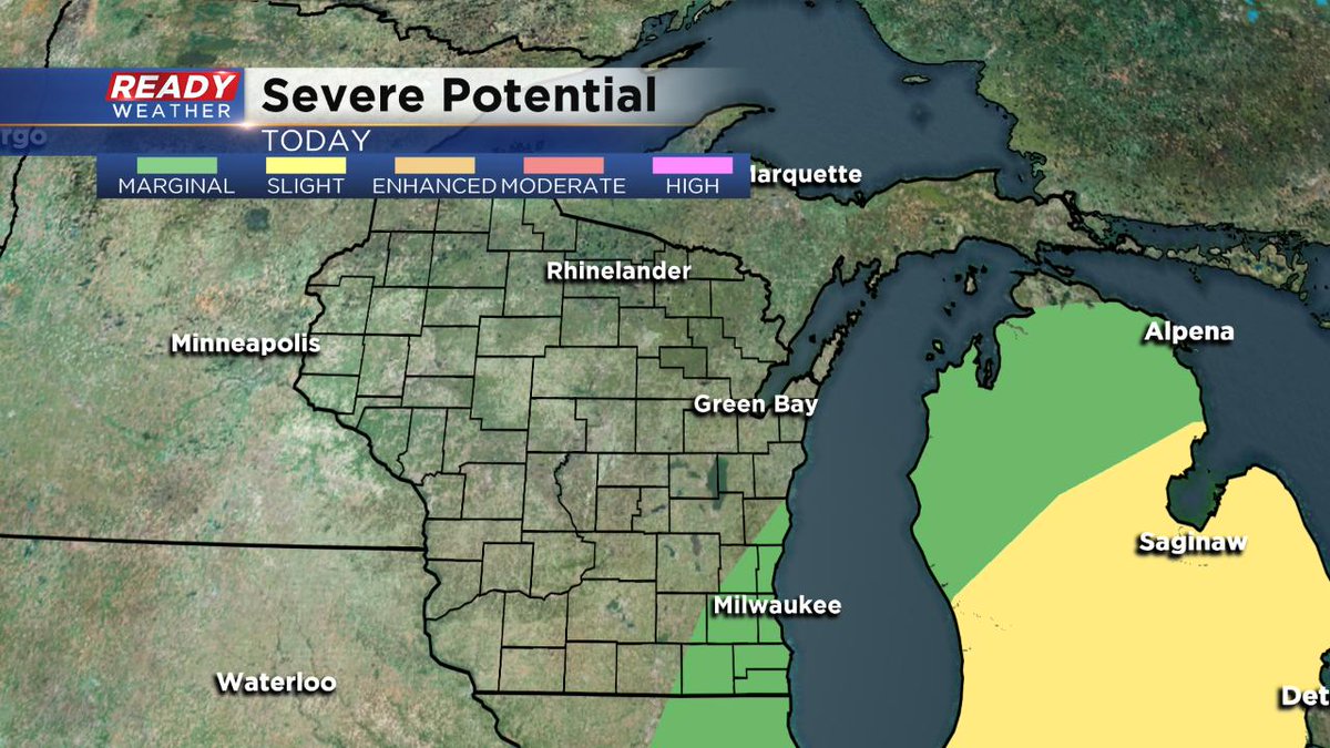
The SPC has the slight risk for strong to severe storms outside of our area. A marginal risk for a strong to severe storms is possible for all of southeastern WI. The best dynamics and ingredients for widespread severe weather are well west today.
A warm front will lift north into our area by the afternoon. There could be a major temperature gradient from north to south this afternoon. Areas close to Janesville might push 80 degrees while Sheboygan sits at 50. The lakefront areas could also be much cooler compared to inland.
We will continue to monitor the forecast throughout the day for you.
