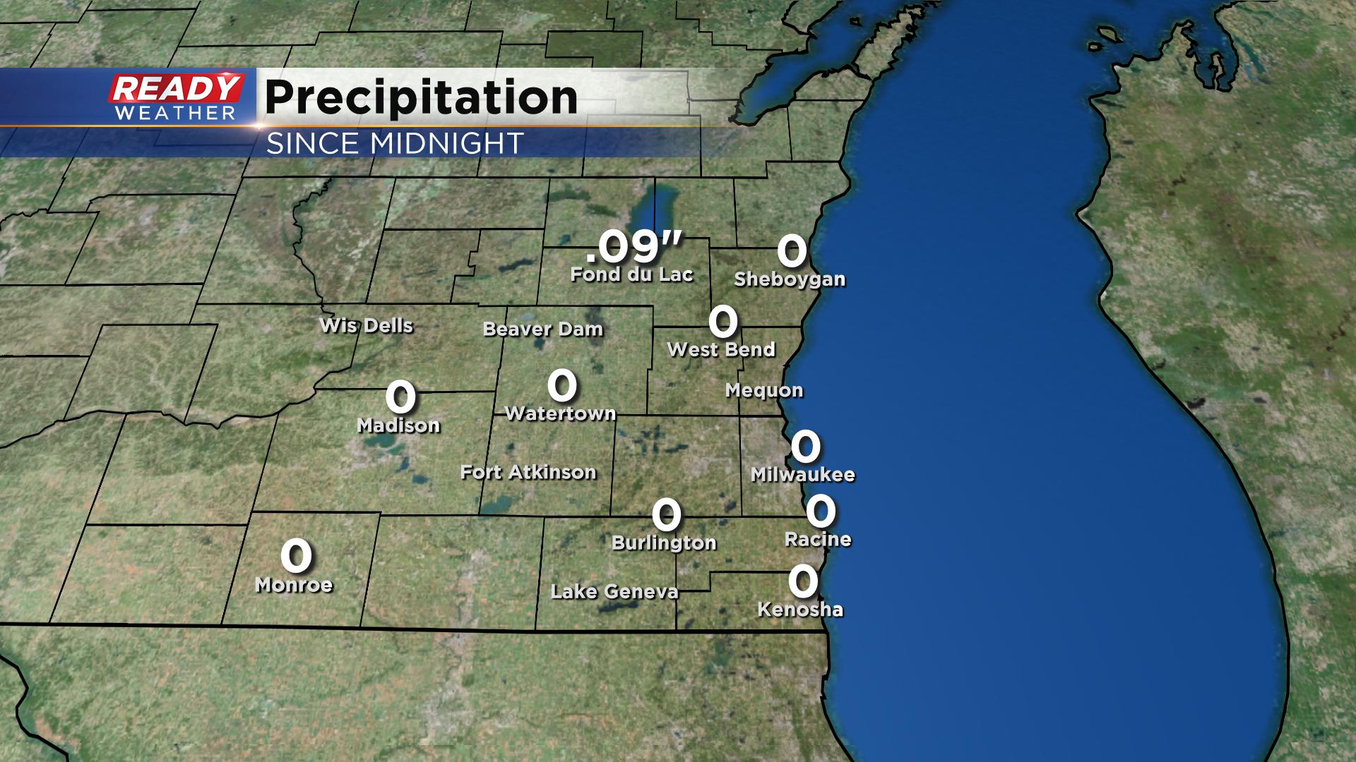
A few isolated thunderstorms tracked across northern Fond du Lac and Sheboygan counties before sunrise this morning, but the rest of SE WI was mostly dry besides a stray sprinkle in Kenosha. The rain didn't add up to much with only .09" recorded in Fond du Lac.
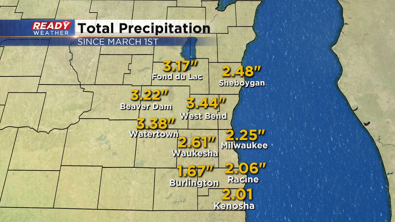
We desperately need a soaking rain across southeast Wisconsin. Since the beginning of meteorological spring (March 1st), most of southeast Wisconsin has only picked up 2-3" of rain. Northern spots are running 1-2" below normal for precip, while Milwaukee, Racine, Kenosha, and Burlington are at a deficit of 3.25-3.50".
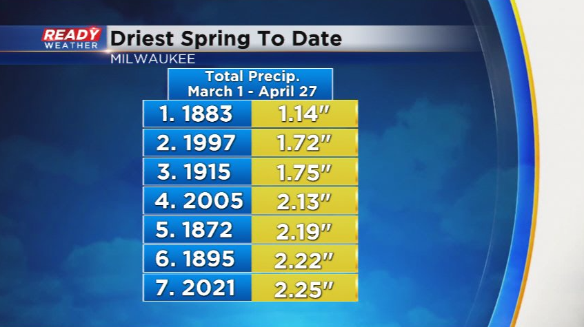
Milwaukee's 2.25" of rain so far this spring make this the 7th driest spring to date.
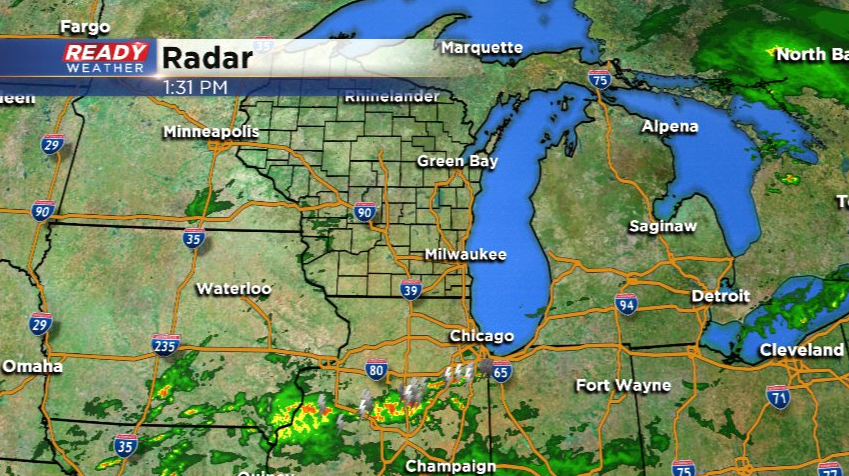
While we have the clouds around today, the air is pretty dry and that should keep us dry the rest of the day. The showers to our west are evaporating, and the dry air should keep most of the rain in Illinois to our south. There's a very small chance a few showers sneak into Kenosha county early Thursday morning, but it wouldn't add up to much.
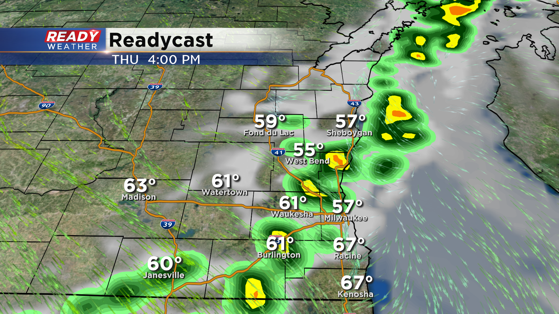
A cold front will track through the area later Thursday afternoon, which will bring a chance for a few isolated showers, maybe a rumble of thunder. However any rain that does fall likely won't even add up to .10".
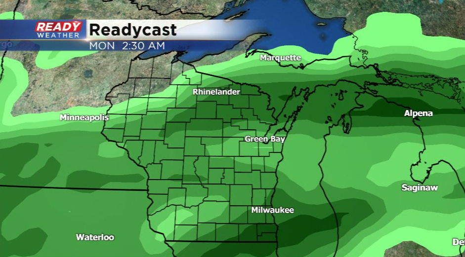
Dry weather is expected Friday and for most of the weekend, but some much needed steadier rain may be on the way Sunday night into Monday as a front stalls across the area.
Download the CBS 58 Ready Weather App track any afternoon showers Thursday afternoon.
