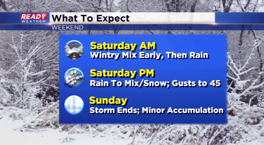
Messy weekend ahead, should dodge most of the snow


No major concerns on your Friday in southeastern Wisconsin. However, a powerhouse of a storm is expected to scoot into the Midwest and Great Lakes this weekend. The storm system will bring rain, mix, and snow. Cloud cover will be on the increase later tonight, and the leading edge of precipitation Saturday morning will be freezing rain, sleet, or snow. The roads will be messy to start the weekend.
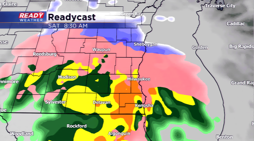
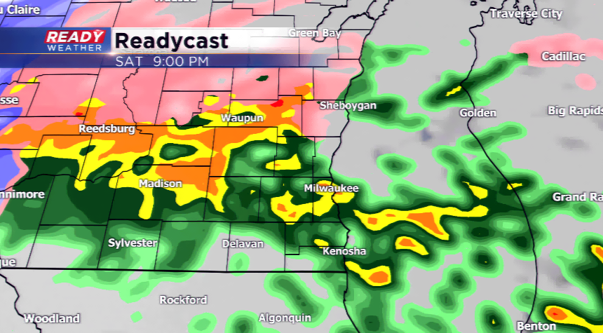
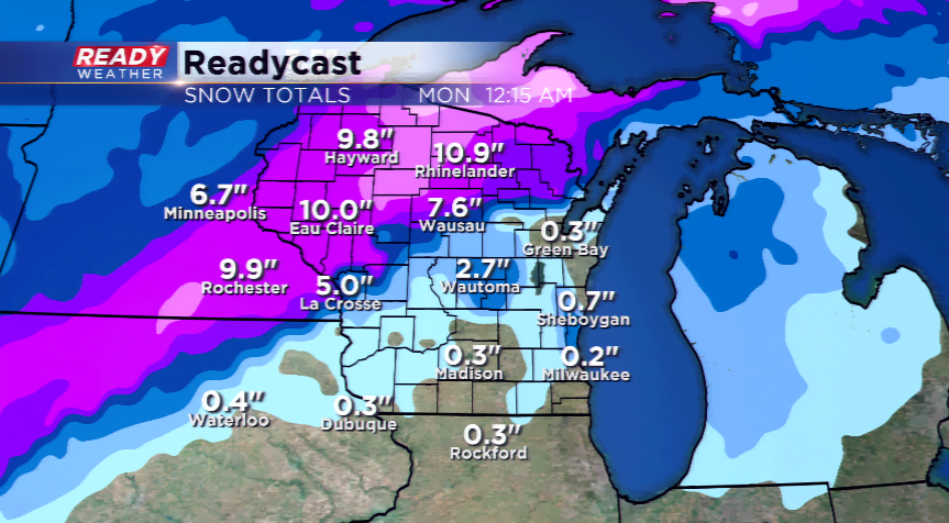
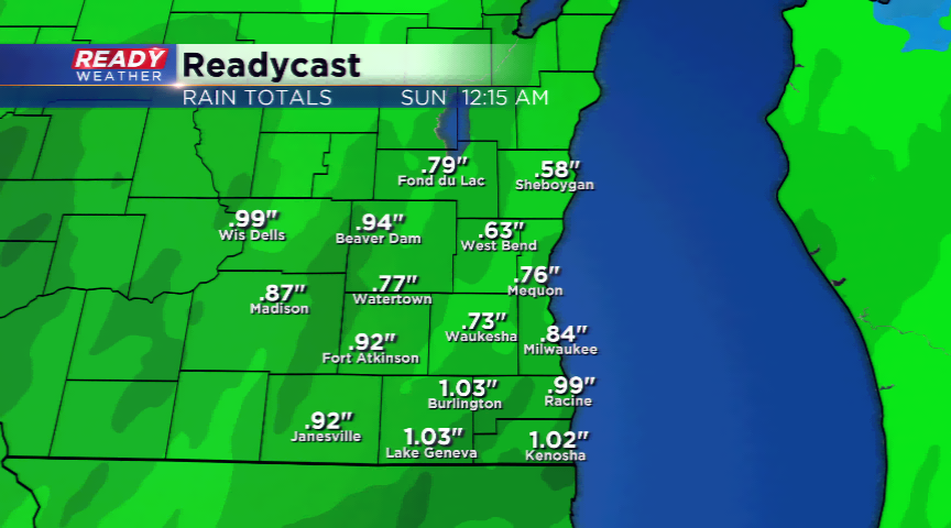
As the day progresses, the frozen slop will switch to rain for most of the viewing area. It could be heavy at times with almost an inch falling. The colder temperatures take a glide in with the storm by Saturday night and the precipitation will once again switch over to a wintry mix. Any precipitation leftover on Sunday will flip over completely to snow; however, by then the storm’s moisture supply will be running out. The accumulation for snowfall will be minor at best.
Along with the messy weather the winds will be hollowing as high as 45 mph. It will be an ugly weekend!