Mainly dry this week, but turning colder by Wednesday
![](/images/cbslogo_gray.png?x)
-
1:48
Man charged in Prince McCree’s murder sentenced to life in...
-
1:43
Onlookers enjoy Air and Water Show practice ahead of big weekend...
-
1:26
Brewers help fight hunger at Summer Sizzle event
-
2:07
’Justice, fairness, equity’: Milwaukee County leaders celebrate...
-
2:58
CBS 58 checks out Milwaukee’s 42nd annual German Fest
-
5:21
CBS 58’s Feel Good Fridays: Lakefront fun, German Fest and...
-
2:40
Meet CBS 58’s Pet of the Week: Esther
-
2:02
Pleasant start to a busy weekend in Milwaukee
-
2:10
Armed robbery attempt ends with gunfire exchange in Wauwatosa,...
-
3:08
Drew Burgoyne tastes treats in Tosa
-
3:06
Eduardo Galvan appointed MPS interim superintendent, despite...
-
2:13
Multiple festivals expected to draw thousands to Milwaukee’s...
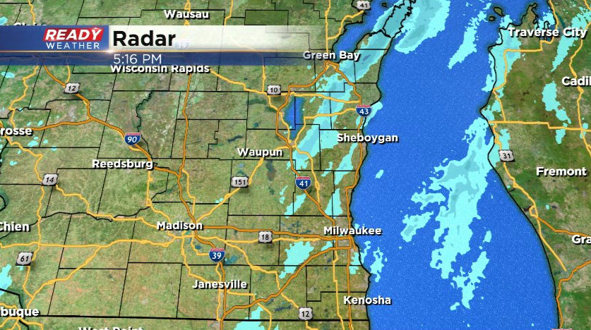
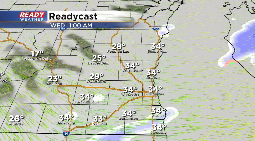
Dry air has been winning the battle with most of the band of light snow this afternoon and evening with only patchy light snow reported in parts of southeast Wisconsin.
![](https://newscdn2.weigelbroadcasting.com/aAXTD-1642375030-embed-dgsf.png)
Besides a stray flurry or two tonight under the lingering low clouds, dry weather will return on Monday and for most of this week. Our only real chance of precipitation comes late Tuesday, but the chance is rather small.
![](https://newscdn2.weigelbroadcasting.com/tnmHx-1642375054-embed-271806321_792878011637263_1316699044601283683_n.jpg)
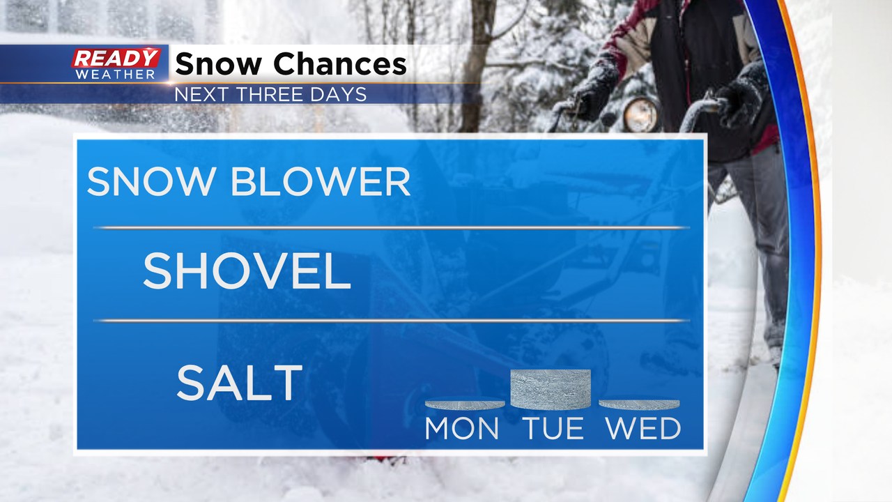
An area of low pressure will track across northern Wisconsin on Tuesday, keeping the accumulating snow well to our north.
![](https://newscdn2.weigelbroadcasting.com/v6Ob9-1642375065-embed-state%20df.png)
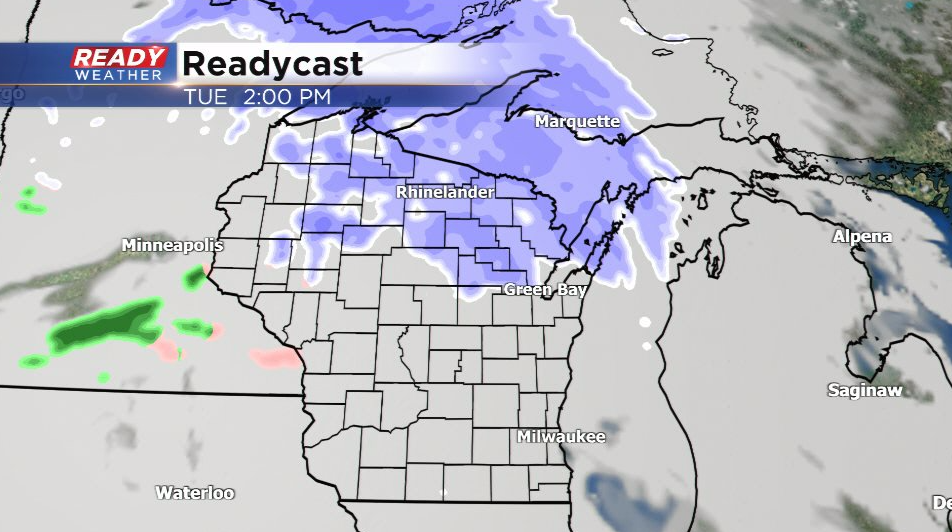
Fond du lac and Sheboygan counties may get clipped with some light snow showers briefly late in the afternoon, but the best chance (20-30%) of any flurries or sprinkles with this system will come Tuesday night along the cold front.
![](https://newscdn2.weigelbroadcasting.com/B4HPU-1642375087-embed-10%20pm.png)
![](https://newscdn2.weigelbroadcasting.com/5bClB-1642375094-embed-1am%20wed.png)
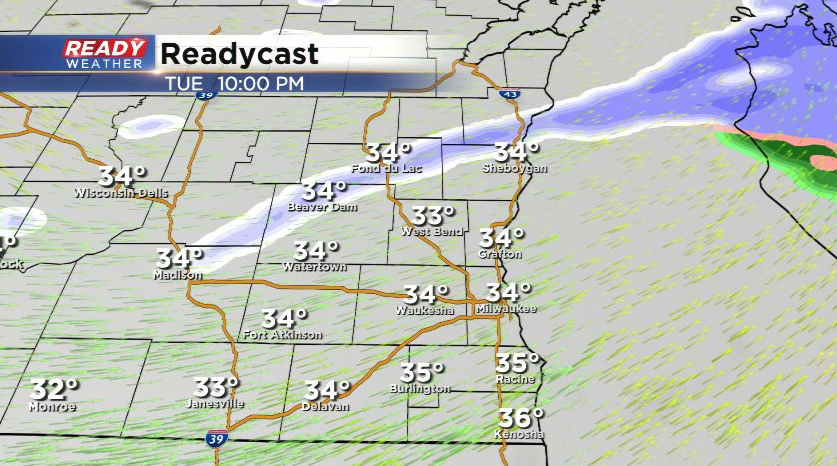
Little to no impacts are expected. Behind this cold front, strong northwest winds will gust between 25-35 mph and bring much colder air into the Badger state. After a near normal day on Monday and an above normal day on Tuesday, temps will reach their highs in the 20s early in the day Wednesday, dropping into the teens for most of the day.
![](https://newscdn2.weigelbroadcasting.com/J4baK-1642375309-embed-waercf.png)
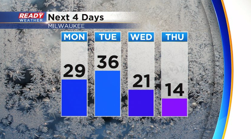
Temps remain in the teens on Thursday and will struggle to reach the low 20s on Friday. Temps look to stay below normal through next weekend as well. Download the CBS 58 Ready Weather App to see the full 7 day forecast.