Magnificent Monday brings a chance at 70° before a midweek taste of winter


After a long wait through the winter and rocky start to spring, summer-like warmth is returning on Monday. If you have the opportunity to get outside don't waste it because the warmth won't last long. High temperatures Monday are expected to reach at least the upper 60s and most spots should get to 70°. An afternoon lake breeze could cool down a few eastern spots in the afternoon but 70s look to be a lock to the west.
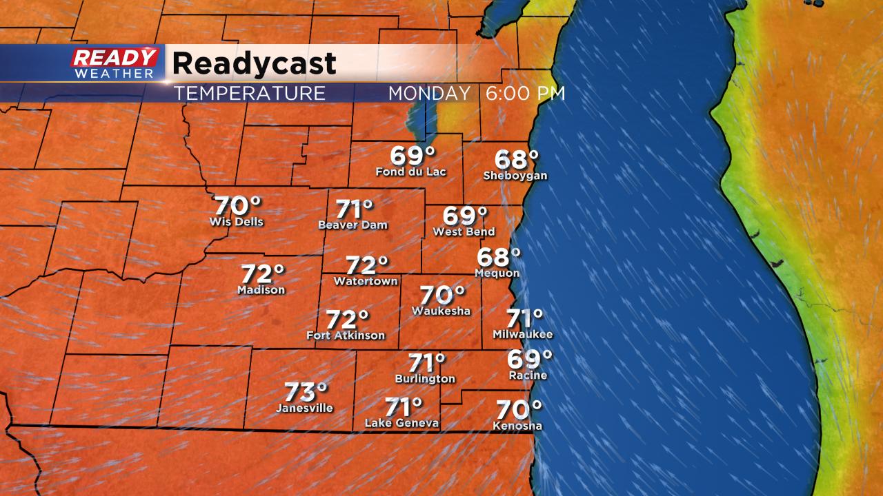
The breeze to get us to 70° will be present but won't be too strong gusting to 15-20 mph at times. The 70° warmth is more typical of the end of May.
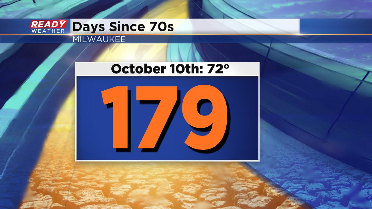
The last time we were in the 70s was in October. 179 days ago on October 10 the high reached 72° in Milwaukee and then cooled for the rest of the fall and winter.
A cold front will roll in Monday evening. A quick drop in temperatures doesn't look likely but expect a few clouds to end the day along with an isolated shower.
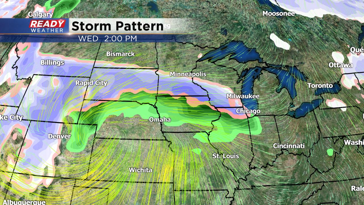
After Monday's chance at 70° our attention quickly turns to a powerful midweek storm moving into the Midwest. The exact track of the storm has shifted over the past couple days and now looks a little warmer with more rain instead of snow in southeast Wisconsin. The best chance for some snowflakes right now looks to be on Wednesday and light accumulation is not out of the question especially for our northern spots.
Download the CBS 58 Ready Weather App to track the temperature where you live and see the changes to the forecast for the middle of the week.