Evening Update: Scattered Snow Showers Continue
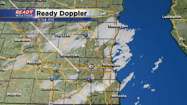
Scattered snow showers will continue through 10 pm. Persistent light snow bands remain across southeastern Wisconsin. We aren't expecting any significant accumulation and the roads should remain wet.
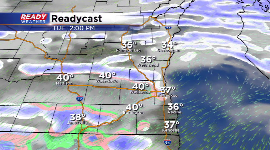
Most of the snow showers will fall apart by Midnight as the winds shift out of the northwest. Wind chills tomorrow morning will drop into the single digits.
3 PM Update:
Scattered snow showers and some drizzle remain in the forecast through 9 PM. Additional accumulation is not expected with surface temperatures hovering above freezing. Roads will remain wet this evening; however, later tonight, we are expecting a drop in temperature, so isolated slick spots are possible.
Additional snow overnight is not expected.
Noon Update:
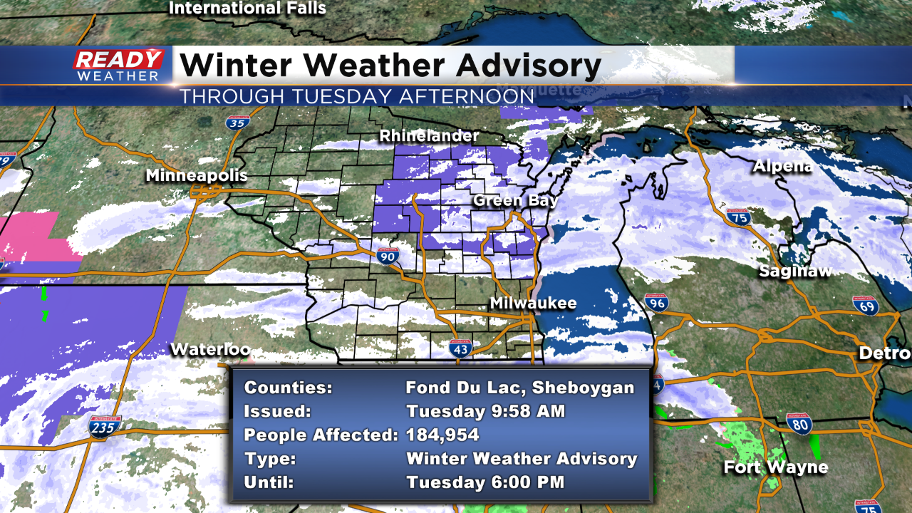
A Winter Weather Advisory continues until 6:00pm this evening for Fond du Lac and Sheboygan counties.
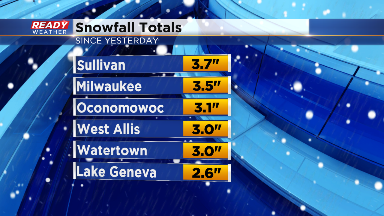
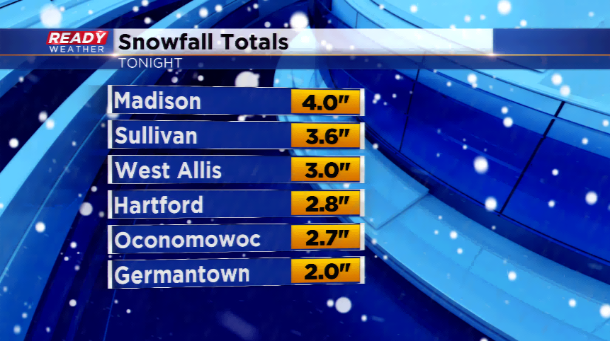
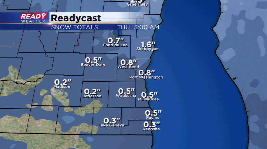
Here's how much snow we've received so far:
8AM UPDATE: Snowfall is scattered around southeastern Wisconsin. The NWS has taken down the Winter Weather Advisory for everyone except Fond du Lac and Sheboygan Counties. This WWA will run until 6pm with the threat of light to moderate snow, at times. Totals there could range between 4"-6"+ inches.
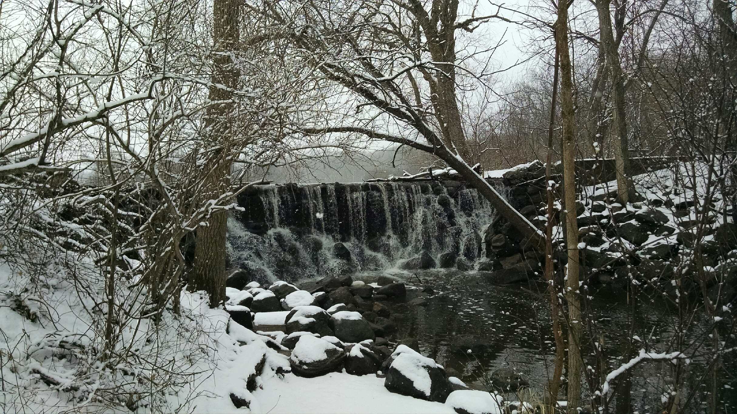
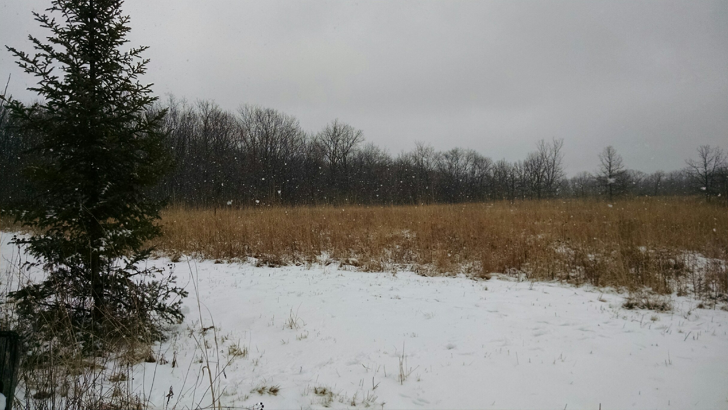
The heaviest snowfall is behind us now, which fell from yesterday evening through parts of the overnight. Anywhere from 2”-4” of snow fell, with a little less in the southern parts of the viewing area. The roads will continue to improve through the morning hours as the main highways are better than the side roads.
The threat of light snow and/or freezing drizzle will continue the rest of the day. An additional 1” of snowfall is possible along with patchy freezing drizzle.
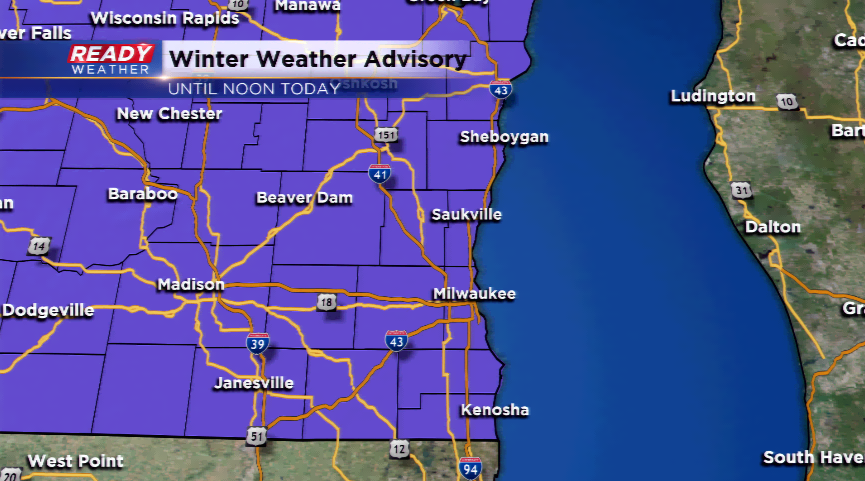
The Winter Weather Advisory continues for all of southeastern Wisconsin until noon today. The winds will gradually taper off, but are expected to gust back up later today and tonight behind the storm system. A strong north-northwest wind will pull in cooler air. This will be the coldest air in two weeks!