


The light snow for Saturday is still on track. Some northern counties could see the snow in the mid to late morning hours with the rest of southeast Wisconsin seeing the best chance for snow in the afternoon. Most of the snow wraps up during the evening.
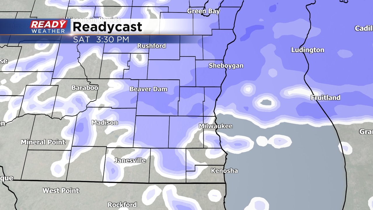
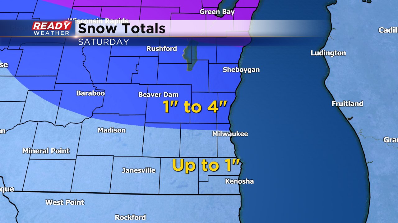
Snow totals haven't changed much from what we have shown you the last 24 hours with under an inch in the Waukesha/Milwaukee metro area and south of there. Can't completely rule out some wintry mix with the snow closer to the IL border. Northern counties could see 1-2" but any 3" or 4" numbers will be pretty isolated and confined to Fond du Lac and Sheboygan Counties if it happens at all.
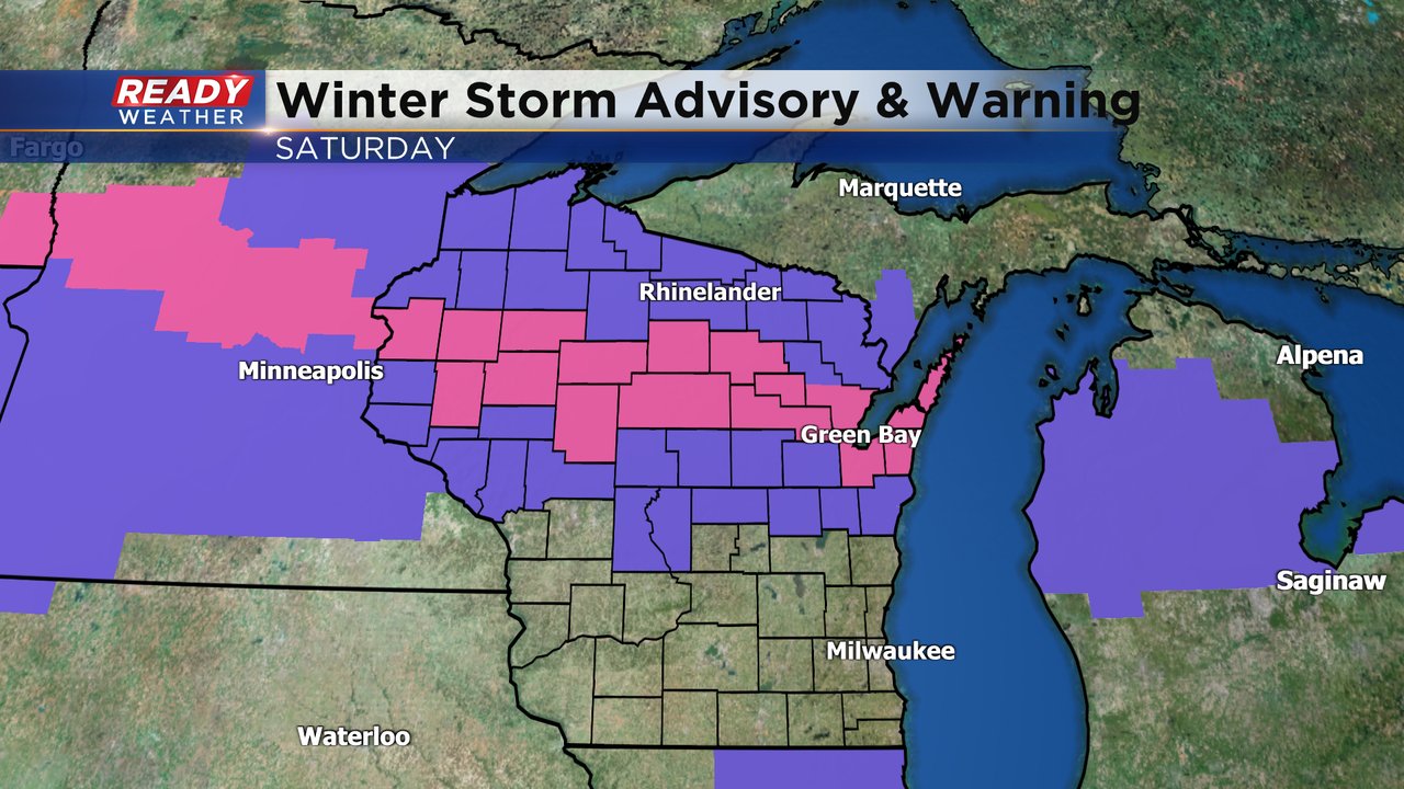
If you want more snow you'll have to go to the northern half of the state where Winter Weather Advisories (shown in purple) and Winter Storm Warning (shown in pink) are in effect until Saturday evening. Those counties could get up to 8" of snow.
Download the CBS 58 Ready Weather app to track the snow for Saturday.