Light snow for tonight. A new winter storm watch has been issued for the area.


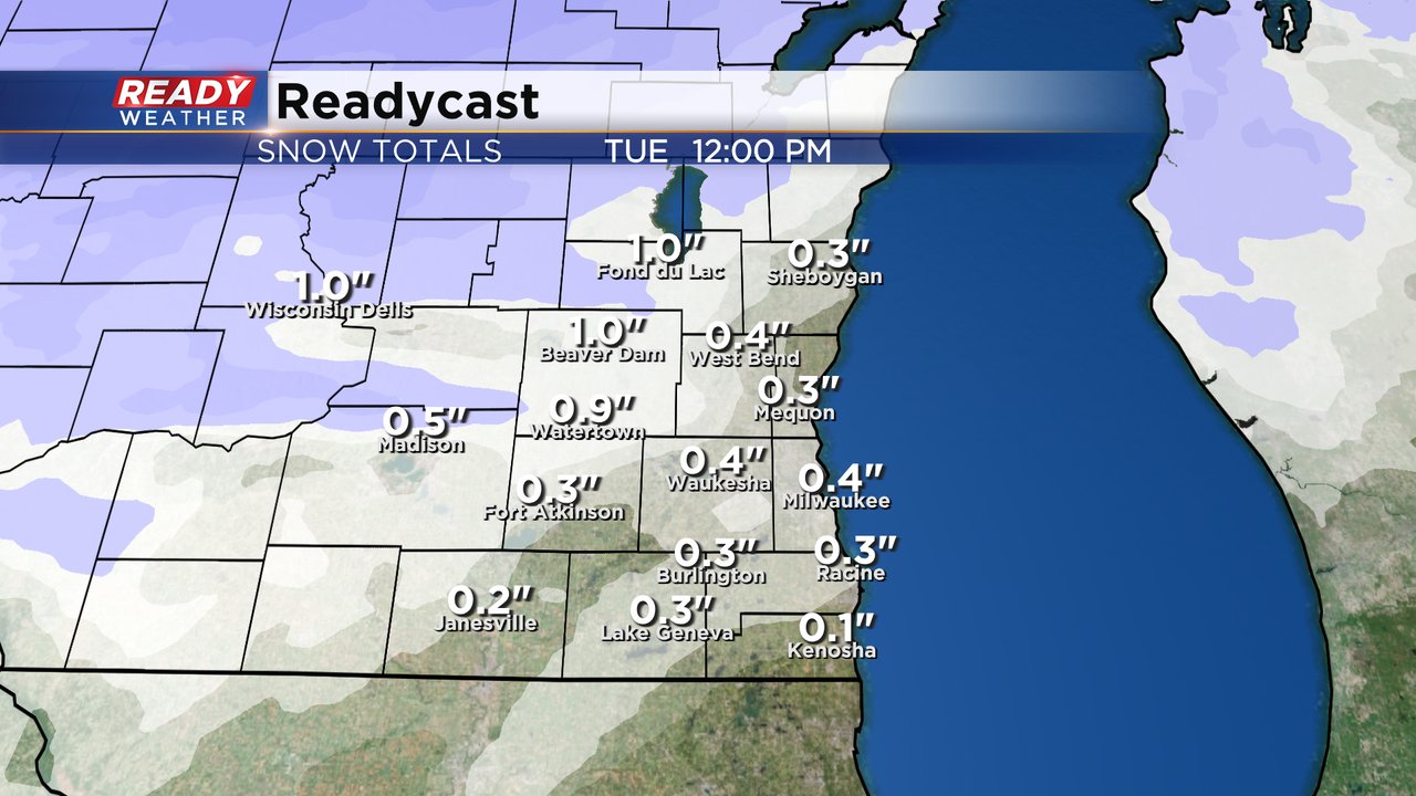
We dealt with off and on flurries most of the weekend with a mostly cloudy sky. After a little bit of sunshine Monday morning the clouds increase Monday afternoon with a round of light snow starting Monday evening. Thankfully most of this snow will miss both the Monday evening commute and the Tuesday morning commute.

Up to an inch of snow is expected for most of southeast Wisconsin by early Tuesday morning. While not a hugely impactful snow, temperatures will be cold enough for this to stick even in lakeside hometowns. Expect snow covered side roads for the Tuesday morning commute and it's probably not enough snow for the plows to be out.
The NWS in Milwaukee has issued a winter storm watch for all of the area starting Thursday and goes into Saturday morning. The potential for major snow and travel issues continues to go up, especially late Thursday night through Friday.
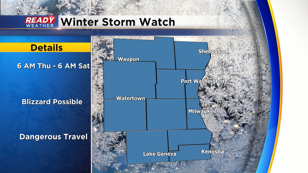
Beyond Tuesday we are still watching a major winter storm to impact Wisconsin from Wednesday night through early Saturday morning. This storm will have major impacts to travel. If you are driving or flying on Wednesday you should be ok. Traveling on Thursday will be difficult, but better earlier in the day. Friday travel will be nearly impossible with blizzard conditions possible. Expect mass flight cancellations Friday with road travel not advised. Conditions will improve quickly on Christmas Eve.

The good news about this snow is our White Christmas Chance is nearly 100%.

Download the CBS 58 Ready Weather app to track the snow Monday night and watch the changes to the forecast with the end of the week storm.