Thursday Morning Update: Light lake effect possible Thursday


Updated: 5:00 a.m. February 6, 2020
Light snow Thursday morning has stayed in Racine and Kenosha Counties and it's looking less likely that the snow will make it much farther north than that. Those communities still have a chance to pick up an inch or two of fresh snow.

The chance for snow continues throughout Thursday morning and the afternoon as a few lake effect snow bands are possible. The best chance for these remain in Racine and Kenosha Counties but it could make it as far north as Milwaukee County. There is a high level of uncertainty whether or not the lake effect forms but if it does some quick light accumulation is possible.
After Thursday a few flurries are possible both Friday and Saturday with little to no accumulation.
------
Updated: 6:00 p.m. February 5, 2020
Decent snow continues to show up across central Illinois this evening. We don't anticipate any watches or advisories out of this event.
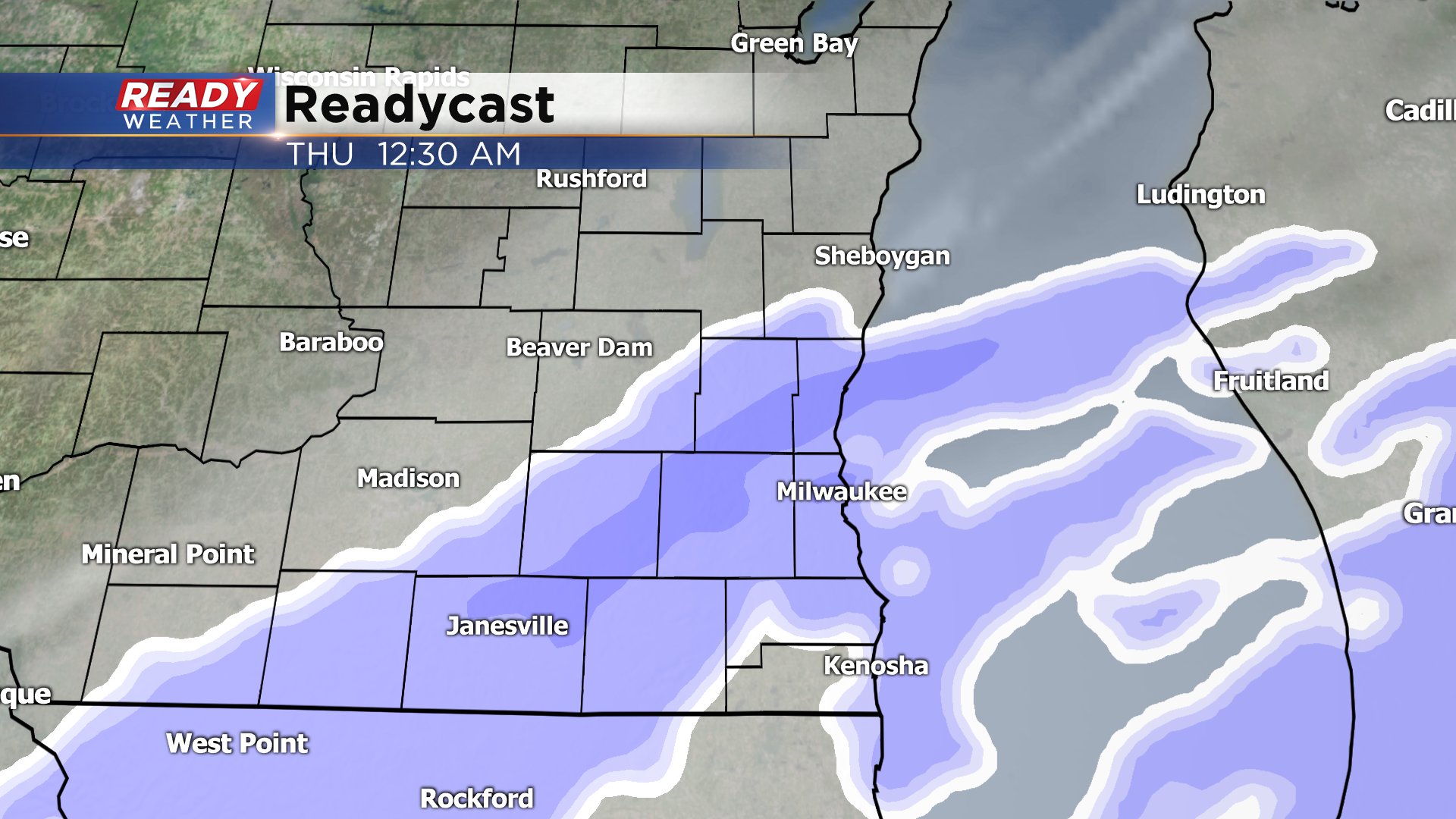
There's plenty of dry air over the area right now. Late this evening into the overnight some light snow is forecast to develop. After looking over the latest model runs it appears that areas north of Milwaukee will struggle to get much accumulation.
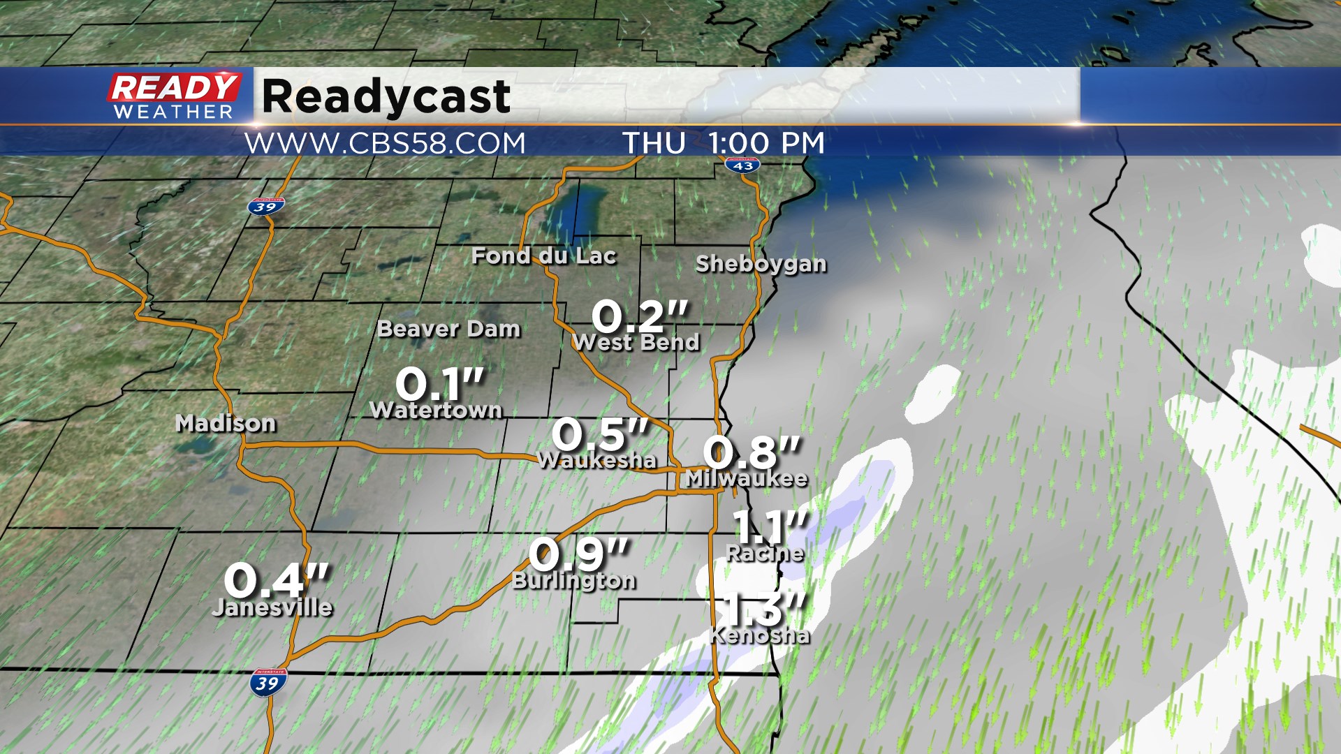
Milwaukee and south has the chance for an inch or so. Near the border of IL/WI will see the greatest chance for 1" to 2" of accumulation.
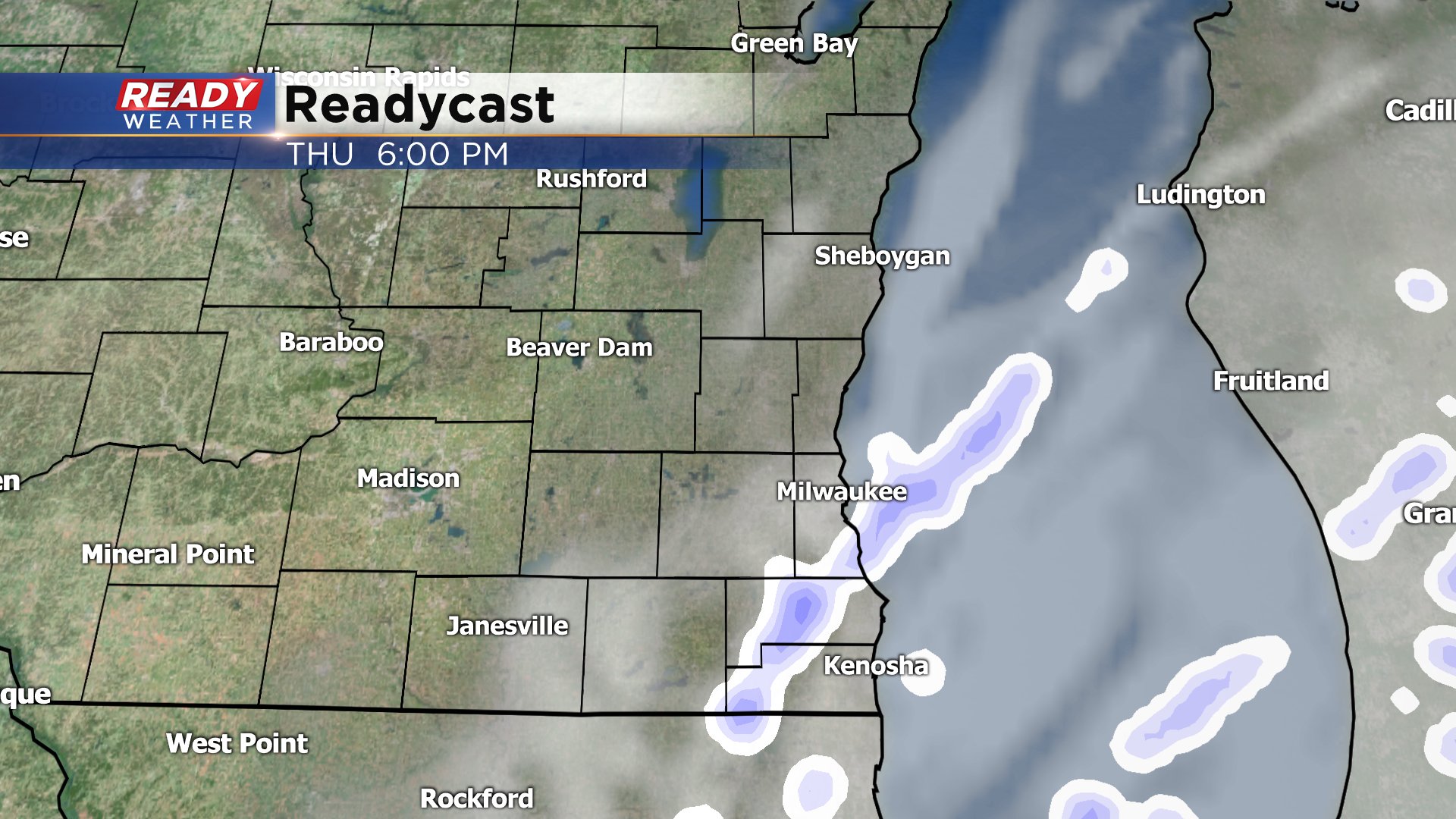
Light snow is possible into Thursday afternoon. Some light lake effect could produce some light snow lakeside Thursday night into Friday morning with a northeast wind.
------
Posted: 7:20 a.m. February 5, 2020
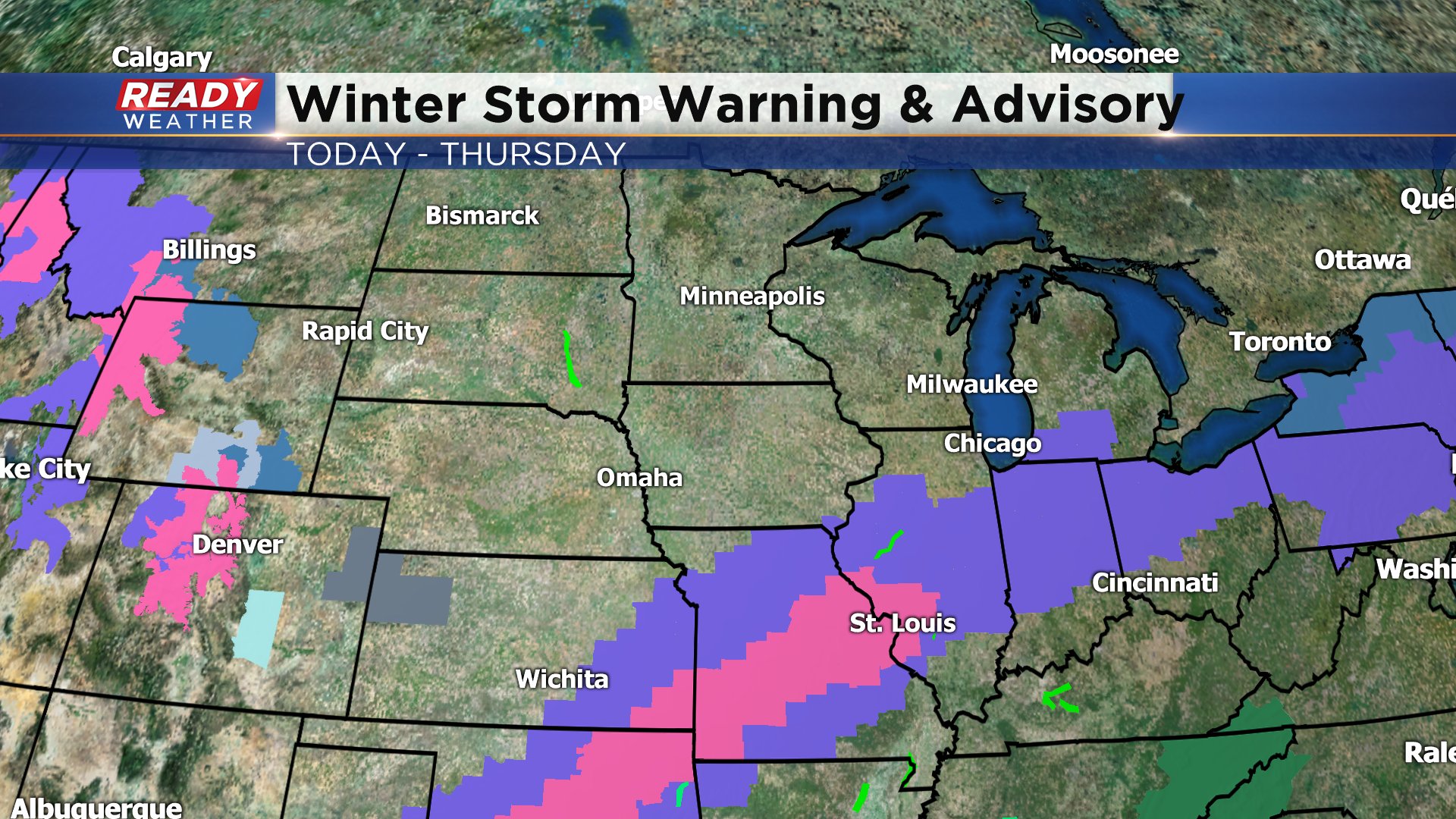
Our next winter storm is on the way bringing plenty of snow across the central and southern plains. Parts of Texas and Oklahoma are getting up to 6" of snow and winter storm warnings stretch as far northeast as St. Louis. Southern Wisconsin stays on the northern fringe of this storm so snow totals look just below the threshold for a winter weather advisory.
Snow starts to move in Wednesday evening after 9 p.m. in most spots. By midnight most of our eastern and southern communities will be under snow that continues off and on through at least Thursday morning. A little lake effect and lake enhancement may be possible Thursday afternoon.
It's not an impressive storm when it comes to snow totals but up to 2" can be expected with highest totals in southern communities and only a dusting in northern spots. Milwaukee and Waukesha can expect around 1" or so.

The one wildcard in the forecast is how much lake effect there is. If we see more lake effect Thursday evening into Friday morning snow totals will likely go up. Download the CBS 58 Ready Weather App to track the snow as it arrives.