Afternoon Update: Friday's snow winds down, now a Winter Weather Advisory for snow Saturday


Updated: 2:25 p.m. Jan. 27, 2023
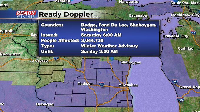
The National Weather Service has just issued a Winter Weather Advisory for accumulating snow Saturday.
Updated: 12:59 p.m. Jan. 27, 2023
The latest data suggests we may get solid snowfall into the weekend. I've tweaked totals up just a bit in central and southern spots. The track is wobbling north, in fact, one outlying model brings the heaviest snow through our northern locations so it certainly worth considering higher totals from this system. There's also enough instability that would support the totals here. However, at this time there are still no weather alerts for the area from the National Weather Service.
Updated: 10:57 a.m. Jan. 27, 2023
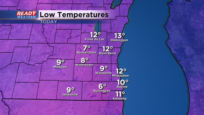
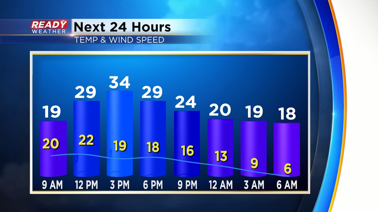
Snow and wind is the theme on this Friday. And it comes on the coldest start to the year with temps starting in the single digits and low teens. Check it out:
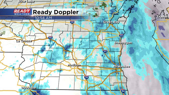
Updated: 8:42 a.m. Jan. 27, 2023
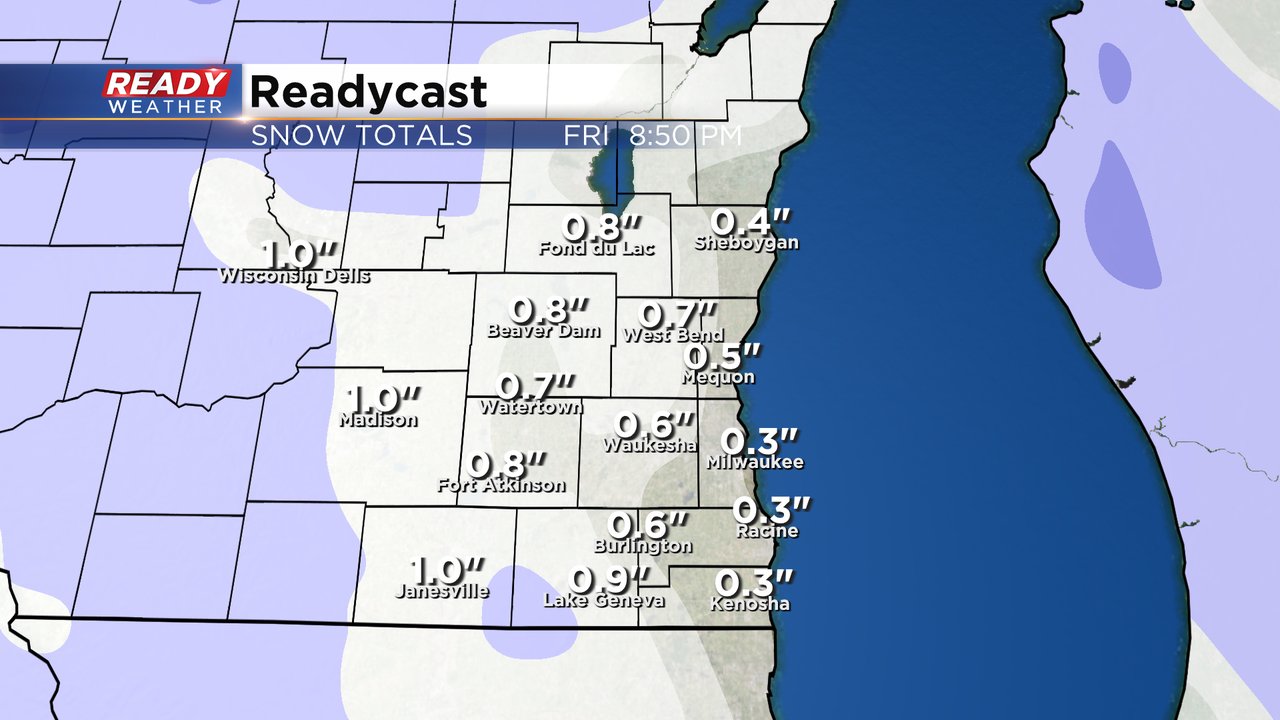
Our next round of snow has arrived! This is a quick clipper system that brings quick accumulating snow through the rest of Friday morning into the early afternoon. Snow totals remain on track with under an inch of snow expected.
Check out an updated radar image below:
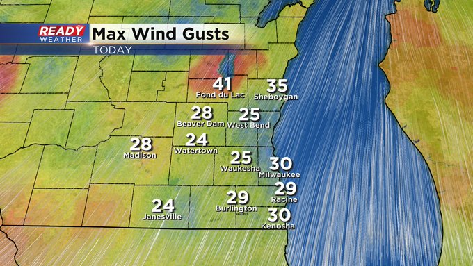
In addition to the snow arriving, the wind gusts are starting to ramp up. Gusts could reach 35 mph on Friday which will causing blowing and drifting snow and push wind chills into the teens most of the day.
Here's a map of wind gusts that will update with time:
Temperatures Friday morning dropped into the low teens for much of southeast Wisconsin which is the coldest morning of the month so far! Those temperatures will warm fast with highs Friday afternoon in the low to middle 30s then drop again this evening.
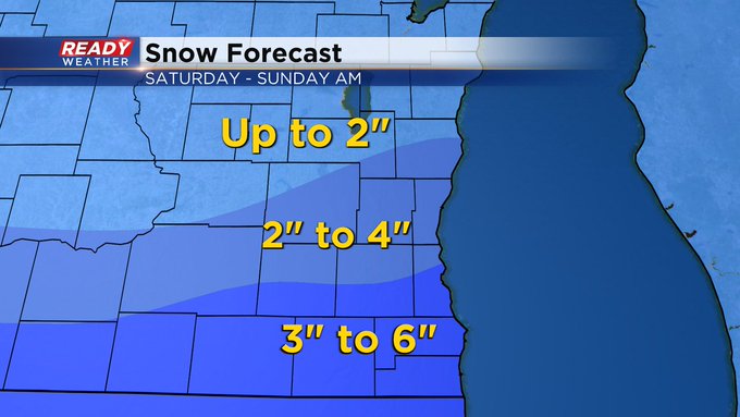
More snow is still on track for Saturday with 2-5" for most.
------
Posted: 6:02 a.m. Jan. 27, 2023
Our snow train keeps rolling on. Most of southeast Wisconsin saw 1-3" of snow Wednesday and Wednesday night then we picked up anywhere from a few tenths to another inch of snow on Thursday. Friday will feature another storm system with a clipper rolling in from the west. The snow will miss most of the Friday morning commute and wrap up before the evening commute.

Snow amounts don't look very heavy on Friday with under an inch in most hometowns but the wind will ramp up with gusts to 40 mph. Gusts that strong will cause reduced visibility and blowing snow. Those conditions could make travel difficult at times from late morning Friday through the early afternoon.
Our third storm system of the week arrives Saturday. This storm is looking more impressive and potentially the most snow of the week. Snow will roll in during the mid to late morning hours Saturday and then last the rest of the day. Snow could come down at a heavy rate at times during the afternoon and early evening.
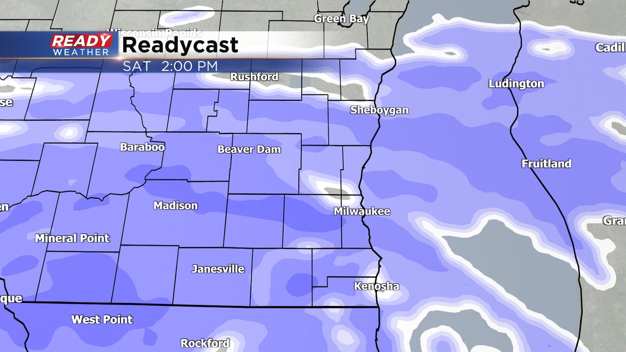
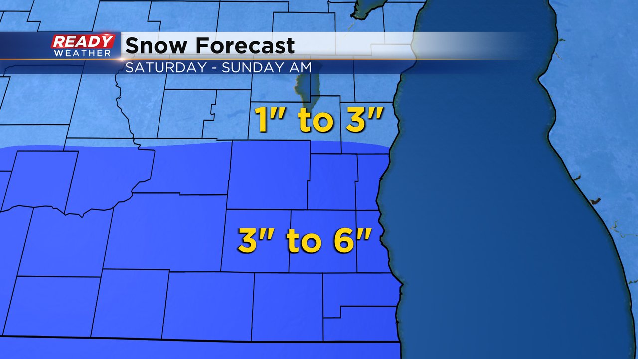
Overall this is a narrow band of snow so any shift in the track of the storm from north to south or visa versa will cause changes to the snow totals. As of Friday morning, our southern counties have the best chance to see more snow with 3-6" there. Fond du Lac and Sheboygan Counties are looking a little less with 1-3" of snow.
Download the CBS 58 Ready Weather app to track the blowing snow on Friday and changes in the forecast for Saturday.