


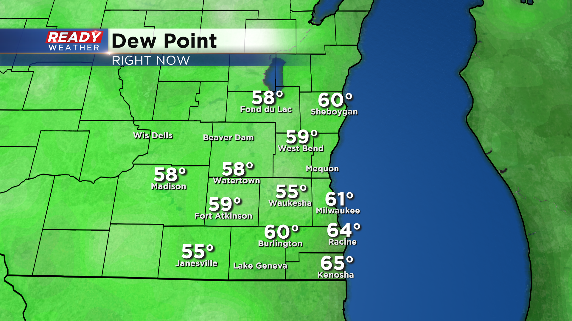
Dew points are dropping across southeast Wisconsin this evening behind a slow moving cold front.
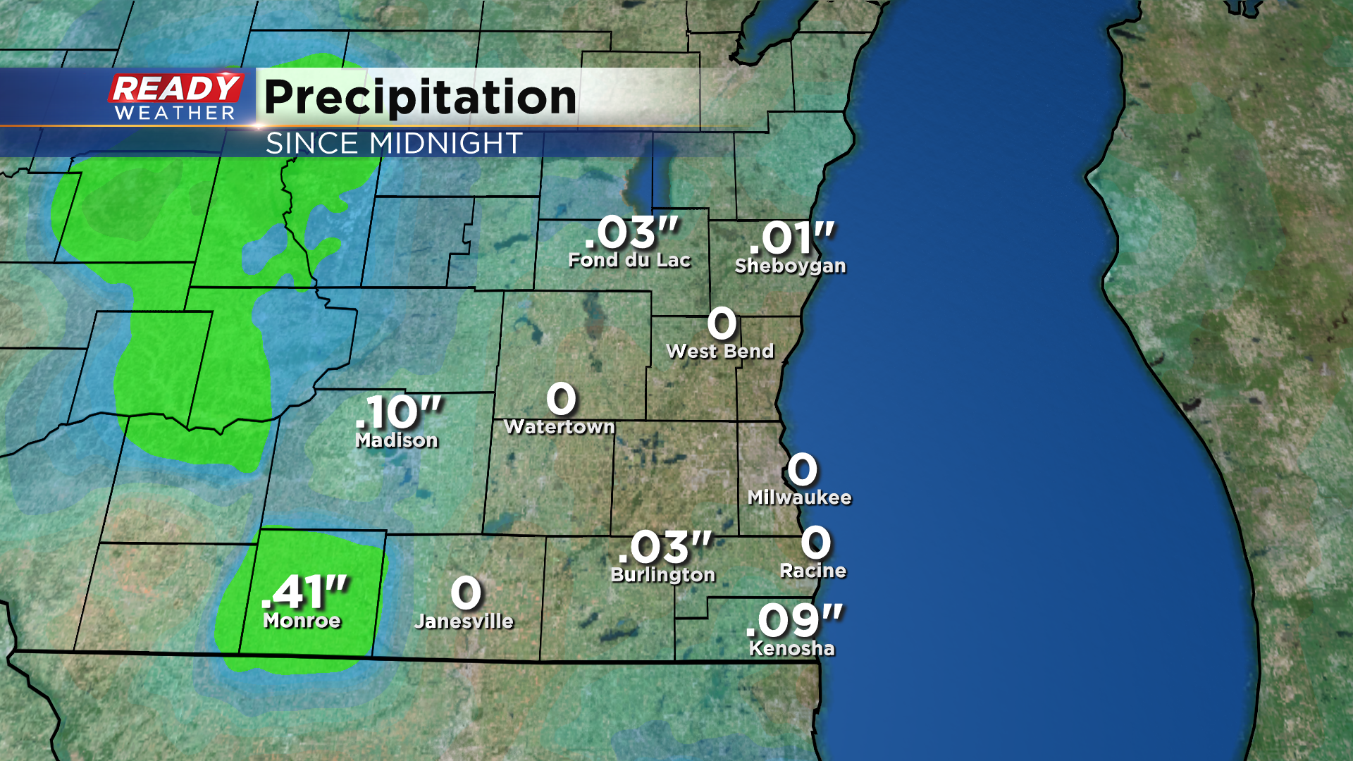
This front triggered a few scattered showers and isolated storms at times today, but not everyone saw the rain. What rain that did fall was light, with most spots picking up under .10” of an inch.
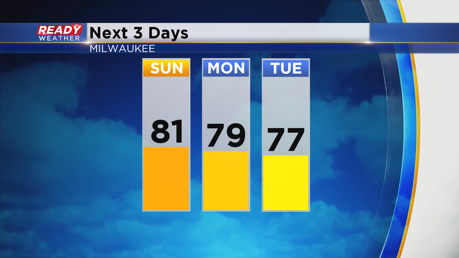
Dew points will remain at comfortable levels on Sunday and for the first few days of the work week.

Our shower or storm chances during this time are slim to none, so this would be a great opportunity to get any outdoor projects done as temperatures won’t be super hot. Highs will be around 80 on Sunday, but drop into the upper 70s to start the work week.
Chances for scattered showers and storms return Tuesday night into Wednesday as a front moves through. Download the CBS 58 Ready Weather App to see if temps will stay in the 70s all week.