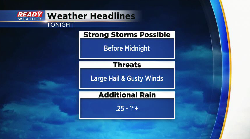
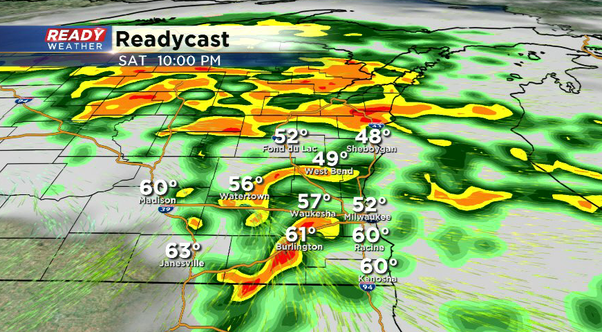
11 PM Update: Storms move out by midnight


11:15 p.m. update:
The last of the storms are racing through SE Wisconsin at 55 mph. Once these storms push out over the lake within the hour, our storm threat will be over.
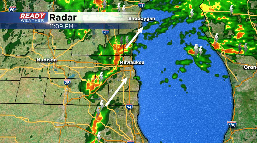
Some small hail will be possible in these storms, but no bigger than penny sized.
--------------------------------------------------------------------------------------
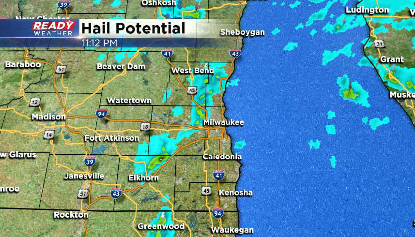
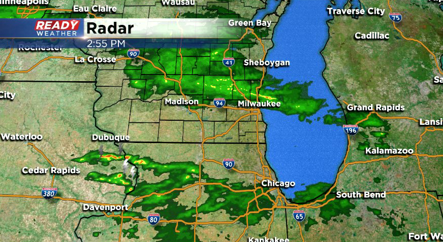
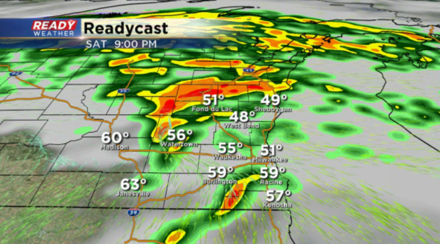
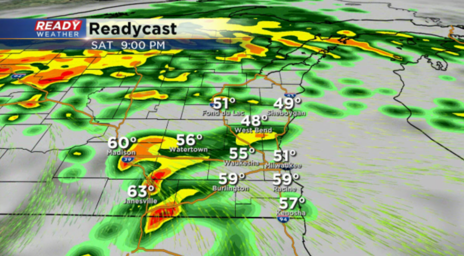
9 p.m. update:
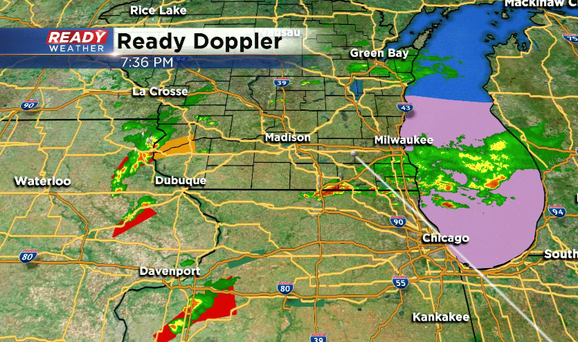
A cluster of storms pushing through SE Wisconsin right now have produced penny sized hail in southern Waukesha county. This threat will continue with this cluster of storms as it moves northeast.
Storms are racing northeast, but the warm front remains just south of SE Wisconsin. Storms will be strong to severe south of the front, and could remain on the stronger side as they move north and cross the warm front.
As storms move farther north, the weaker they will get. Hail and damaging winds continue to be the main threats, but we will continue to watch for any spin ups.
-------------------------------------------------------------------
7:30 p.m. update Saturday March 28th:
A strong storm is pushing into Walworth county at 55 mph. This cell has a history of producing penny sized hail in Rockford. This cell is moving into more stable air and will continue to weaken, but pea to dime sized hail is still possible.
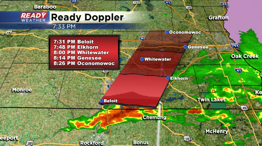
More severe storms are located to our south and west, but as they move towards SE WI between 9-11 p.m. they will move into more stable air and lose their tornado threat. Hail continue to be the main threat this evening, along with very heavy rain and gusty winds.
---------------------------------------------------------------------------------------
5 p.m. update Saturday, March 28th:
Scattered rain and isolate storms continue to push through southeast Wisconsin. Just like earlier today, a few of these storms closer to south central Wisconsin could produce some small hail.
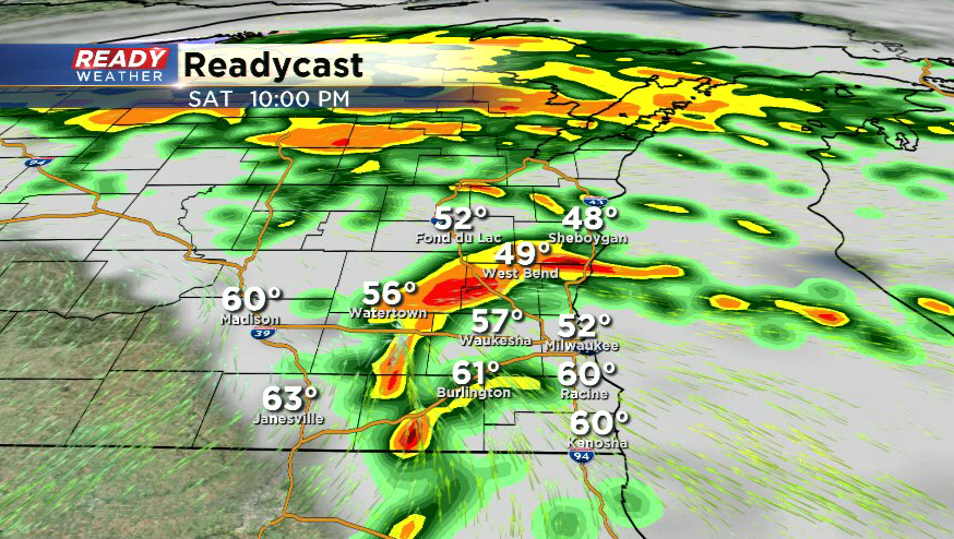
Forecast overall remains on track with the best chance for a few strong to severe storms with large hail arriving between 8-11 p.m.
-----------------------------------------------------------------------------------------------------------
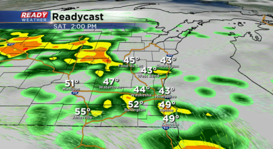
3 p.m. update Saturday, March 28th
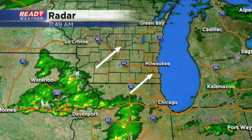
Second batch of rain and embedded rumbles of thunder continues to push north through southeast Wisconsin, with more showers and isolated storms developing to the southwest. No severe weather is expected with any of these storms.
The warm front has moved a little farther north in central Illinois and Iowa, but it still isn't expected to reach southeast Wisconsin.
The best chance for intense severe storms will be along and south of this warm front. A Particularly Dangerous Situation Tornado Watch has been issued for parts of Illinois, Iowa, and Missouri, with Severe Thunderstorm Watches stretching into the Ohio Valley.
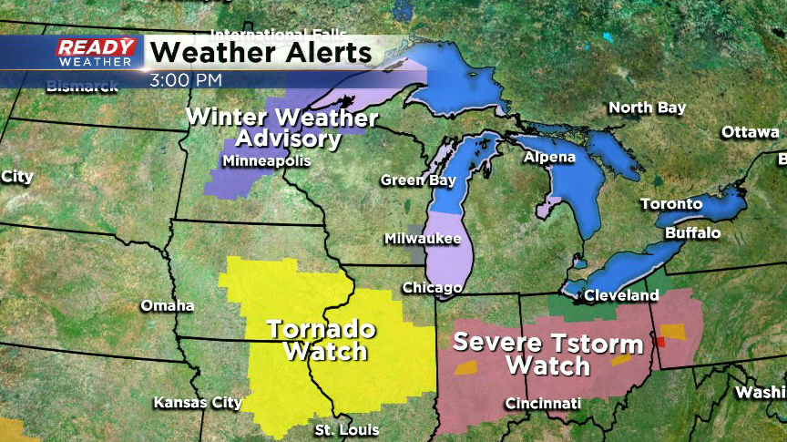
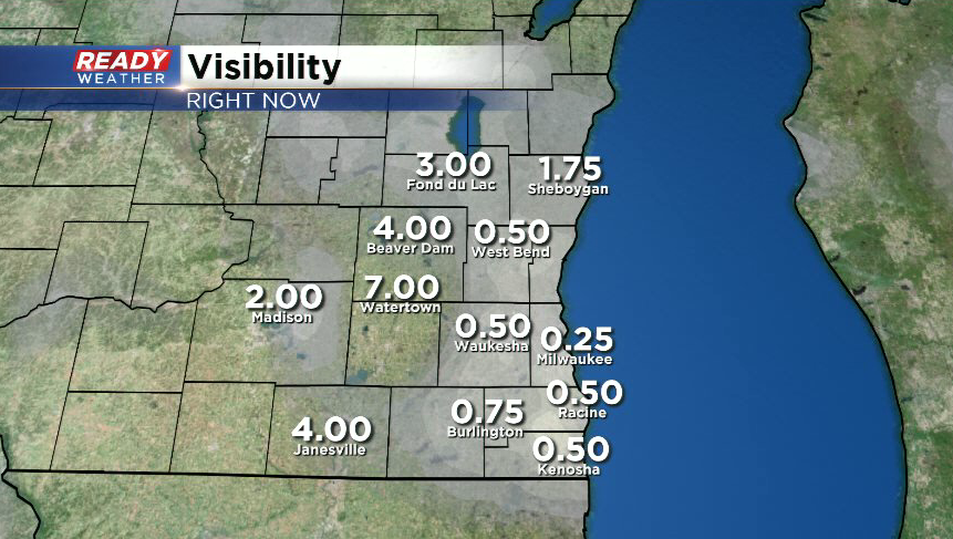
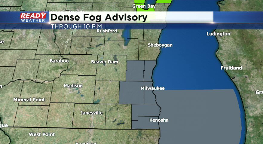
Closer to home, we are dealing with some dense fog with visibility at a half mile or less in many locations. A Dense Fog Advisory is in effect until 10 p.m.
There's still a chance for a strong storm with large hail or strong winds between 9-11 p.m., but the best chance (still a low chance) for a brief spin up of a tornado will remain along the WI/IL border from Janesville back to the southwest.
--------------------------------------------------------------------------------------------------------------
12 p.m. update Saturday, March 28th
We’ve been able to dry out for the past few hours, but the next round of rain and isolated thunderstorms is quickly moving in from the southwest.There’s no severe threat with these storms, but don’t be surprised if there’s some brief pea sized hail.
No changes in the severe weather outlook for southeast Wisconsin this evening. It still looks like the main threat for stronger storms will be between 8pm and 11pm. Hail and heavy downpours will be the main threats. The best chance for a brief spin up of a tornado would be in southwest Wisconsin, but even that chance is very low.
The showers and isolated storms moving through early this afternoon will likely help keep the warm front south of southeast Wisconsin.
-----------------------------------------------------------------------------------------------
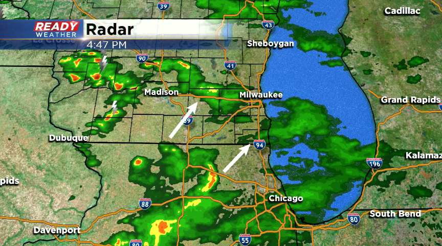
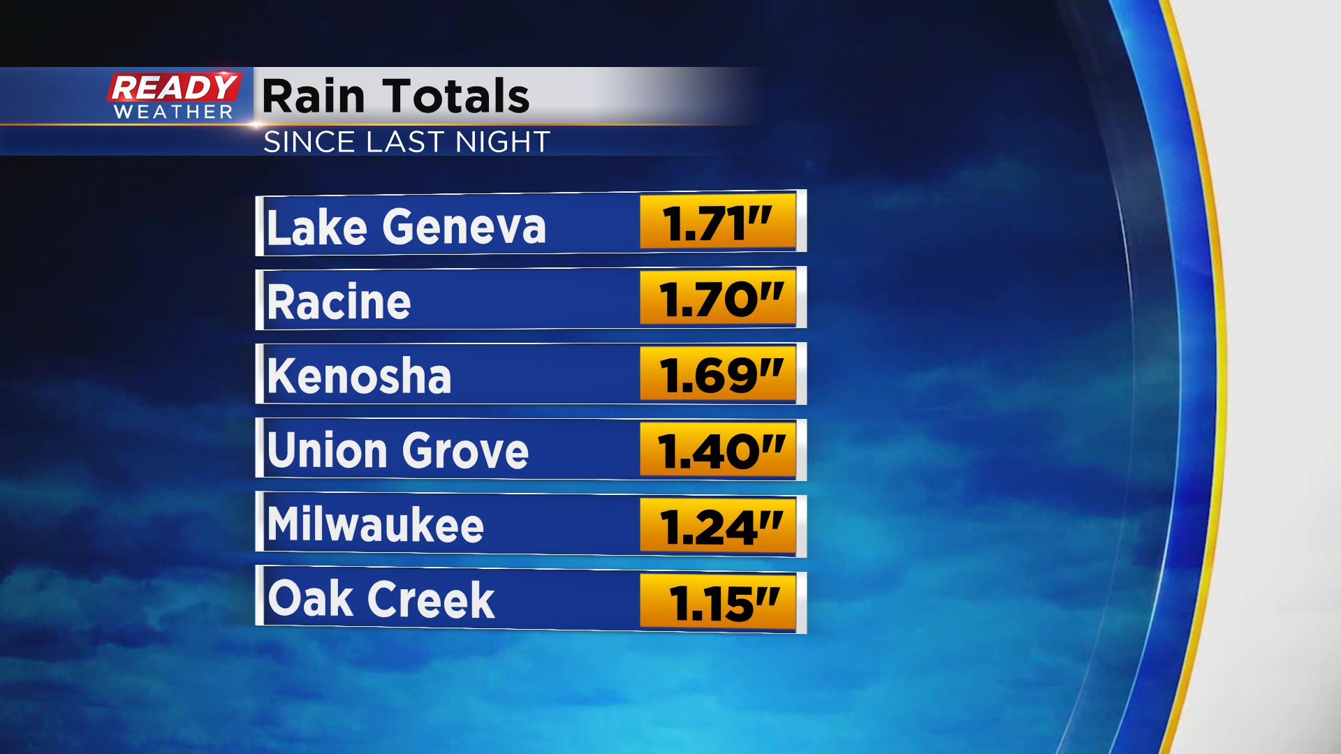
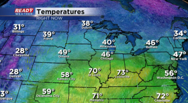
Persistent rain and embedded thunderstorms rolled through the area overnight, producing a soaking rain of 1-1.70” across far southeast Wisconsin.
We’ll see a break in the rain for several hours until the next round currently in Missouri and southern Iowa moves in around mid afternoon.
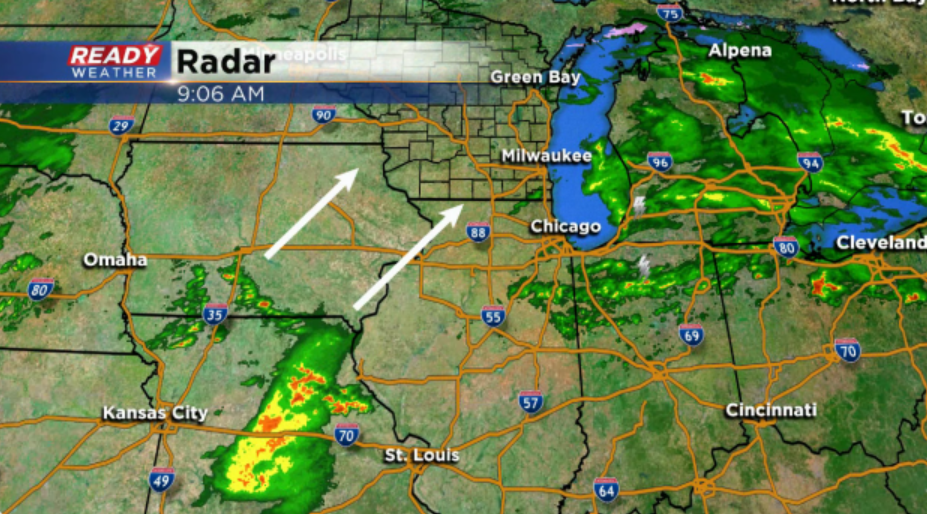
Severe storms are not expected with this round.
A warm front is currently situated across northern Missouri, central Illinois, and northern Indiana and will be the focus for a severe weather outbreak to our south late this afternoon and evening, including the potential for strong, long tracked tornadoes in parts of Illinois.
That’s where a Moderate Risk (level 4 of 5) is in place.
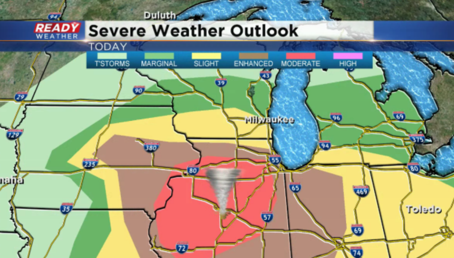
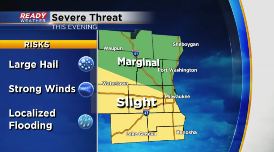
With afternoon showers and storms and an easterly wind off the lake all day, we’re not expecting the warm front to move into southern Wisconsin, so most of the severe storms will stay to our south. The southern half of the area is in a Slight Risk (Level 2 of 5) for severe storms this evening, but if we get a severe storm it’ll likely be right along the WI/IL border (Walworth or Kenosha counties) between 8-11 p.m.
Large hail will be the primary threat in any strong or severe storms along with gusty winds.
The tornado threat should remain just to our south in northern Illinois, but folks along the border should pay close attention to updates throughout the day.

The front will move across the area by midnight, ending any threat for severe storms. Additional light showers will continue Sunday morning with winds cranking up to 40 mph.
Download the CBS58 Ready Weather App for updates and to get severe weather alerts sent to your phone.