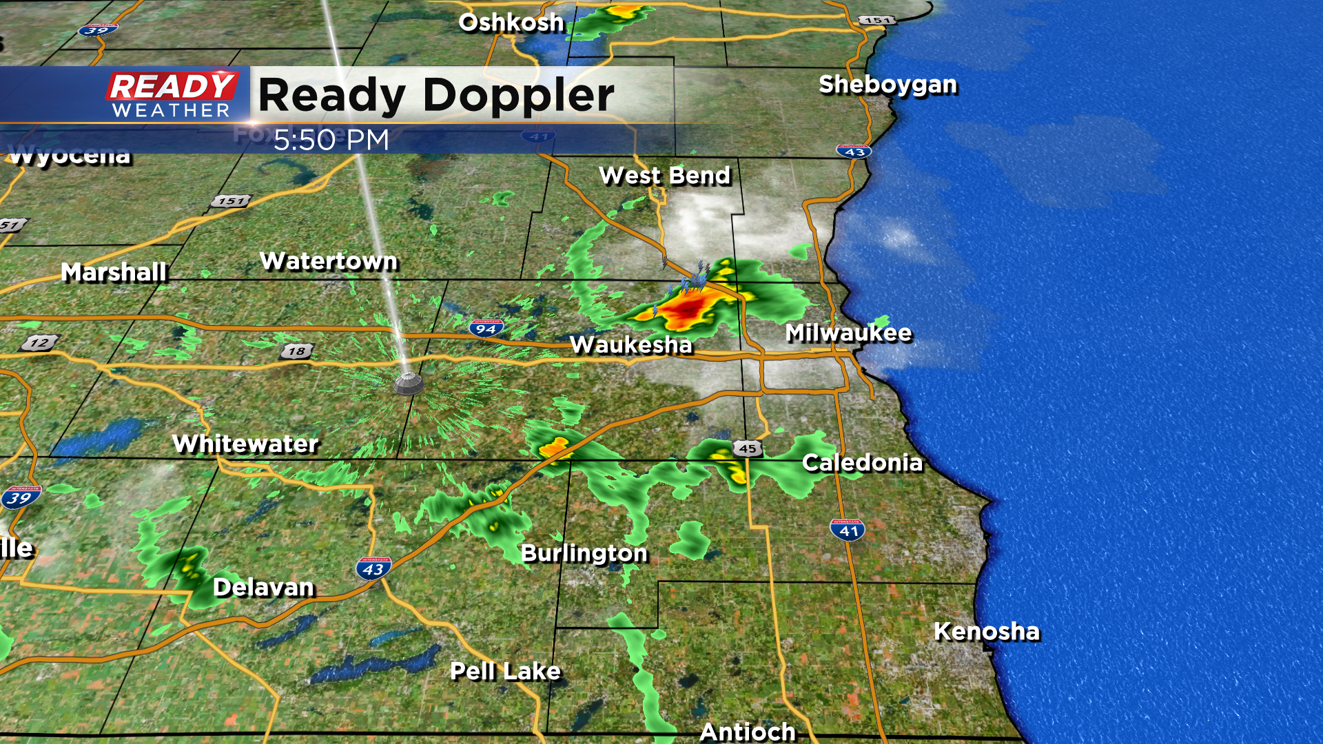
It was a warm day with plenty of sun. This afternoon the lake breeze kicked in. It's denoted by that thin green vertical line cutting down the area. Check it out:
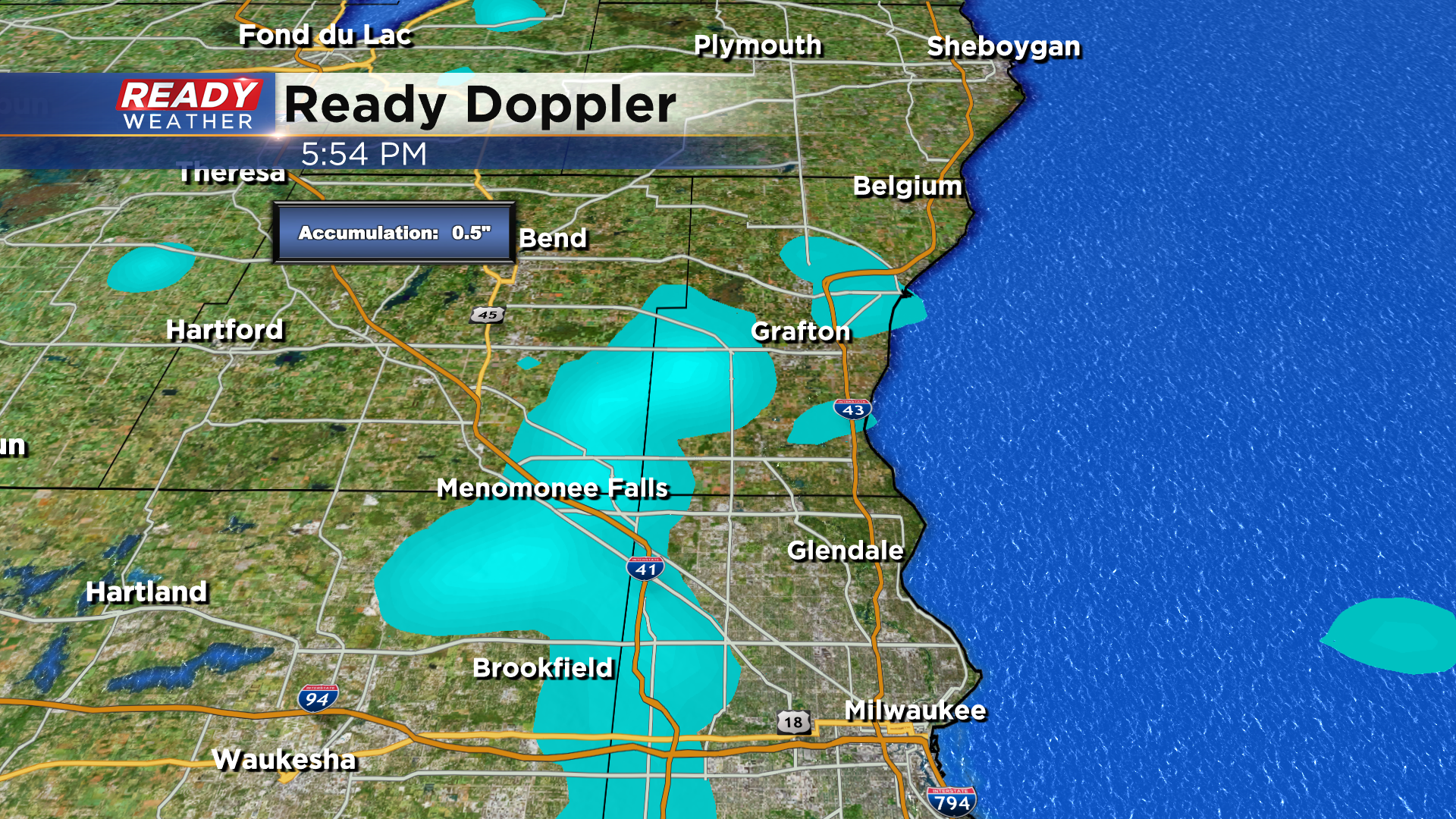
You can see it from about West Bend down through western Racine and Kenosha counties and that's helped to provide enough lift to kick off a few thunderstorms, with downpours. Take a look at what our estimated precipitation tool is showing for accumulation:
Two viewers in Brookfield report between a third and half inch of rain passing through on an earlier cell and now another is heading there again as these storms work south to southeast about 15 mph.
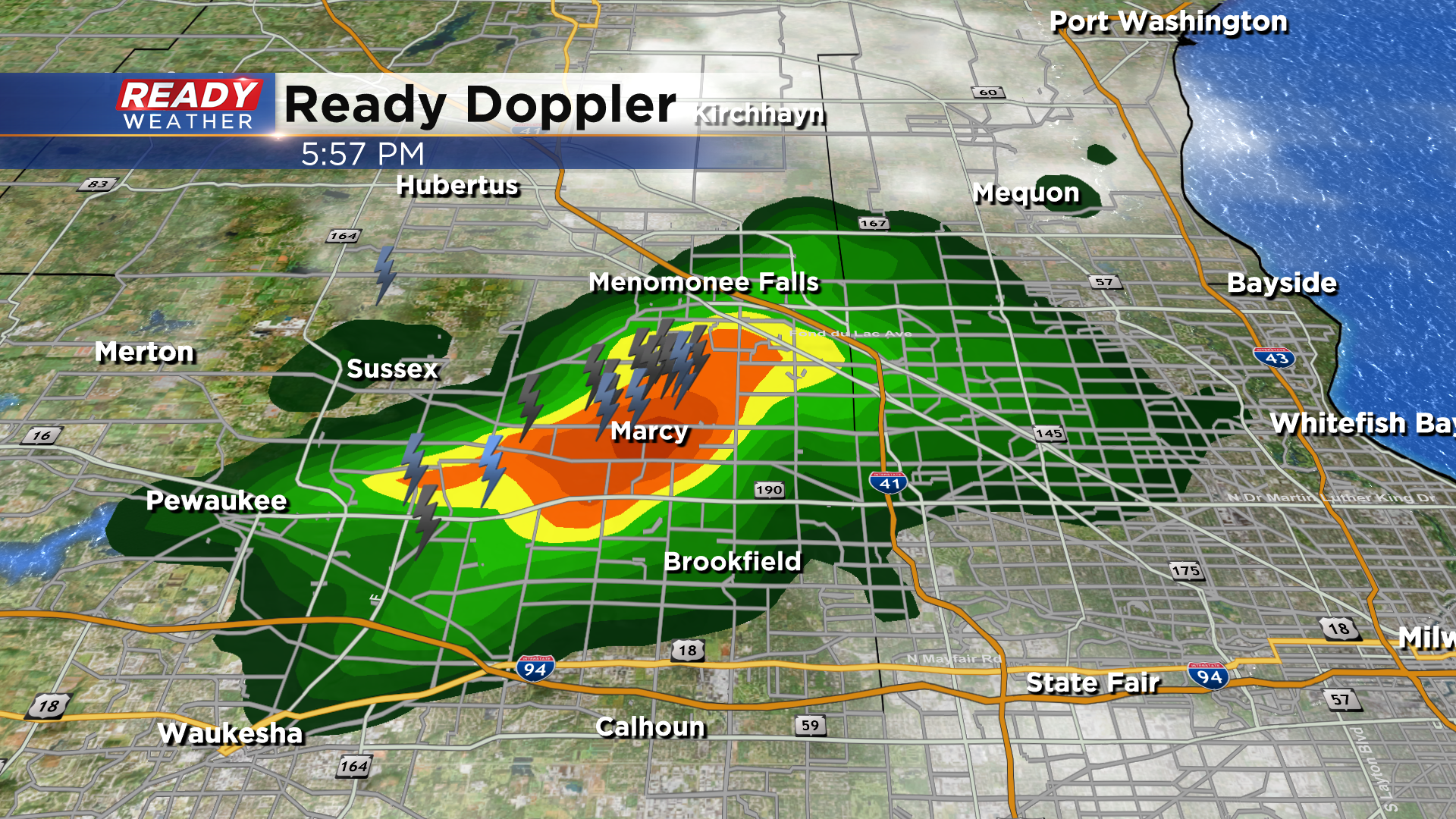
Another report out of Germantown relays 1.19" of rain and pea size hail. Any cells could also provide some thunder and lightning. Additionally, brief gusty winds could rush out from these cells around 30 to 40 mph, but should stay non-severe. With the lack of rain it's a welcome sight, but do prepare for a possible downpour through 8pm. Best chances should be from central to eastern communities. Beyond that the humidity will kick into high gear, especially by the weekend. That will help provide more numerous showers and storms Friday and Sunday.
I'm meteorologist Rebecca Schuld