In Between Storms
Today is the day to get out and go. High pressure is giving us beautiful weather although temperatures are still on the warm side with highs around 80. We should be near 70. Stormier changes take place around dawn on Wednesday and continue on and off through at least Friday. It looks like waves of heavy rain and storms are possible.

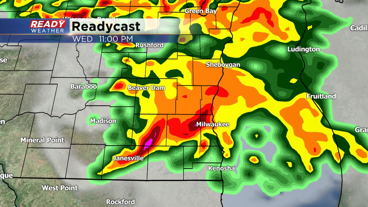
One of our computer models has between four and five inch rainfall amounts falling, especially north and west of the metro into Thursday morning.
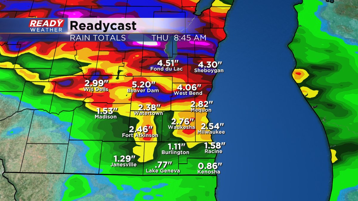
You can't take this data at face value, necessarily, but it does give you a good indication there's a lot of rich, deep moisture to work with, and heavy rain could occur. As of now, there are no flood advisories issued.
The weather appears to calm down by the time we get to the weekend. Daytime highs will be cooler too with readings in the 60s and 70s. It'll be even cooler next week.
Another reminder to download the free CBS58 weather app to keep ahead of all the weather action coming the rest of the week.
