Late Evening Update: Winter weather advisory has begun for most areas. Light icing occurring.
10:00 PM Update:
The winter weather advisory has been pushed back to start at 4 am for Racine, Kenosha, and Walworth counties. Milwaukee starts at 11 pm.
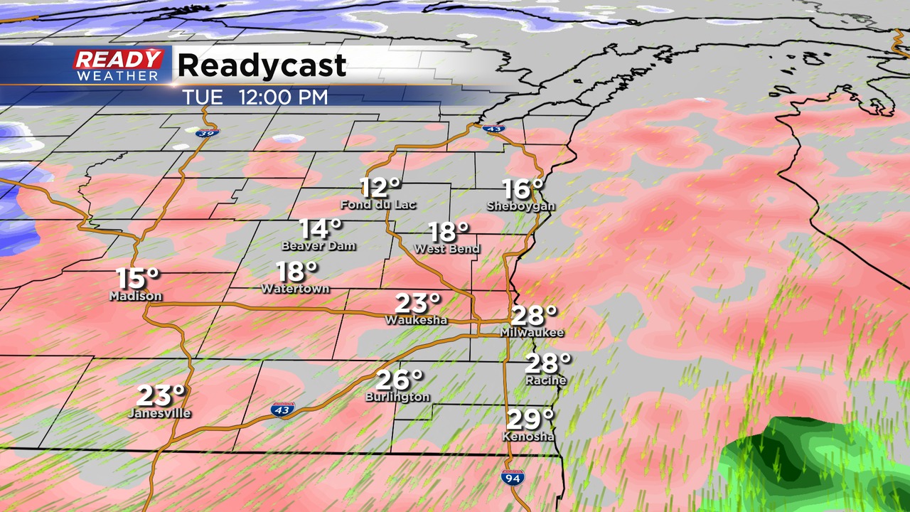
Light drizzle has developed across the area this evening. Depending upon where you are, pockets of freezing drizzle are possible as temperatures drop below 32.
A system to our south will continue to pump moisture across our area. Temperatures aloft will warm as they overrun shallow colder air at the surface. That overrunning is a recipe for freezing rain.
Most of Milwaukee into Racine and Kenosha will experience a cold rain this evening. Areas north and west of Milwaukee won't be so lucky as freezing rain develops where surface temperatures have dipped below 32.
After 3 am, Milwaukee, Racine, and Kenosha will have a chance for light icing as the temps drop to around 30 degrees. Plan on freezing rain across the area for the morning commute.
A big push of precipitation is forecast to occur during the morning into the afternoon on Tuesday, even some thunder is also possible. That is the time that the most significant icing will occur.
By the early afternoon, areas northwest of Milwaukee will have a mix of freezing rain, sleet, and even snow. Sleet is actually a good thing because it will chew into the freezing rain totals. The wintry mix will move out by the early evening.
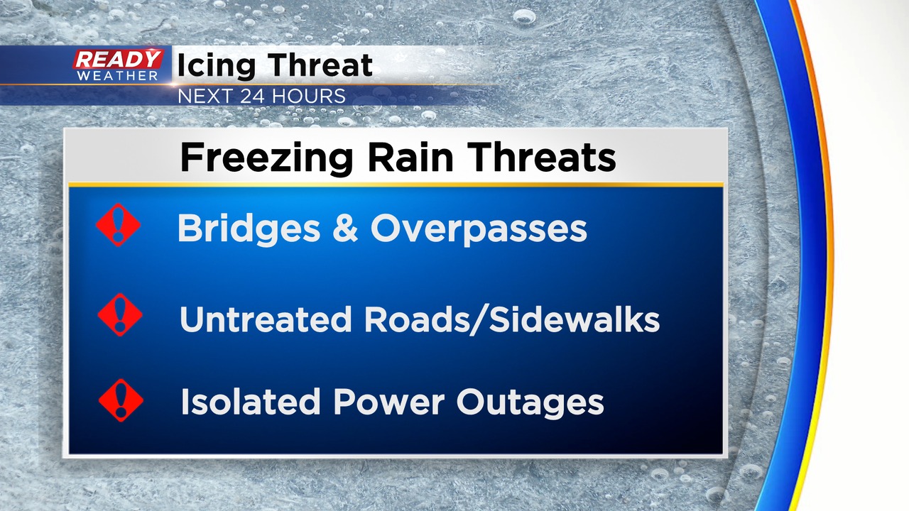
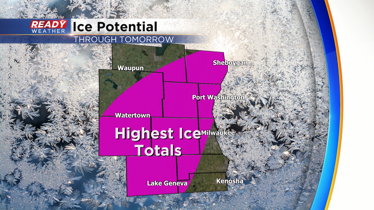
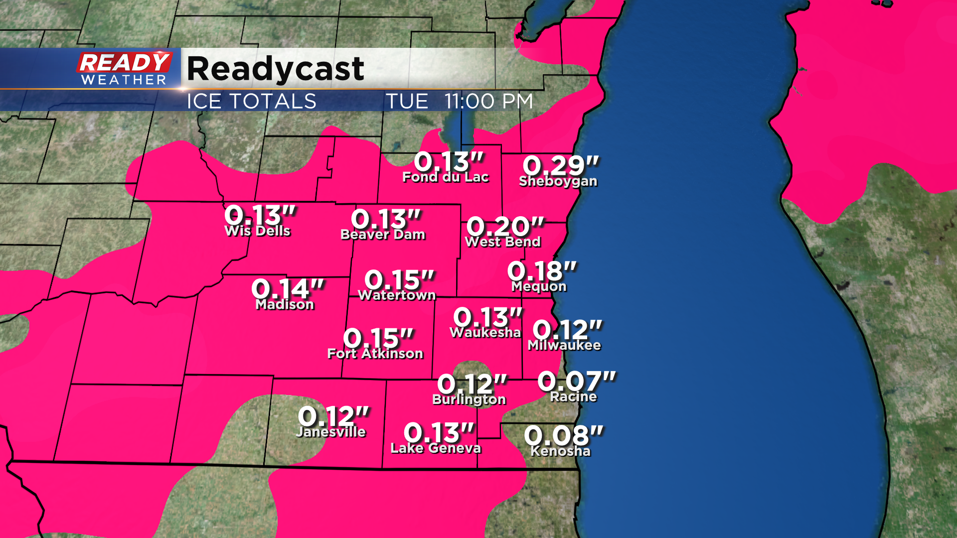
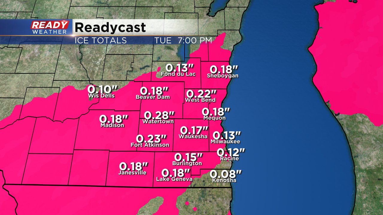
Most areas will see icing between 0.10" to 0.25". That will cause travel issues and even some isolated power outages with winds gusting to 30 mph. The area in purple will have the greatest icing issues. Milwaukee, Racine, and Kenosha would be on the lower end of that.
______________________________________________________________________________________________________________
Afternoon Update:
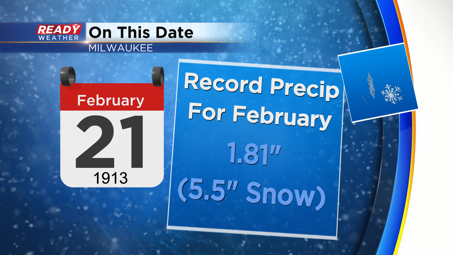
Today's date holds a soggy one!
Back in 1913 a very wet snowfall of 5.5" provided 1.81" of liquid equivalent precipitation. And while we may not break that record today, it will be very wet - particularly icy, as we head into the night. Things are still on track with this storm to provide a strong east to northeast wind with incoming rain,. drizzle or even freezing drizzle to our north by late day. As temps tumble back to the freezing mark and below, the concern for freezing rain will be the top priority for monitoring. The highest amounts are expected in our north and northeast spots, but a bit inland from the lakefront. It's possible on the high end a quarter inch of freezing precipitation could fall leading to very slick roads. While the onset may begin this afternoon, more steady precipitation gets underway just after sunset. We are under a Winter Weather Advisory lingering through much of tomorrow as this long duration event continues. Initially we're looking for rain, to freezing rain or drizzle... but in time the rain will mix with sleet to our north and possible light snow for northwestern spots that will cool back through the day tomorrow. Keep a close watch on forecasts the rest of the day as the storm unfolds across our area.
After the snow squall Friday night our unique winter weather will continue Monday into Tuesday. Most of the day Monday will be fairly dry with a few pockets of drizzle or flurries here and there. That changes Monday evening as rain, snow, sleet and some snow start to move in. The wintry mess will last through most of Tuesday wrapping up in the early evening. A winter weather advisory has been issued for all of southeast Wisconsin. The advisory starts at 5 PM Monday for most of the area except in Milwaukee, Racine, Kenosha and Walworth Counties where it starts at 11 PM. The advisory lasts until 6 PM on Tuesday.
The precipitation will start as rain in our far southern counties, freezing rain and sleet for most of us and a little snow mixing in for far northwestern areas. After midnight temperatures will have cooled below 32* for most of the area switching the bulk of the precipitation over to freezing rain with the possibility of some sleet mixing in. At the end of the storm we could see a little light snow, especially in northwest counties.
The expected ice accumulation from Monday evening through Tuesday will be significant. Anywhere from 0.10-0.30" of ice is possible throughout the entire viewing area. That's enough ice to make sidewalks treacherous and significantly impact roads.
Any snow we see as the storm system wraps up won't be too significant with less than an inch for most but some northwest counties like Dodge and Fond du Lac could see around an inch of snow.
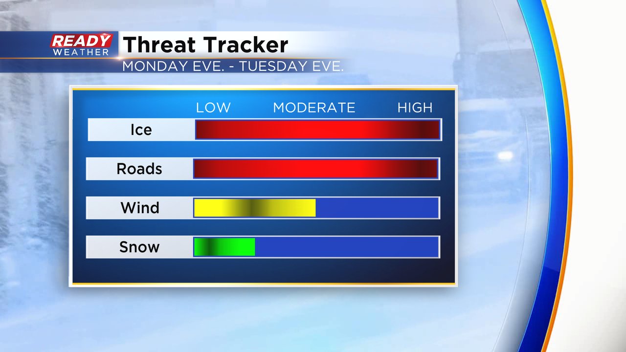
The ice and the impacts on the roads will by far be the biggest threats with this storm. It's not often We recommend staying home with winter weather in Wisconsin. We can handle lots of snow, but ice is a different beast and not to be messed with. With a bit of a breeze as well any ice that forms on tree branches could snap causing power outages. The snow is not going to have big impacts.
Download the CBS 58 Ready Weather app to track the icy mess.


