Late Afternoon Update: Winter Weather Advisory issued ahead of overnight snow
Updated Sunday, March 6th 5:45 pm:
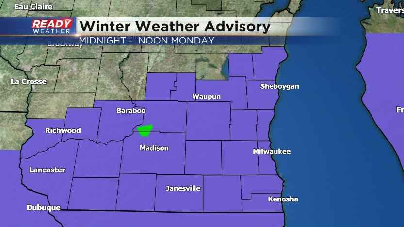
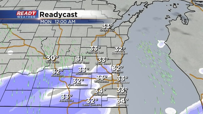
A Winter Weather Advisory has been issued for all of southeast Wisconsin beginning at midnight tonight and running through noon on Monday.
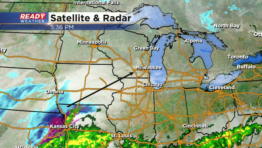
All is quiet for now, but the wet snow currently to our southwest will move in around midnight and continue through Monday morning.
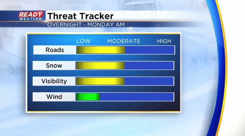
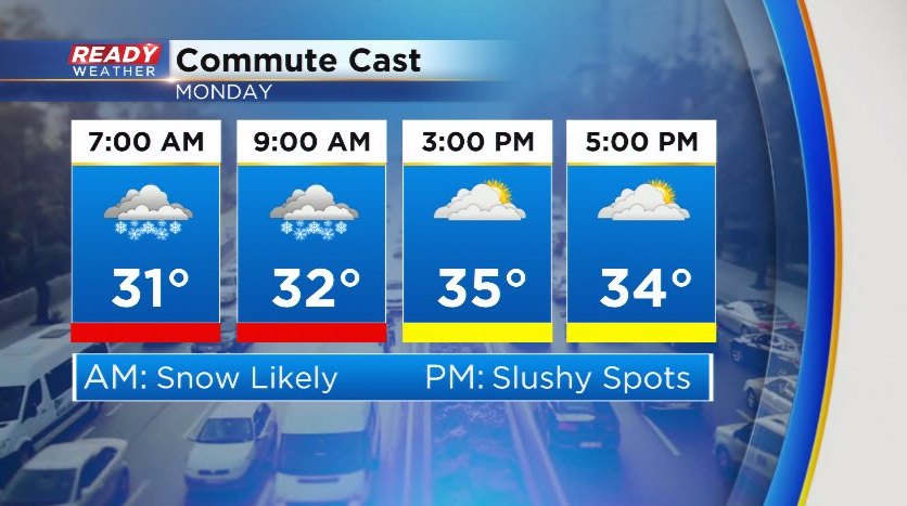
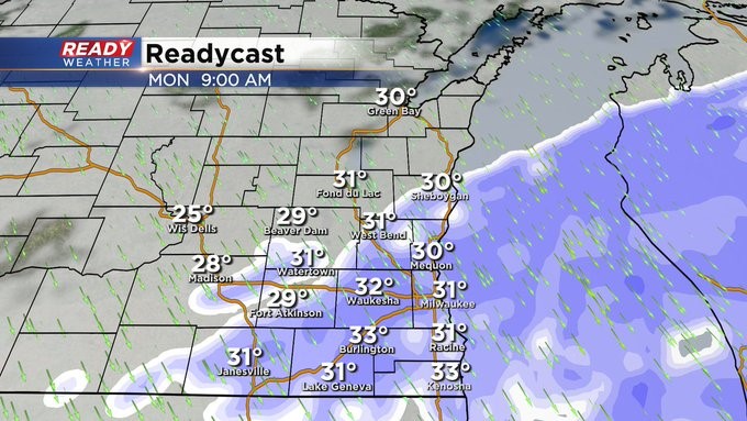
Wet snow will likely be falling at a moderate rate during the morning commute, which will lead to reduced visibility and snowy/slushy roads. Thankfully wind won't be an issue Monday morning.
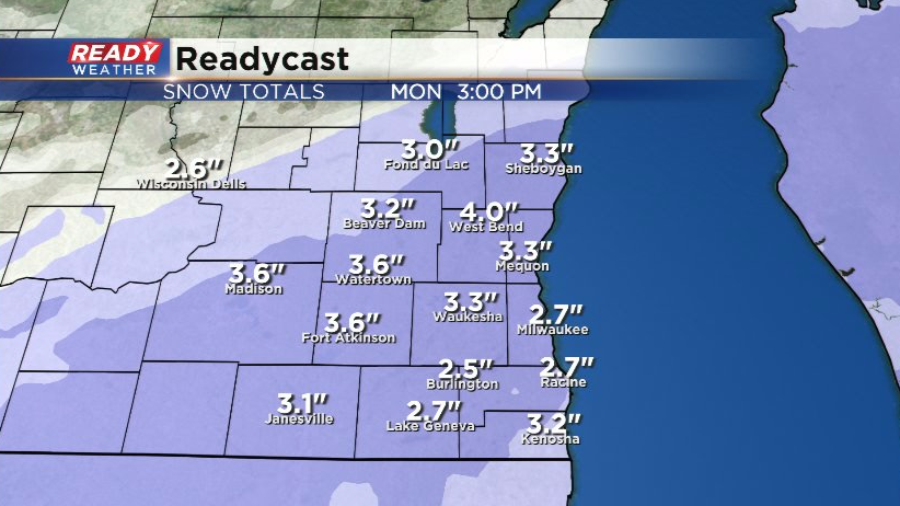
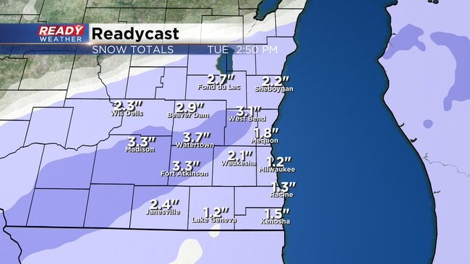
A general 2-4" of accumulation is expected for most of the area.
Temps may rise a few degrees above freezing during the afternoon, which will help roads improve by the PM commute.
Give yourself extra time to get to work and school Monday morning!
-----------------------------------------------------------------
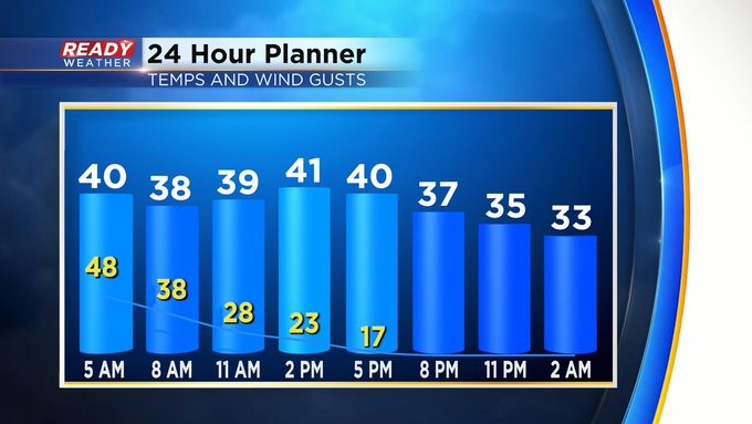
MILWAUKEE (CBS 58)--After reaching a record high of 66 on Saturday and experiencing evening storms, now we're focusing on the wind through much of the first part of Sunday behind a strong cold front. We could experience wind gusts more than 40 mph from the west. They'll quickly die down into the afternoon.
Then, right on cue. Another quick moving storm system will give us snow through much of Monday morning. A few slushy inches could accumulate. The morning commute could be a bit slick as well. Please use caution. We could see a repeat performance by Friday morning as well.
I don't see a big warmup coming again but at least highs will be in the 30s and 40s for most of the week.


