Higher humidity & scattered storms make a return to the forecast


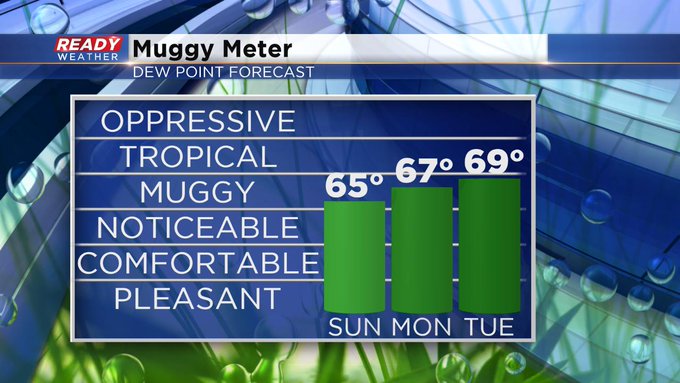
Milwaukee (CBS 58)--Our weather honeymoon with lower humidity is over, at least for while. Look for higher dew points through the first part of this coming week. Anytime we're above 60 degrees, you start to feel it. Plus we have chances for some showers and storms, especially later Monday afternoon into early Tuesday and then another chance on Thursday. The air mass at the end of the week looks a lot better.
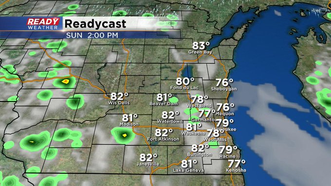
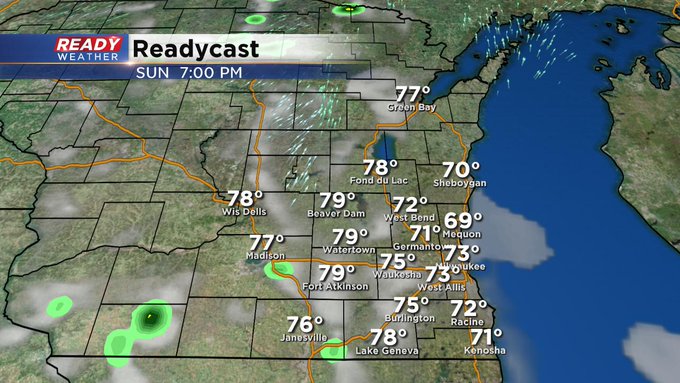
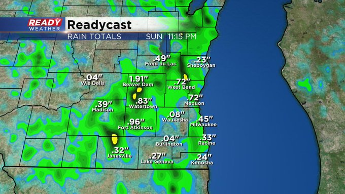
Sunday looks to be a lot like Saturday although it'll be a bit drier, but there's still a possibility of pop up storms, especially west of the Milwaukee metro. It's hard to pinpoint exactly who'll be getting the highest amounts of precip. But some of you could receive a few tenths of an inch.
We look to be under the influence of high pressure by next weekend. I think you'll enjoy it with temps in the 70s again and air that's a little easier to handle.