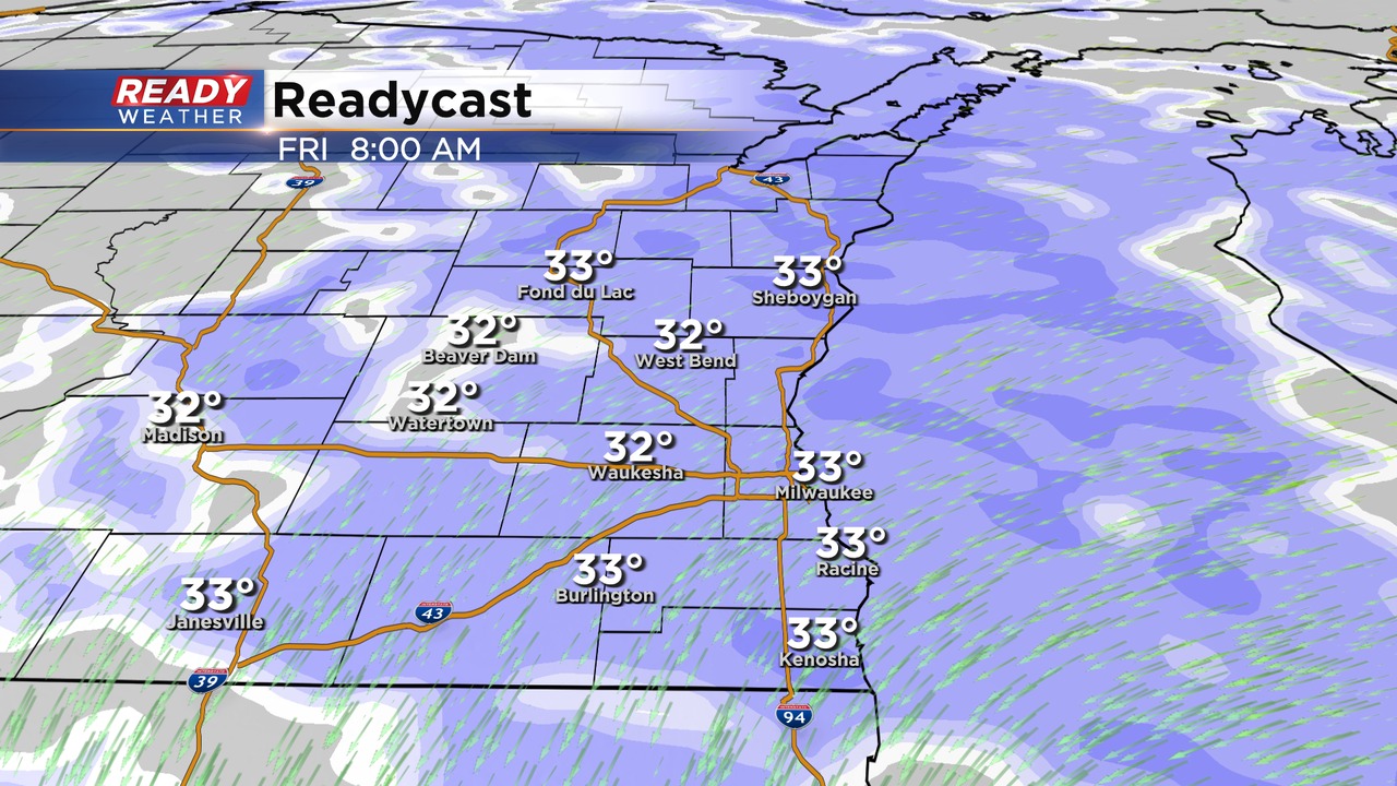
Overnight update: Snow will continue overnight. Roads will remain very slick and snow covered.
Updated: Thursday, March 9th 10:30 pm:
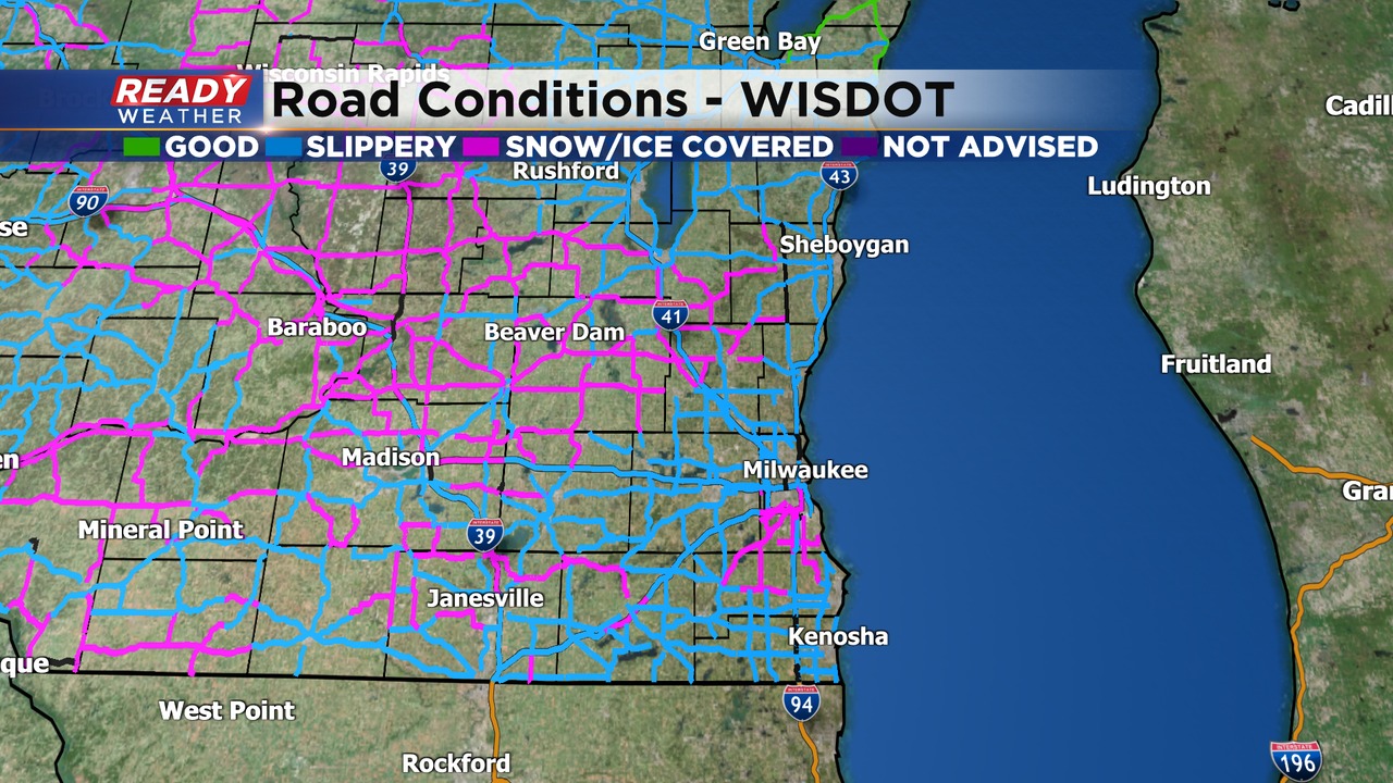
Roads are a slushy mess across the entire area. Main roads are also snow covered. The heavy snow is forecast to continue overnight into the Friday morning commute.
Visibility has also been an issue tonight. Many spots have dropped below a mile within the heavier snow bands.
No changes in the ongoing snowfall forecast. Snow will come to an end between 7 am and 10 am.
______________________________________________________________________________________________________________
Updated: Thursday, March 9th 6:00 pm:
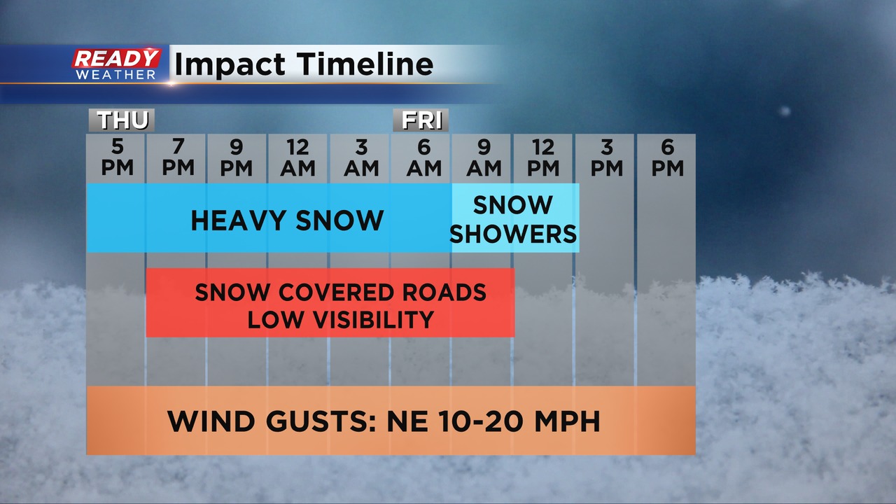
Already an inch at Mitchell! The snow continues across the area this evening, and it is starting to come down very quickly. Temperatures have dropped from the upper 30s down to the lower 30s. The drop in temperature will allow the snow to start to accumulate on roads over the next several hours.
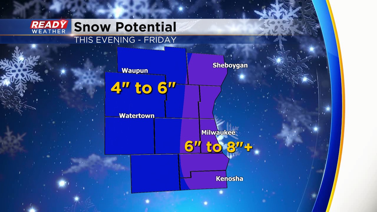
The roads will start to be impacted after 7 pm. That will last all night into the Friday morning commute. Snoe will come to an end by the late morning. Most areas will have picked up between 4" to 7" with locally higher amounts lakeside.
______________________________________________________________________________________________________________
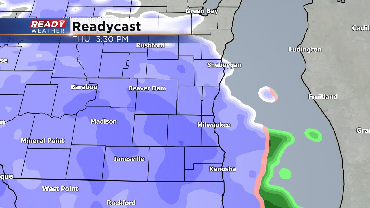
Updated: Thursday, March 9th 3:00 pm:
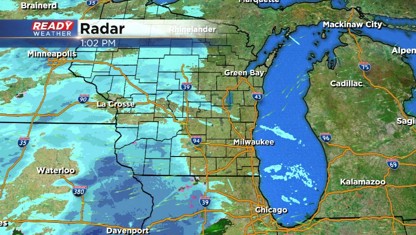
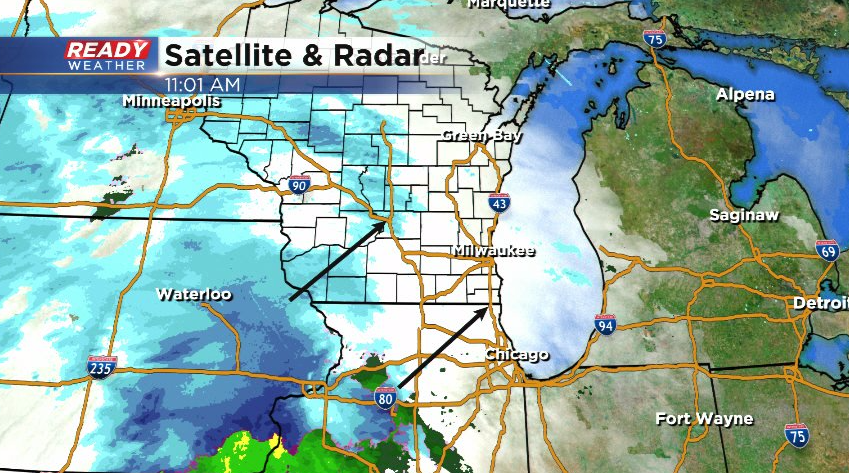
Snow is reaching the ground in SW WI and northern Illinois, but there's still lingering dry air over SE WI at the moment, evident by the lack of snow over us.
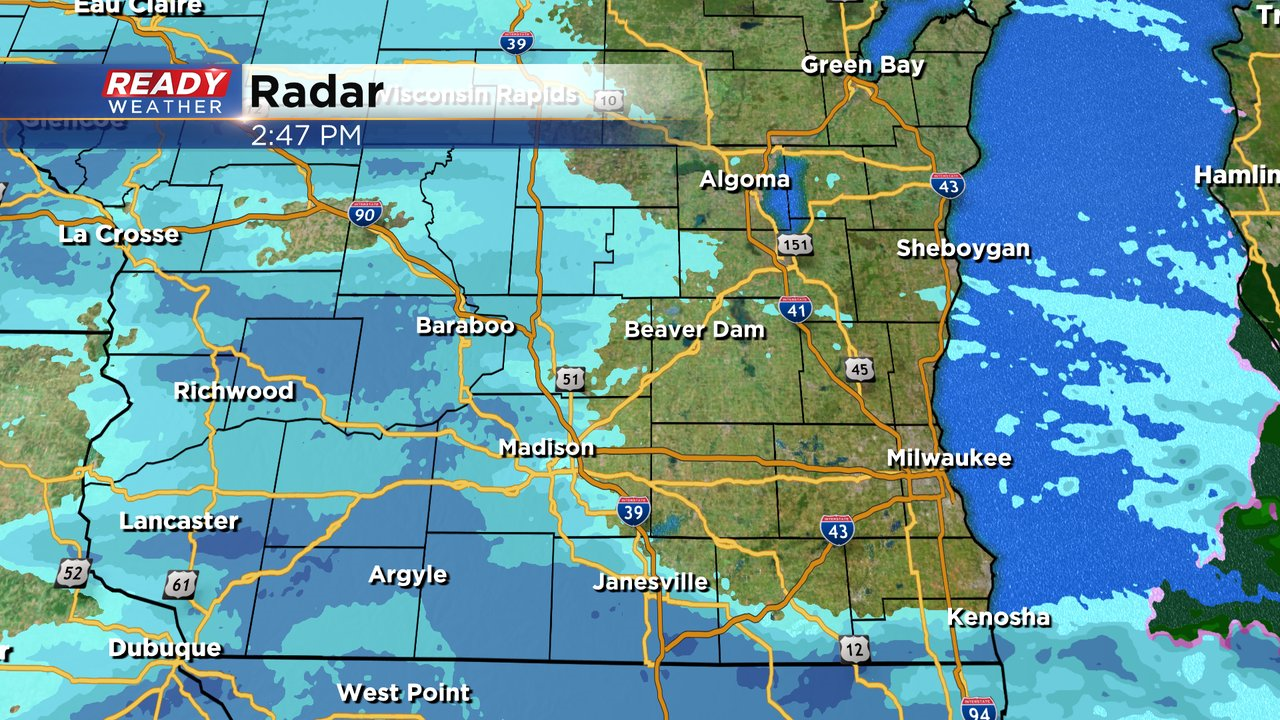
Light snow and flurries will start overcoming the dry air between now and 6pm. Snow is still on track to pick up in intensity this evening and overnight with the widespread snow tapering off Friday morning.
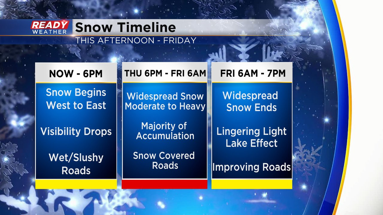
Additional light snow showers are possible Friday afternoon and evening, but additional accumulation at that point will be minimal. Going snow forecast remains on track.
-------------------------------------------------------------------------------------------
Updated: Thursday, March 9th 1:00 pm:
Snow is inching closer to southeast Wisconsin, but the previous timing of light snow reaching the ground between 3-6pm remains on track.
No real changes to our snow amount forecast either. Lakeshore counties and areas along and east of the Kettle Moraine in Washington and Walworth counties have the best shot at the higher end totals of 6-8" thanks to lake enhancement. 4-6" of accumulation is a good bet for most of the area.
---------------------------------------------------------------------------
Updated: Thursday, March 9th 11:00 am:
The forecast remains on track late this morning. There's still plenty of dry air over southeast Wisconsin right now, which will keep the snow at bay until mid to late afternoon.
As the snow starts reaching the ground between 3-6pm, it'll be rather light and wet. Roads that are treated will likely be wet during the evening commute with slushier spots on less traveled roads as temps will still be in the mid 30s as the snow begins.
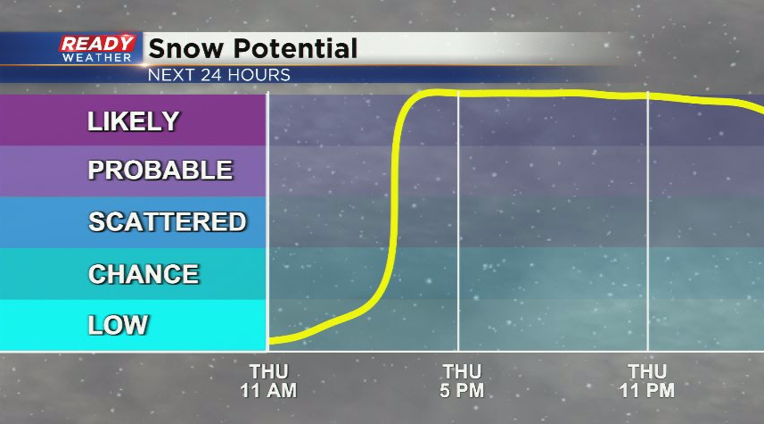
Temps drop into the low 30s this evening as snow picks up in intensity. Most of the accumulation will occur between sunset tonight and sunrise Friday morning. The snow total forecast below remains unchanged.
---------------------------------------------------------------------------------
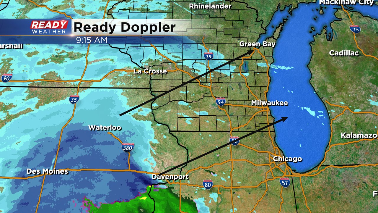
Updated: 9:16 a.m. March 9, 2023
The forecast looks good! Snow is currently rolling its way through Iowa and expected to arrive in southeast Wisconsin between 1-4 PM. A slushy evening commute is expected with worsening road conditions Thursday evening through Friday morning.
Scroll down to see the latest snow map and the current advisories and warnings associated with this storm.
------
Updated: 7:04 a.m. March 9, 2023
There are no big changes to the ongoing forecast for snow Thursday into Friday. Scroll down to see the snow map. One minor change is an earlier start time of the snow with steady snow now expected for most by 4 PM. This means that the Thursday evening commute will be impacted by the snow with at least some slushy snow out there on most roads if not snow covered roads in some communities. The Friday morning commute is still expected to be the most impacted.
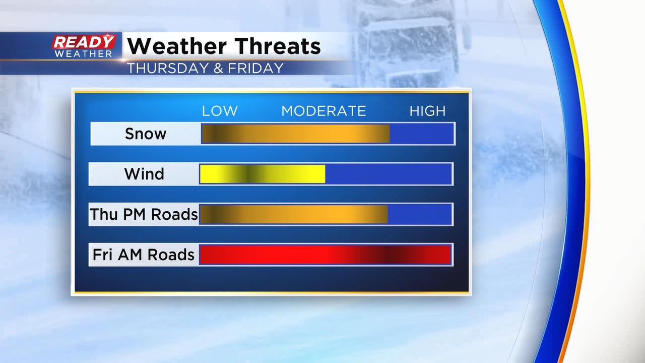
Also the wind threat has decreased slightly but breezy conditions between 10-20 mph may still be enough to causing some minor blowing and drifting snow.
------
Posted: 5:49 a.m. March 9, 2023
Our next winter storm is nearly here. After a dry start to the day Thursday morning, snow will start rolling in Thursday afternoon with heavy and steady snow expected during the evening and overnight hours. Most of the accumulating snow will be done by 9 AM Friday morning. The start time of the snow has trended a bit earlier with most seeing steady snow by 4 PM Thursday.
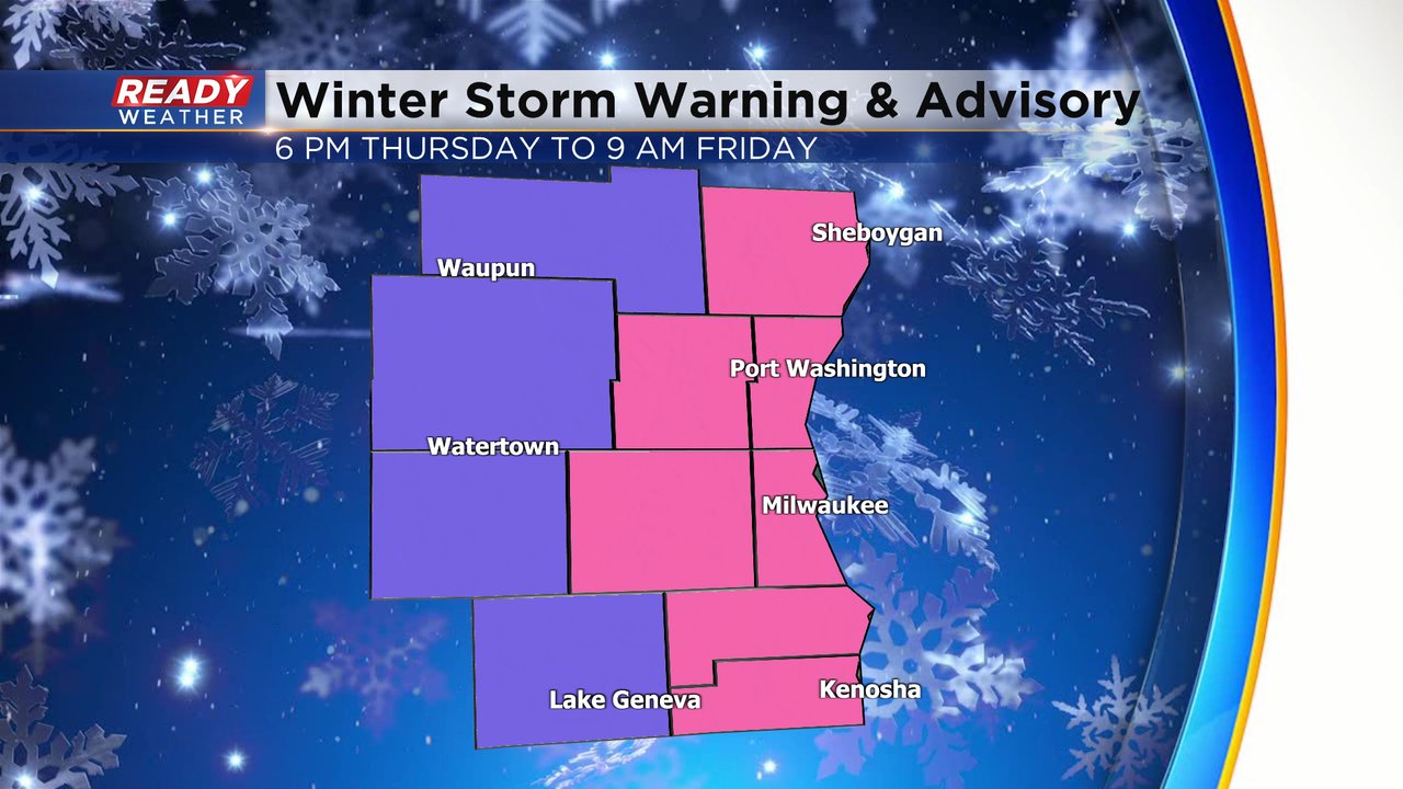
A winter storm warning has been issued for some lakeside and inland counties including Sheboygan, Washington, Ozaukee, Waukesha, Milwaukee, Racine and Kenosha. These areas could see the most snow. The warning starts at 6 PM Thursday evening and ends at 9 AM Friday morning. A winter weather advisory remains in effect for our western counties of Fond du Lac, Dodge, Jefferson and Walworth Counties where over 4" is still expected.
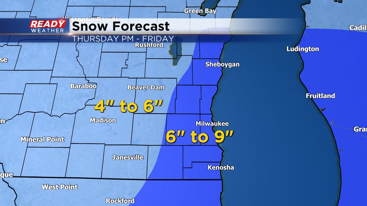
Overall most of southeast Wisconsin can expect 4-8" of snowfall but some lakeside areas may see up to 9" so we've done a bit of refinement to the snow map. Counties under the advisory may be more in the 4-6" range with 6-9" for some inland and lakeside areas.
Download the CBS 58 Ready Weather app to track the snow with the interactive radar.
