Heavy Rain System Moving North

A very slow moving low pressure system across the south is finally going to head northeast. Terrible flooding and flash flooding has occurred across the Gulf Coast over the last 48 hours. The town of Baton Rouge was particularly hit hard.
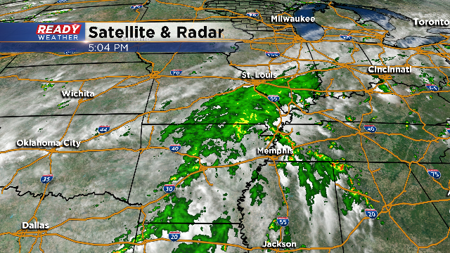
The track of the low now centered over Arkansas will move northeast over the next 12 hours into Missouri. The track of the low is important because we could be impacted late Monday night if the low stays further west from the model forecast.

The forecast is to have the heaviest rain stay south across Illinois. Late Monday evening there could be some showers across Racine and Kenosha counties; however, we do expect the majority of the rain on Monday to stay dry.
An upper level storm system will provide additional chances for showers and storms late Tuesday night into Wednesday across southeastern Wisconsin.
