Heavy Rain and Storms Possible This Week
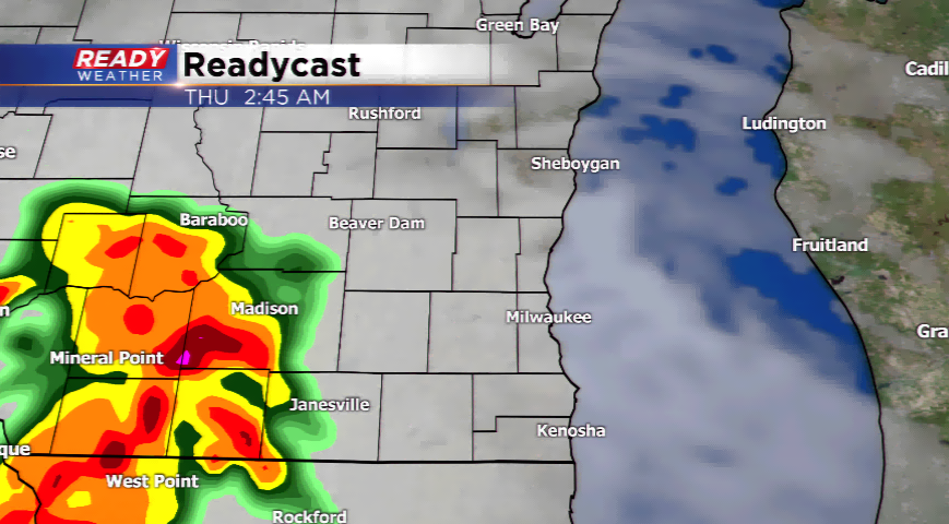 Storms firing by Thursday morning which could produce heavy rain.
Another beautiful day is expected, but you will feel a big difference in the humidity today compared to yesterday. The moisture begins to stream in with dew points in the 60s for the rest of the week. This will lead to storms the next few nights, and an overall stormy weather setup the next several days.
The “Ring of Fire” will keep the highway for storms near the viewing area. Our first round of showers and t’storms will develop later today out to our northwest and slide into the area late tonight. A lot of the activity in terms of strong to severe storms will likely stay to our northwest; however, a few strong storms and heavy downpours could make it into our region. Expect a secondary line of showers and thunderstorms again on Wednesda
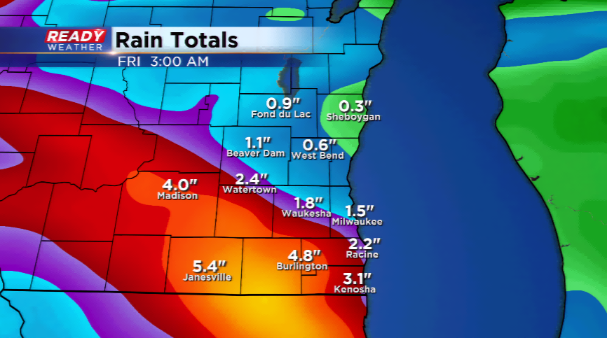 North American Model indicating a heavy swath of rain similar to last week!
More storms could be triggered for Thursday afternoon, Friday, and Saturday. Highs stay in the 80s with muggy air helping to fuel the thunderstorms.
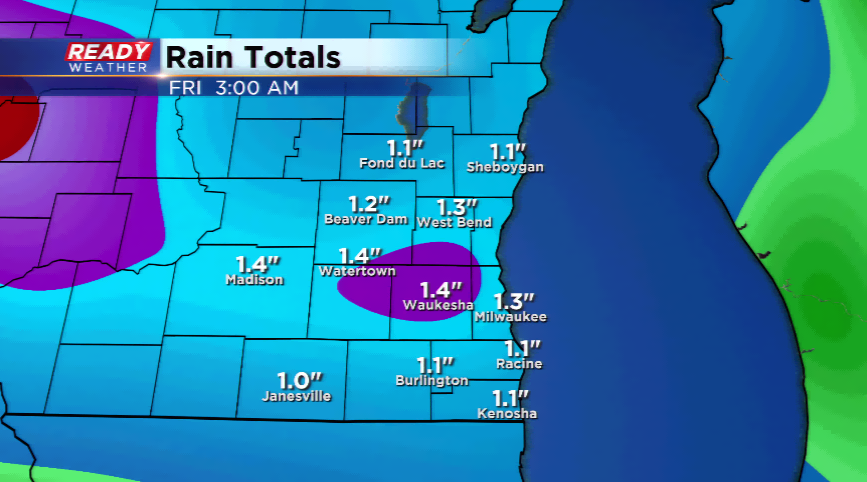 GFS computer model showing at least 1" of rainfall through the end of the week.
