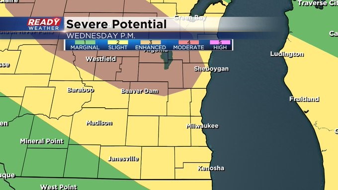
Heat & humidity pave the way for stronger storms Wednesday night

-
1:24

Schlesinger’s Saturday Showcase (3/21)...Spring Home & Garden...
-
2:48

The first weekend of spring features wild swings and a bit of...
-
2:43

’They are almost mentally broken’: Wisconsin TSA workers...
-
1:02

Marquette women’s lacrosse holds Pancreatic Cancer Awareness...
-
2:02

City of Port Washington planning commission votes to limit hours...
-
1:28

Covering all the bases: Brewers preview variety of new stadium...
-
1:34

West Bend man facing 18 felonies after investigators say he had...
-
0:50

Muslim community gathers to commemorate Eid al-Fitr at Milwaukee’s...
-
2:10

Statue of Cesar Chavez on Milwaukee’s south side removed following...
-
0:57

Medical College of Wisconsin students paired with residency programs...
-
1:23

Shop Just Between Friends pop-up consignment in West Bend through...
-
2:02

Meet CBS 58’s Pet of the Week: Biship

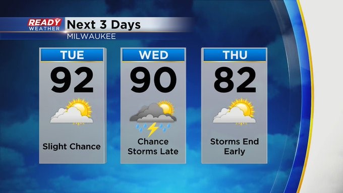
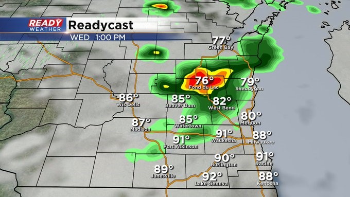
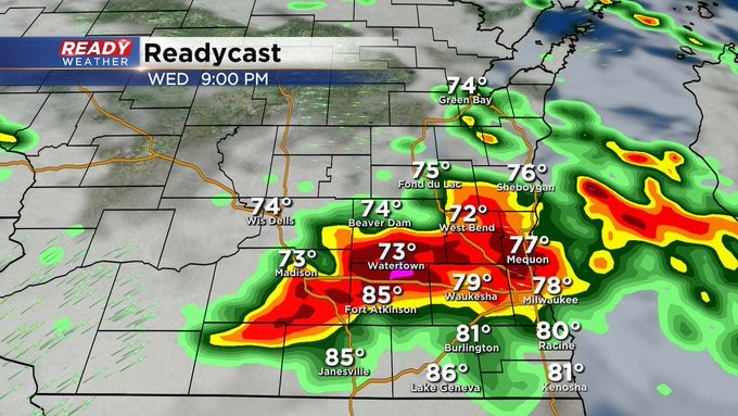
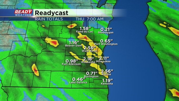
MILWAUKEE (CBS 58)--It's like a boiling pot with the heat and humidity. Look for a "boil over" into Wednesday night with strong to severe weather as low pressure moves into very unstable air.
There' s an "enhanced" risk of severe weather just to the north and west of the metro. Elsewhere it's a "slight" risk. Wind, hail. heavy rain, frequent lightning all possible. An initial band of storm activity could roll through early in the afternoon.
The dangerous weather should exit into Thursday morning.
Look for the 90s to continue both Tuesday and Wednesday before backing off for the rest of the week.
The weekend looks fairly quiet except for some storm chances late in the day Saturday and Saturday evening with highs near 80 and lows in the 50s and 60s.