Gulf Storm Brings Big Changes To Wisconsin Weather (Slide Show)
Cloudy skies this morning will give way to raindrops by late afternoon and evening. The rain will spread from south to north across the viewing area through the evening. A steady sideways rain is expected overnight as winds increase from the east-southeast. Sustained winds of 20 to 25 mph are expected along Lake Michigan's shoreline with gusts exceeding 30 mph at times. A Small Craft Advisory has been issued by the National Weather Service as waves are expected to build to 5-8 feet by tonight.
The heaviest rain will also arrive tonight. Most locations are expected to receive between .5" - .75" overnight. The storm total rainfall is shown in the graphic below. As you can see, this will be a soaker with many locations receiving around an inch of rain.

This is a good time to remember to keep your storm drains clear of excess leaves and lawn debris. With this kind of rain, clogged storm drains can lead to flooded streets, yards and even basements.
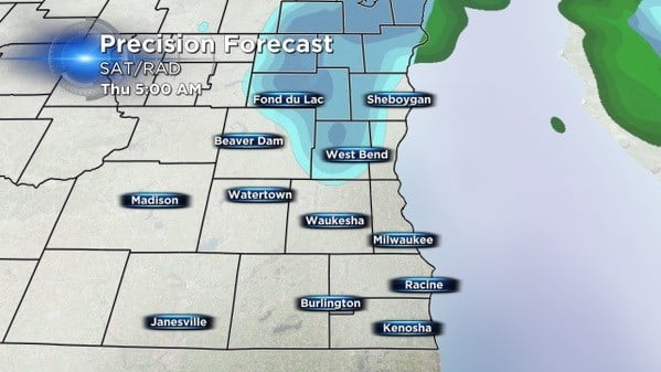
As the storm intensifies over the state Wednesday, it will start wrapping in colder air from Canada. By the time this cold air arrives most of the moisture will be to our north and east. However, we are still expecting parts of the area to see the first flakes of the season as a few snow showers or flurries fill in behind the storm. The window of opportunity for snow appears to be greatest between midnight - 6 A.M. Thursday.