Does it feel like endless days of the lake breeze with cool temps and recent gloomy skies? If you said yes, you're not wrong! We have had very little blue sky days in the last two months.
Check this out:
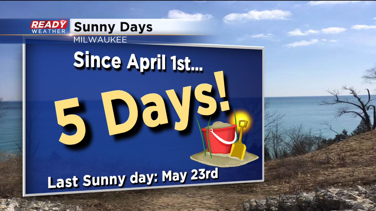
With just two days left in May, we've had less than a week of sunny conditions (30% cloud cover or less) in the last two months. Pretty unbelievable stuff! May has also been quite soggy.
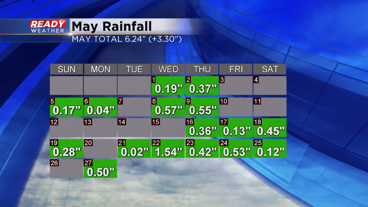
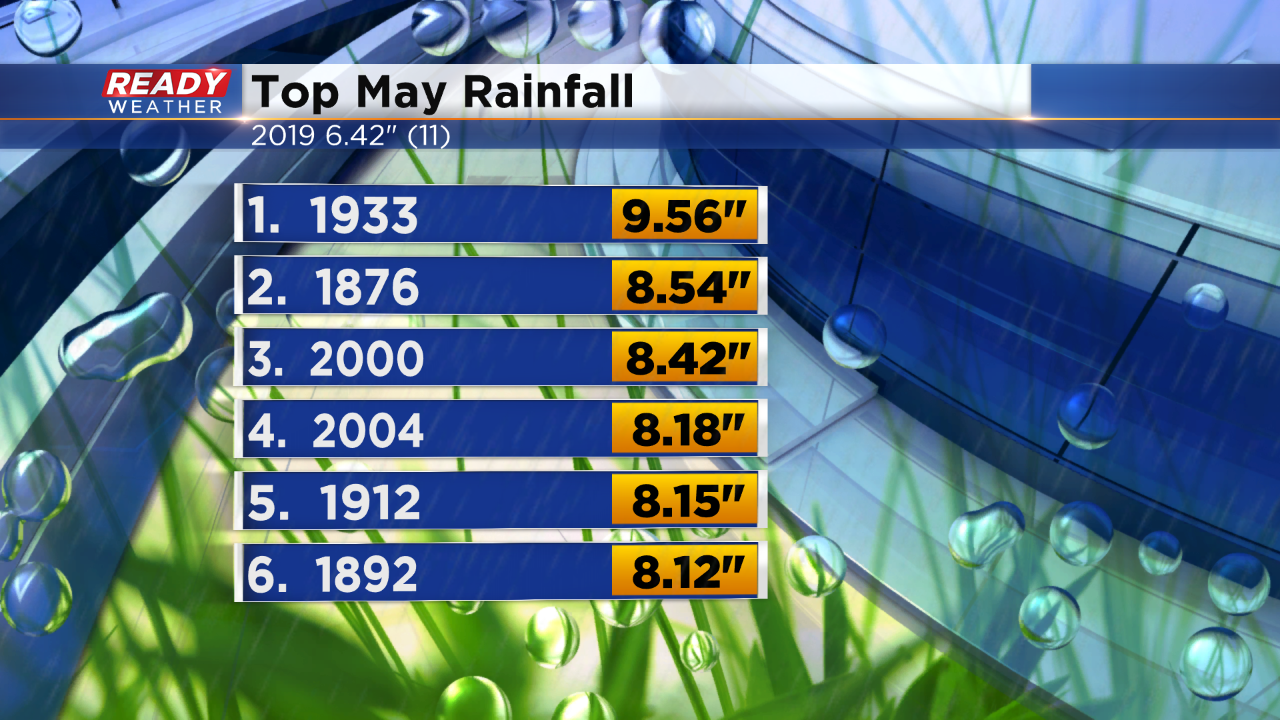
Over half the month recorded rainfall, and despite a mainly dry afternoon, the clouds are still overhead. The clouds are a signal of more rain on the way for tonight. Most of it moves in after midnight and diminishes by sunrise. So while the next batch of wet weather moves through while most of us are asleep, it doesn't escape records. From the above graphic you can see we have over six inches of rain so far. That's over three inches above normal to date. With that tally we sit at 11th wettest May for Milwaukee, since records began. Here's a look at the top six rainiest:
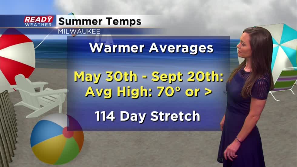
We have the potential to pick up another quarter inch of rain overnight and then we focus on warmer thoughts. Starting tomorrow, the average high temperature in Milwaukee rises to seventy degrees! The warmth lasts, per the averages, through much of September. Have a look:
Beach weather is right around the corner. To that note we look to find temperatures around eighty by Friday afternoon.
I'm meteorologist Rebecca Schuld