Get ready for snow and cold
THIS IS AN OUTDATED FORECAST. CLICK HERE FOR THE LATEST BLOG.
The cloudy conditions will persist for most of your Thursday with slight chances of flurries. Temperatures today will be slightly warmer than what we saw yesterday as the winds begin to turn ahead of a major storm system still brewing out to the west.
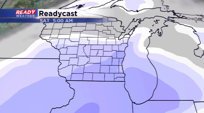
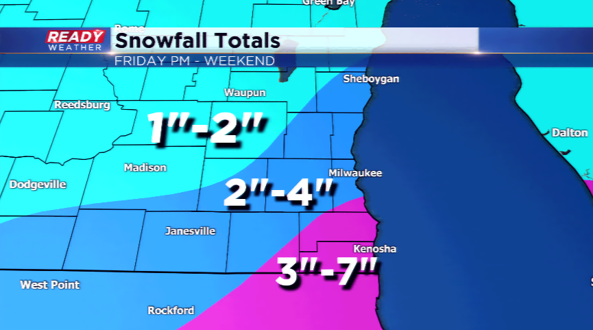
Our eyes are on the winter storm that will move into the Midwest and Great Lakes by tomorrow night and this weekend. The big uncertainty remains the exact track, which will help dictate the first main batch of snow. If it does have a more north track, this would be favorable for our region to see higher snowfall totals. As the main batch moves out by Saturday morning, watch for lake enhanced snowfall to take place around southeast Wisconsin, especially near the lakefront. This will also have a direct effect on how high the totals will get. Expect around the region for snowfall totals 1”-4”, with areas near Lake Michigan to see a few more inches due to the lake effect.
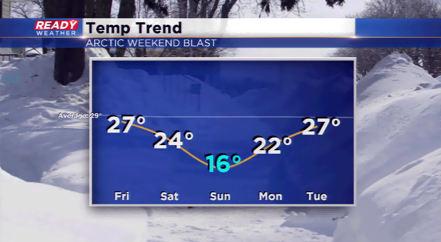
Everyone will get their hands on the cold behind the storm. Highs and lows will be the coldest we have seen in almost a year! Daytime temps will plunge into the teens for Sunday, and overnight lows for Sunday and Monday morning will be near zero.