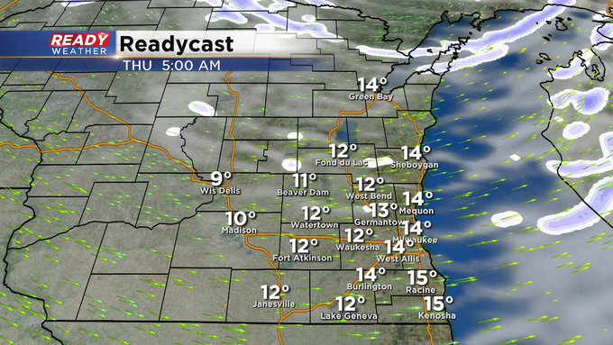
MILWAUKEE (CBS 58)--I love how Mother Nature teases us. We have 40s, even 50s, in the forecast the next few days before an Arctic front changes everything in a drastic way by Christmas Eve. Unfortunately, our nice weather will give way to scattered rain showers later Wednesday afternoon right before the arctic boundary moves through the region Wednesday night. At this point, I don't see much in the way of snow. The timing looks to be off. In other words, the moisture moves out before the cold air comes in from the north and west.
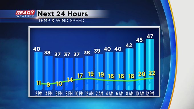
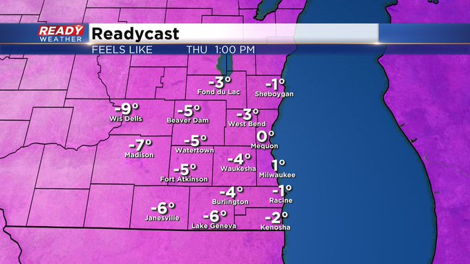
As far as the Christmas cold goes, look for highs only near 20 for both Christmas Eve and Day. Any wind will make it feel subzero at times. Parents, keep in mind, as your child opens his or her presents Friday morning, we'll have wind chill readings well below zero. And as tempting as it is playing with new toys outside, I would highly suggest limiting time outdoors to, at most, 15 minute intervals. Make sure to bundle up and wear the layers. Protect the head, hands, and outer extremities. This will be the coldest air of the season.