From record warmth to a smattering of snow in 48 hours


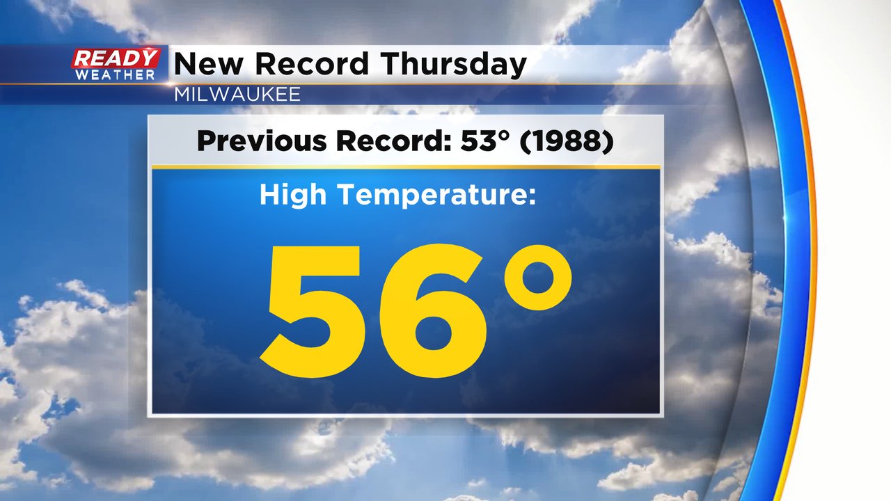
We warmed fast on Thursday and reached high temperatures in the middle 50s across all of southeast Wisconsin. It was record breaking warmth in Milwaukee shattering the previous record of 53 degrees set back in 1988.
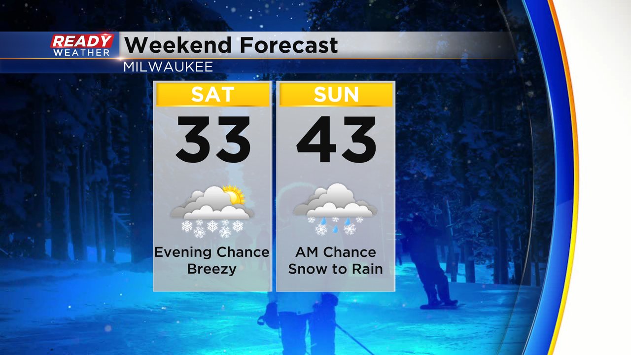
Warmer than average temperatures are still expected through the weekend with highs ranging from the mid 30s to the low 40s.
The next chance for precipitation starts late Saturday evening through Sunday morning. The chance for precipitation is trending better and with most of it falling during overnight hours the chance for snow is increasing as well. Some scattered snow showers are possible from Saturday evening through Sunday morning then switches to rain during the morning hours of Sunday.

Due to the showery nature of the snow, some places might just see a few snowflakes but otherwise could see minor accumulation. A dusting to half inch looks possible, but some areas could get a bit more as well.

Besides the snow Saturday night, the rest of Saturday looks dry and cooler in the 30s with a bit of a breeze. Sunday dries out in the afternoon and warmer in the low 40s.
Download the CBS 58 Ready Weather app to track the snow with the interactive radar.