Fog and rain Tuesday, then wind and snow Wednesday, then a cold Thanksgiving


This is going to be a wild week of Wisconsin weather. There is literally a little bit of everything in the forecast from highs in the 50s to lows in the teens, rain showers to snow showers, fog to very strong wind.
We start out Tuesday with some fog and rain showers. A dense fog advisory is in effect until 10 AM for all counties that don't border Lake Michigan. Visibility has been below a mile in many locations.
Here is current visibility that will update with time:

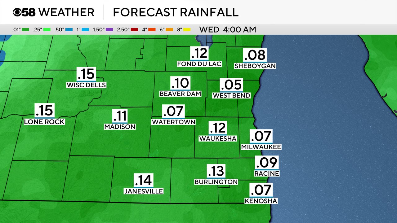
Along with the fog, we have seen rain showers Tuesday morning. Some of our southern counties south of I-94 have had a few hours of steady rain. Most of us may dry out from mid-morning through early evening Tuesday before another round of showers going into Tuesday night. Rain totals are not expected to be heavy Tuesday with most areas getting around a tenth of an inch when it all ends.
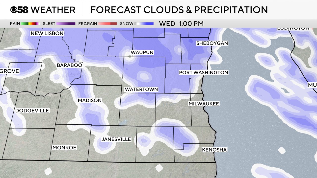
As the rain wraps up the temperatures will drop and a round of snow is expected on Wednesday. The best timing for snow showers Wednesday looks like 7 AM to 7 PM so if you are traveling, or have family traveling to you, make sure you/they are aware that it will be slow on the roads. Some of the snow could come down heavy at times and the wind is expected to be strong leading to blowing snow and reduced visibility.
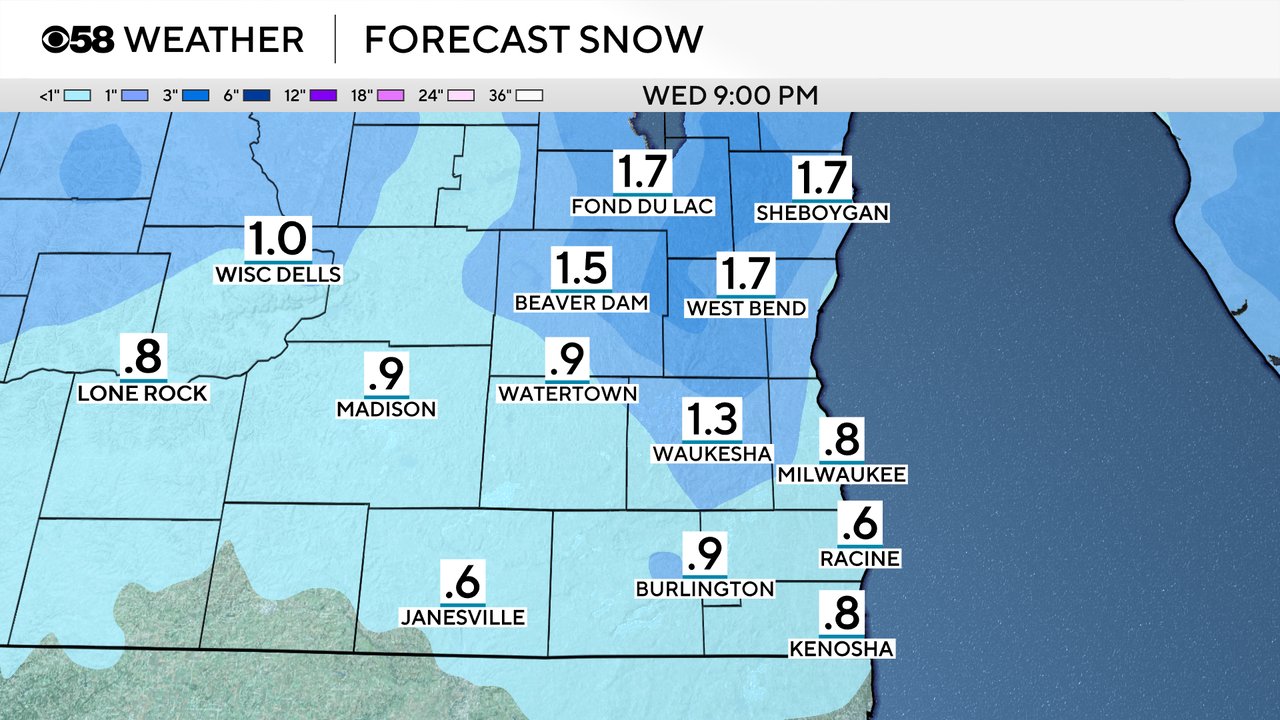
Snow totals Wednesday are not expected to be overly heavy. Around 1-2" of powdery snow can be expected in most areas with highest totals likely in our northern counties where they are closer to 2" then around an inch in the Waukesha/Milwaukee metro area and slightly less the farther south you go.
After a very light wind on Tuesday, the wind will ramp up Tuesday night with gusts out of the southwest to 30 mph. As that cold front rolls in early Wednesday morning the wind will shift to the northwest and increase in speed with wind gusts to 50 mph possible. That wind will stay gusty for Thanksgiving Day with wind gusts above 30 mph at times.
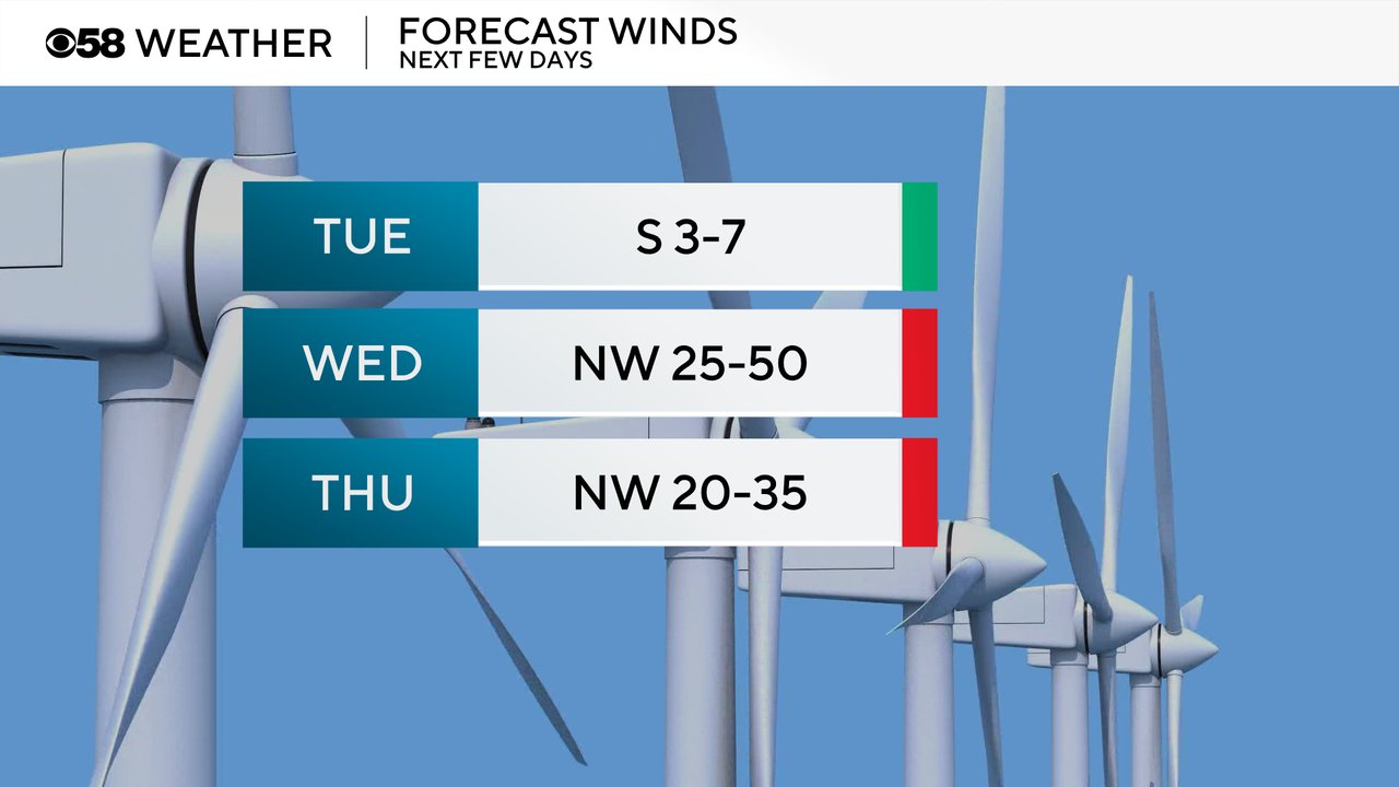
A Wind Advisory has been issued for all of southeast Wisconsin from 6 AM to 6 PM Wednesday for the potential for wind gusts to 50 mph. Driving, especially in open areas, could be difficult. Semis and other high-profile vehicles could be susceptible to tipping. Blowing/drifting snow and reduced visibility will be likely with the snow showers.

Download the CBS 58 Weather app to get alerts as watches, warnings, advisories are issued and updated and to track all of the rain and snow with the interactive radar and hour-by-hour forecast.