Sunday Night Update: Light snow ends, eyes turn towards heavy snow Monday night


Updated: 10:50 p.m. February 10, 2019
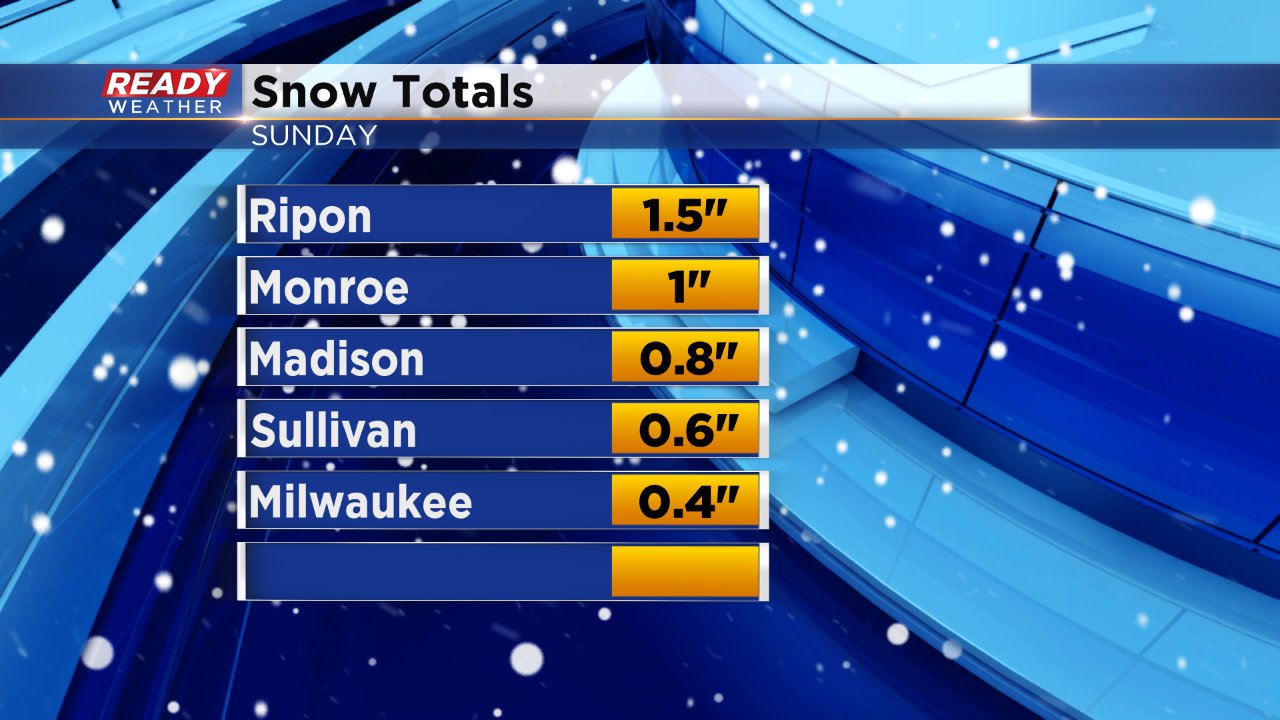
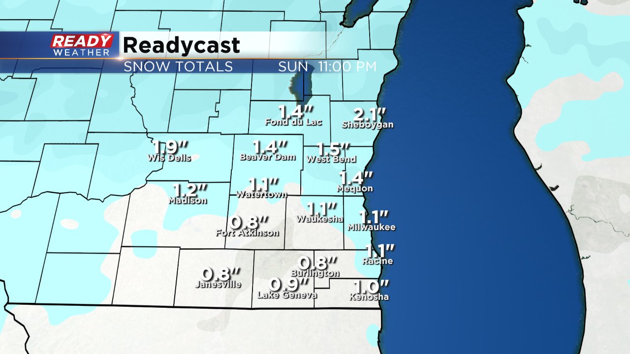
Sunday's light snow event has ended for all of southeast Wisconsin. Most of the area picked up a dusting of snow to around 1".
We have about 24 dry hours before the next round of snow arrives Monday night.
------
Updated: 5:55 p.m. February 10, 2019
Snow reports for Sunday's light snow are coming in at around or less than 1" for most of southeast Wisconsin. Snow showers are still lingering Sunday evening and are expected to wrap up around 9 or 10 p.m.
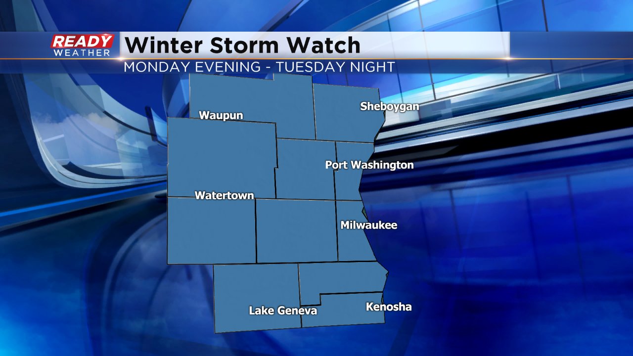
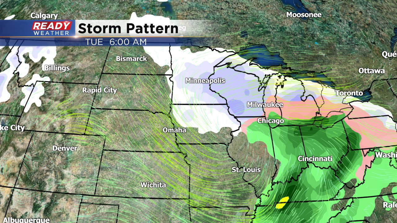
A heftier storm system is expected to arrive Monday evening and last through most of Tuesday. 4-9" of snow is expected for most of the area.
For more on Tuesday's storm including expected snow totals, click here.
------
Updated: 3:28 p.m. February 10, 2019
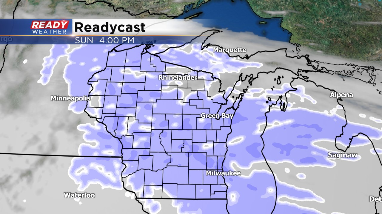
Light snow is continuing to fall across eastern counties, but western spots are already seeing a break. A lot of dry air has moved its way into the system leading to more scattered snow showers the rest of the evening instead of steady snow. Light snow will continue through 9 or 10 for some with most only seeing up to 1" and a max of 2".
The storm for Monday night into Tuesday is looking more potent. A Winter Storm Watch has been issued for all of southeast Wisconsin from Monday evening through Tuesday night. In general, 4-8" of snow is expected with totals increasing the farther north you live.
------
Updated: 12:48 p.m. February 10, 2019
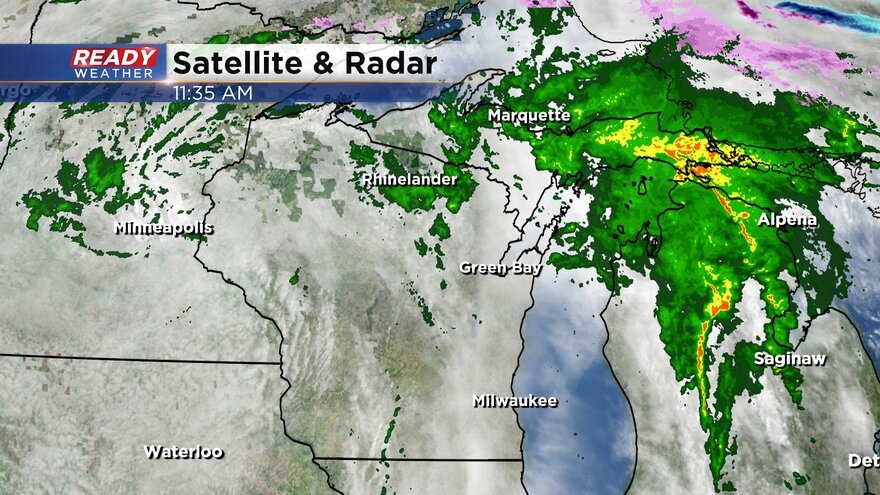
Light snow has started moving into Wisconsin. The bulk of the snow is still just west of Madison, but radar is showing parts of Fond du Lac and Sheboygan Counties are seeing some flakes fly.
A light, fluffy but steady snow will overspread southeast Wisconsin through around 3 p.m. with snow continuing until 10 p.m. in eastern areas.
Up to 2" of fresh snow is expected for most.
------
Updated: 7:16 a.m. February 10, 2019
Snow is still on track to arrive in the early afternoon Sunday and then continue through evening. For most, the snow only lasts about 6 hours or so wrapping up around 9 or 10 p.m. giving road crews plenty of time to clean up the streets before the Monday morning rush.
Although this will be a fairly light and fluffy snow that falls lightly, roads could get slick Sunday afternoon and evening.
Snow totals are still on track with most of southeast Wisconsin seeing up to 2" of fresh snow. A few northern spots may see up to 3" with the possibility of lake enhancement.
------
Posted: 4:18 p.m. February 9, 2019
The first of two back-to-back snow storms arrives Sunday. Weather models have been trending a little later with the arrival of snow by a few hours, but are also trending a little lighter on snow totals. For most, this will just be a nuisance and picturesque snow arriving around or just after noon on Sunday and lasting through the evening.
No winter weather advisories have been issued locally since snow totals will likely stay below limited. If there are any questions in the forecast, it's if and how lake enhancement could impact totals. If it does, Sheboygan could see a little more snow, but still not much to cause issues.
Snow totals will increase slightly the father north you live with some close to the Illinois border not even seeing an inch and those in northern spots seeing a little more than 2".
Snow could blow around on some area roadways due to cold road temps but widespread travel impacts are not expected and everything should be good to go by the Monday morning commute.
This is just the first of two snowstorms to move into southeast Wisconsin. The second storm arrives Monday night and lasts through most of Tuesday. We will be closer to the warmer side of this storm meaning a little sleet or rain could mix with snow at times, but right now ice is not a big factor.
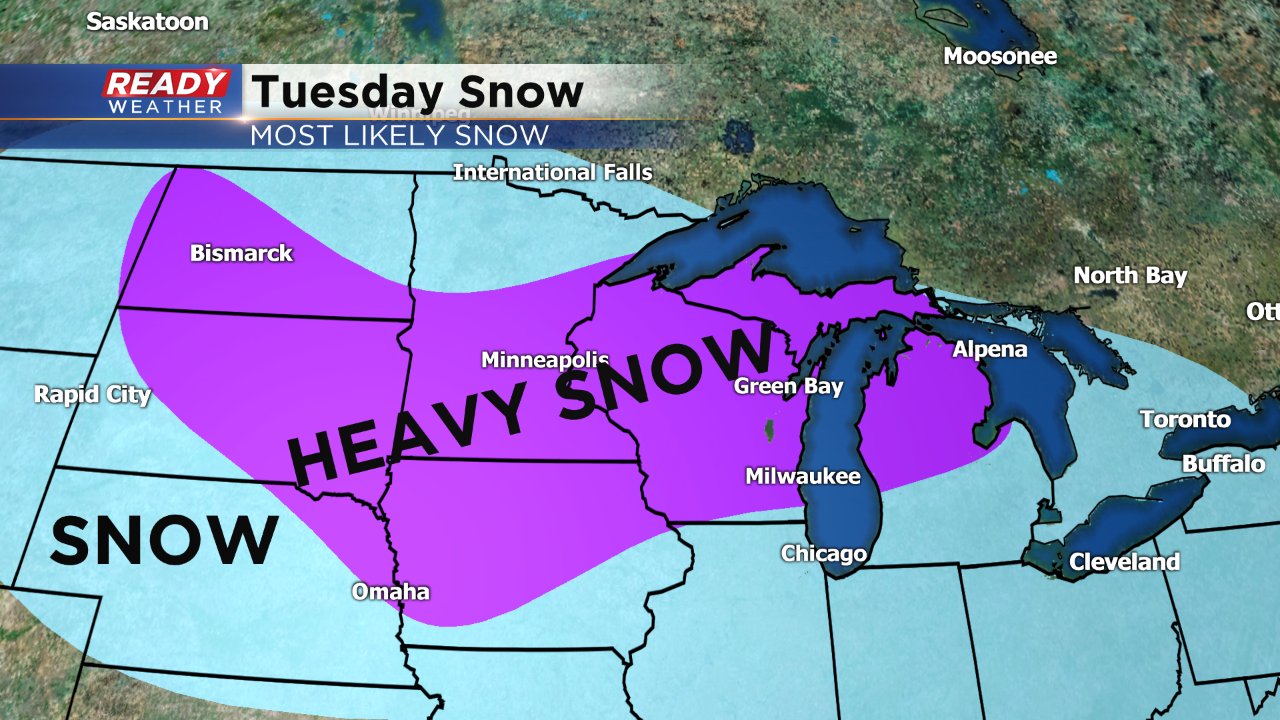
Significant snow accumulation is possible for some across our area, but a tight gradient of snowfall may be possible meaning a few dozen miles could separate a couple inches from a half foot of snow. Here's where the heaviest band of snow could set up based on Saturday's weather models.
Download the CBS 58 Ready weather app to track the radar as Sunday's snow arrives and see the updated forecast for Tuesday's snow including expected totals soon.