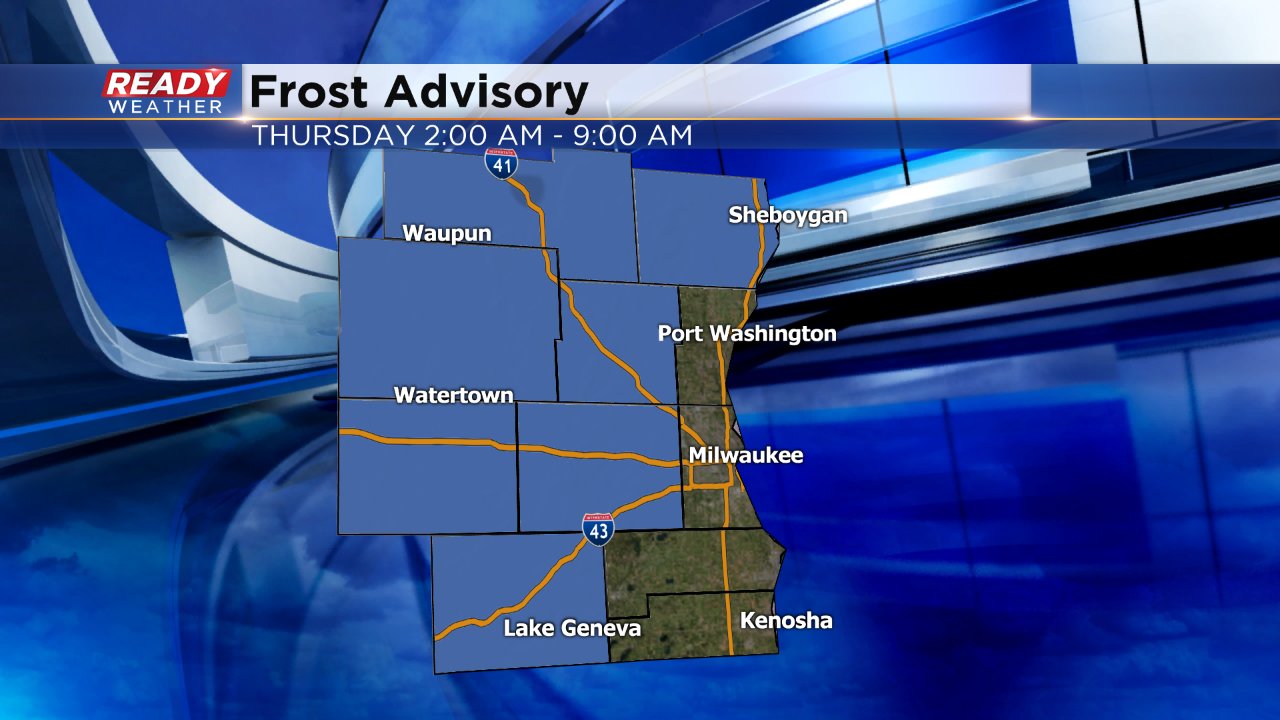
First Frost Advisory of Season Issued
Wednesday is our day of change. The past few days have been very warm but a cold front is pushing across the state sparking some showers and storms which will continue through the afternoon. Temperatures started mild Wednesday in the lower 60s and will slowly warm to the middle to upper 60s by noon before falling. By 5:00 PM Most locations will be around 50°.
After the rain ends, clouds will quickly clear as high pressure moves in. Clear sky combined with a light wind will allow temps to cool down into the lower to middle 30s in inland areas and middle to upper 30s lakeside.
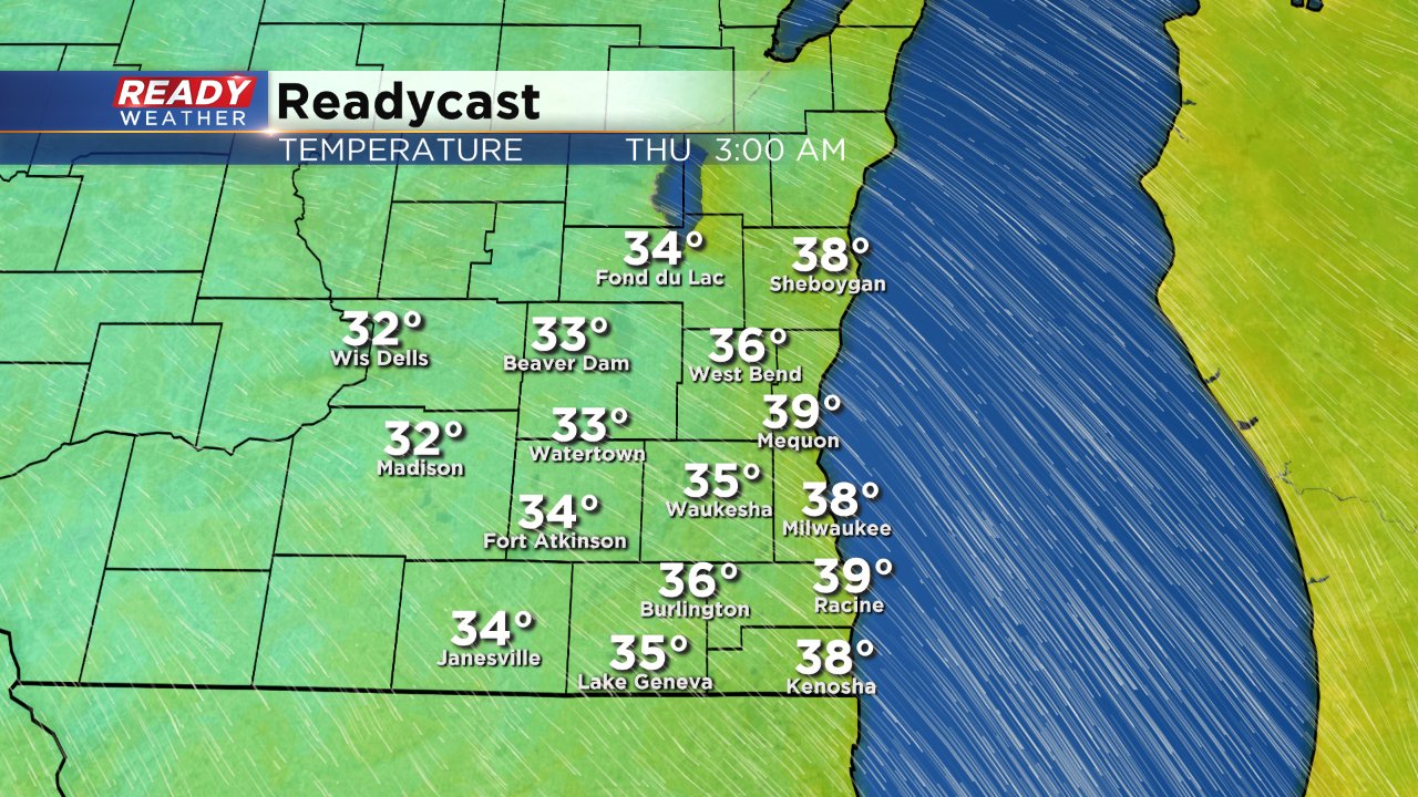
Inland spots will be cold enough for some widespread frost to occur. A frost advisory has been issued from 2:00 AM to 9:00 AM Thursday morning. Plants should be taken inside if possible or covered. Even those not under a frost advisory could see patchy frost so all occupants of southeast Wisconsin will want to take plants inside just to be safe.
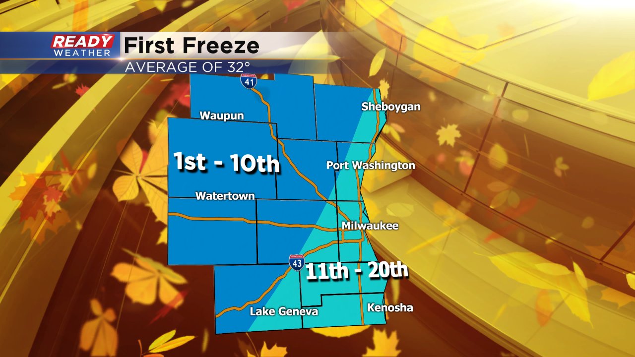
Our warm summer and start to fall may have been deceiving but this is right on track for when we typically see our temperatures hit 32° which typically happens during the first three weeks of October.