First cold blast of the season arrives with wind chills going sub-zero


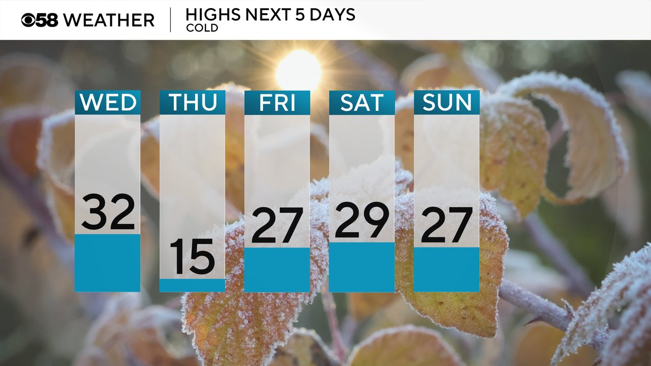
The first big cold blast of the season is approaching. Temperatures in November were overall right at average but every day so far to start December has been below average. The colder temps get even colder heading into Thursday. Highs on Wednesday happen around midday in the low 30s then the temps drop with the cold front through the 20s, teens and bottom out in the single digits by Thursday morning. Highs on Thursday stay in the teens then a bit better the rest of the week in the 20s, but still well below average.
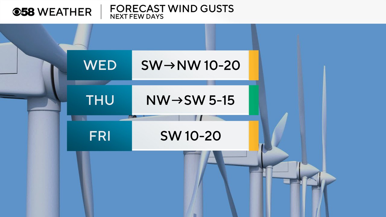
The wind will be a bit blustery Wednesday as it shifts from the southwest to the northwest. Thursday the wind shifts back to the southwest and is overall lighter. On Friday the breeze returns.
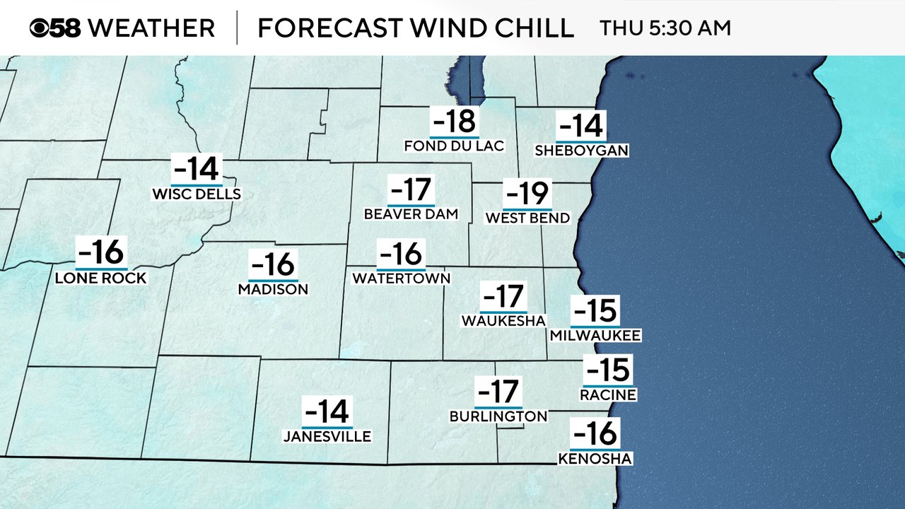
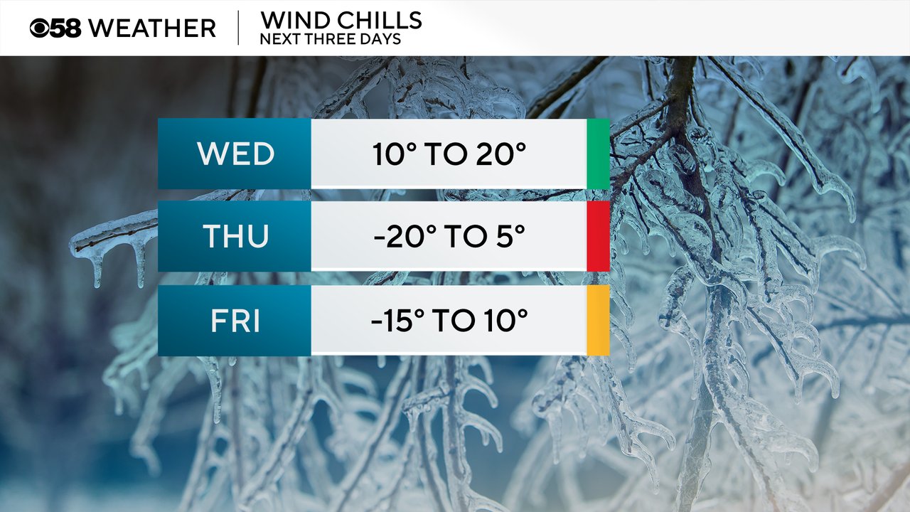
Wind chills will be at their coldest levels Thursday morning when they could get as cold as -20. That would be just warmer than wind chill advisory criteria. By Thursday afternoon wind chills will warm into the single digits both above and below zero.
Some clouds returning Thursday night could make temps just a little warmer Friday morning but it's still going to be cold with wind chills as cold as -15 in the morning and warming to around 10 in the afternoon.
Download the CBS 58 Weather app to see the hour-by-hour forecast to track the wind chills where you live.